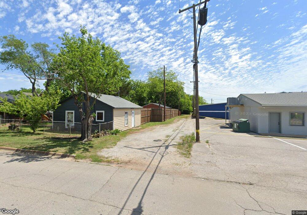
1622 W Bond St Denison, TX 75020
Estimated Value: $83,378
--
Bed
--
Bath
1,283
Sq Ft
$65/Sq Ft
Est. Value
About This Home
This home is located at 1622 W Bond St, Denison, TX 75020 and is currently estimated at $83,378, approximately $64 per square foot. 1622 W Bond St is a home located in Grayson County with nearby schools including Mayes Elementary School, Scott Middle School, and Denison High School.
Ownership History
Date
Name
Owned For
Owner Type
Purchase Details
Closed on
Mar 28, 2019
Sold by
Landers Michael W
Bought by
Lopez Yanesi
Current Estimated Value
Purchase Details
Closed on
Oct 19, 2006
Sold by
Maxwell John A
Bought by
Landers Michael W
Home Financials for this Owner
Home Financials are based on the most recent Mortgage that was taken out on this home.
Original Mortgage
$59,000
Interest Rate
6.41%
Mortgage Type
Purchase Money Mortgage
Create a Home Valuation Report for This Property
The Home Valuation Report is an in-depth analysis detailing your home's value as well as a comparison with similar homes in the area
Home Values in the Area
Average Home Value in this Area
Purchase History
| Date | Buyer | Sale Price | Title Company |
|---|---|---|---|
| Lopez Yanesi | -- | Grayson County Title | |
| Landers Michael W | -- | Richmond Title Ser Lp |
Source: Public Records
Mortgage History
| Date | Status | Borrower | Loan Amount |
|---|---|---|---|
| Previous Owner | Landers Michael W | $59,000 |
Source: Public Records
Tax History Compared to Growth
Tax History
| Year | Tax Paid | Tax Assessment Tax Assessment Total Assessment is a certain percentage of the fair market value that is determined by local assessors to be the total taxable value of land and additions on the property. | Land | Improvement |
|---|---|---|---|---|
| 2025 | $1,167 | $46,116 | $43,125 | $2,991 |
| 2024 | $1,167 | $50,226 | $47,250 | $2,976 |
| 2023 | $1,004 | $44,331 | $40,875 | $3,456 |
| 2022 | $1,047 | $44,066 | $40,875 | $3,191 |
| 2021 | $579 | $22,965 | $20,250 | $2,715 |
| 2020 | $467 | $17,698 | $15,000 | $2,698 |
| 2019 | $414 | $15,047 | $12,450 | $2,597 |
| 2018 | $287 | $10,362 | $7,800 | $2,562 |
| 2017 | $267 | $9,537 | $6,975 | $2,562 |
| 2016 | $189 | $6,762 | $4,200 | $2,562 |
| 2015 | $151 | $5,362 | $3,150 | $2,212 |
| 2014 | $151 | $5,362 | $3,150 | $2,212 |
Source: Public Records
Map
Nearby Homes
- 1601 W Bond St
- 2900 W Morton St
- 3130 W Morton St
- 3030 W Morton St
- 1700 W Morton St
- 3300 W Morton St
- 1721 W Walker St Unit A and B
- 1505 W Johnson St
- 1320 W Morton St
- 1609 W Woodard St
- 1309 W Morton St
- 1905 W Morton St Unit 6
- 1905 W Morton St Unit 5
- 1905 W Morton St Unit 17
- 1905 W Morton St Unit 20
- 1905 W Morton St Unit 7
- 1315 W Gandy St
- 1531 W Main St
- 1915 W Bond St
- 916 Leeper Dr
- 1614 W Bond St
- 1626 W Bond St
- 1612 W Bond St
- 1630 W Bond St
- 1610 W Bond St
- 1631 W Morton St
- 1604 W Bond St
- 1700 W Bond St
- 1623 W Bond St
- 1619 W Bond St
- 1627 W Bond St
- 1615 W Bond St
- 602 N Bush Ave
- 1609 W Bond St
- 1704 W Bond St
- 1701 W Morton St
- 1605 W Bond St
- 601 N Bush Ave Unit 603
- 1712 W Bond St
- 1530 W Bond St