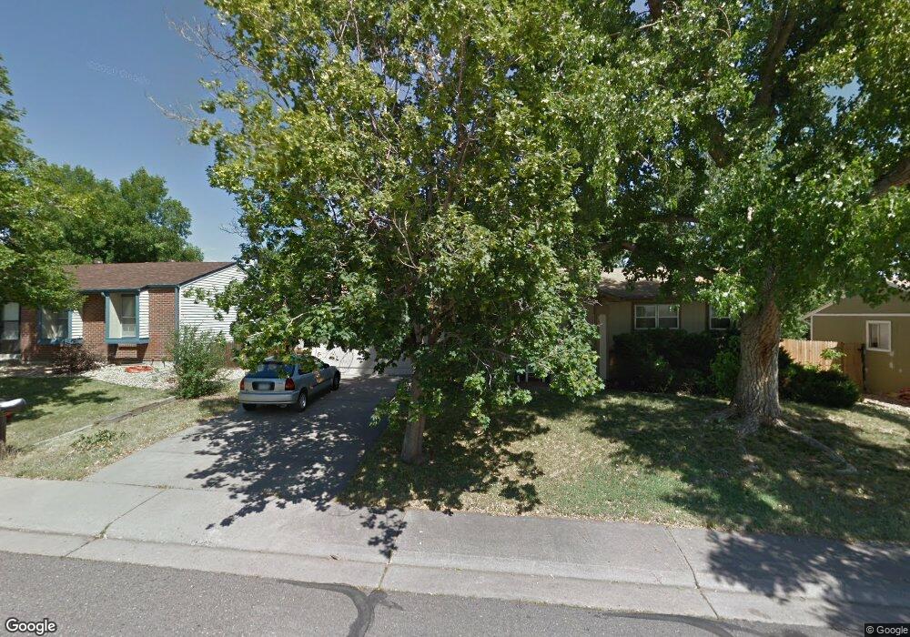
16237 E Union Ave Aurora, CO 80015
Pheasant Run NeighborhoodEstimated Value: $425,000 - $448,000
3
Beds
2
Baths
984
Sq Ft
$446/Sq Ft
Est. Value
About This Home
This home is located at 16237 E Union Ave, Aurora, CO 80015 and is currently estimated at $439,285, approximately $446 per square foot. 16237 E Union Ave is a home located in Arapahoe County with nearby schools including Independence Elementary School, Laredo Middle School, and Smoky Hill High School.
Ownership History
Date
Name
Owned For
Owner Type
Purchase Details
Closed on
Aug 3, 2019
Sold by
Slusher Zachary Y and Estate Of G Douglas Shusher
Bought by
Slusher Lena Y
Current Estimated Value
Purchase Details
Closed on
Mar 1, 1986
Sold by
Conversion Arapco
Bought by
Conversion Arapco
Purchase Details
Closed on
Jul 1, 1983
Sold by
Conversion Arapco
Bought by
Conversion Arapco
Purchase Details
Closed on
Oct 1, 1981
Sold by
Conversion Arapco
Bought by
Conversion Arapco
Purchase Details
Closed on
Jul 4, 1776
Bought by
Conversion Arapco
Create a Home Valuation Report for This Property
The Home Valuation Report is an in-depth analysis detailing your home's value as well as a comparison with similar homes in the area
Home Values in the Area
Average Home Value in this Area
Purchase History
| Date | Buyer | Sale Price | Title Company |
|---|---|---|---|
| Slusher Lena Y | -- | None Available | |
| Conversion Arapco | -- | -- | |
| Conversion Arapco | -- | -- | |
| Conversion Arapco | -- | -- | |
| Conversion Arapco | -- | -- |
Source: Public Records
Tax History
| Year | Tax Paid | Tax Assessment Tax Assessment Total Assessment is a certain percentage of the fair market value that is determined by local assessors to be the total taxable value of land and additions on the property. | Land | Improvement |
|---|---|---|---|---|
| 2025 | $2,288 | $29,188 | -- | -- |
| 2024 | $2,017 | $29,158 | -- | -- |
| 2023 | $2,017 | $29,158 | $0 | $0 |
| 2022 | $1,620 | $22,366 | $0 | $0 |
| 2021 | $1,630 | $22,366 | $0 | $0 |
| 2020 | $1,661 | $23,124 | $0 | $0 |
| 2019 | $1,602 | $23,124 | $0 | $0 |
| 2018 | $1,409 | $19,109 | $0 | $0 |
| 2017 | $1,389 | $19,109 | $0 | $0 |
| 2016 | $1,221 | $15,753 | $0 | $0 |
| 2015 | $1,162 | $15,753 | $0 | $0 |
| 2014 | $919 | $11,041 | $0 | $0 |
| 2013 | -- | $12,480 | $0 | $0 |
Source: Public Records
Map
Nearby Homes
- 4678 S Lewiston Way
- 4614 S Kalispell Way
- 4557 S Laredo St
- 16229 E Stanford Place
- 16222 E Rice Place Unit B
- 16313 E Rice Place Unit B
- 15922 E Rice Place Unit B
- 16373 E Rice Place Unit B
- 16482 E Radcliff Place Unit A
- 4784 S Olathe Way
- 15552 E Temple Place
- 15396 E Temple Place
- 16930 E Stanford Ave
- 4823 S Pagosa Way
- 16923 E Whitaker Dr Unit B
- 17042 E Wagon Trail Pkwy
- 4677 S Pagosa Way
- 15583 E Quincy Place
- 16224 E Belleview Dr
- 4229 S Mobile Cir Unit B
- 16257 E Union Ave
- 16217 E Union Ave
- 4680 S Lewiston Way
- 4682 S Lewiston Way
- 16207 E Union Ave
- 16267 E Union Ave
- 16238 E Union Ave
- 4690 S Lewiston Way
- 16218 E Union Ave
- 16258 E Union Ave
- 16208 E Union Ave
- 16278 E Union Ave
- 16277 E Union Ave
- 16269 E Wagontrail Dr
- 4670 S Lewiston Way
- 4681 S Lewiston Way
- 4679 S Lewiston Way
- 4734 S Lewiston Way
- 4685 S Lewiston Way
- 4677 S Lewiston Way
Your Personal Tour Guide
Ask me questions while you tour the home.