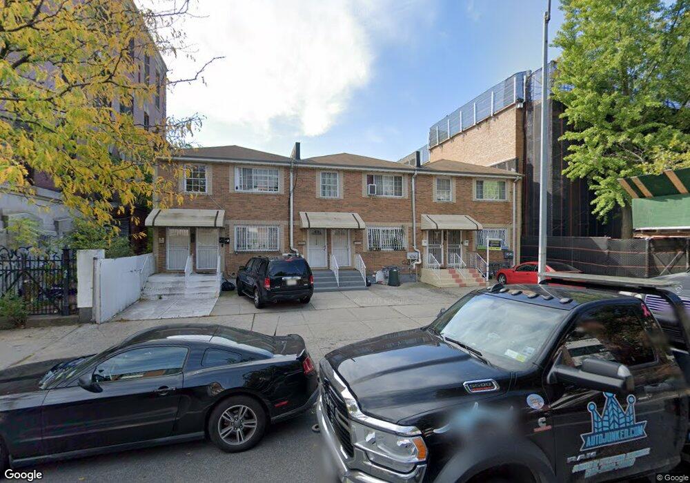
1624 Dean St Brooklyn, NY 11213
Crown Heights NeighborhoodEstimated Value: $943,000 - $1,196,000
Studio
--
Bath
2,100
Sq Ft
$511/Sq Ft
Est. Value
About This Home
This home is located at 1624 Dean St, Brooklyn, NY 11213 and is currently estimated at $1,073,181, approximately $511 per square foot. 1624 Dean St is a home located in Kings County with nearby schools including P.S. 243K- The Weeksville School, Explore Charter School - Empower Upper School, and KIPP AMP Middle School.
Ownership History
Date
Name
Owned For
Owner Type
Purchase Details
Closed on
Dec 1, 2025
Sold by
White Marie
Bought by
Marie White Revocable Trust
Current Estimated Value
Purchase Details
Closed on
Feb 11, 2025
Sold by
White Doris M
Bought by
White Marie E
Purchase Details
Closed on
Mar 9, 2015
Sold by
White Marie
Bought by
White Doris
Purchase Details
Closed on
Apr 12, 2002
Sold by
Homes Plus Associates Lt
Bought by
White Doris and White Marie
Home Financials for this Owner
Home Financials are based on the most recent Mortgage that was taken out on this home.
Original Mortgage
$306,600
Interest Rate
6.8%
Mortgage Type
Purchase Money Mortgage
Create a Home Valuation Report for This Property
The Home Valuation Report is an in-depth analysis detailing your home's value as well as a comparison with similar homes in the area
Home Values in the Area
Average Home Value in this Area
Purchase History
| Date | Buyer | Sale Price | Title Company |
|---|---|---|---|
| Marie White Revocable Trust | -- | -- | |
| White Marie E | -- | -- | |
| White Marie E | -- | -- | |
| White Doris | -- | -- | |
| White Doris | -- | -- | |
| White Doris | -- | -- | |
| White Doris | -- | -- |
Source: Public Records
Mortgage History
| Date | Status | Borrower | Loan Amount |
|---|---|---|---|
| Previous Owner | White Doris | $306,600 |
Source: Public Records
Tax History
| Year | Tax Paid | Tax Assessment Tax Assessment Total Assessment is a certain percentage of the fair market value that is determined by local assessors to be the total taxable value of land and additions on the property. | Land | Improvement |
|---|---|---|---|---|
| 2025 | $7,505 | $61,020 | $22,560 | $38,460 |
| 2024 | $7,505 | $71,820 | $22,560 | $49,260 |
| 2023 | $7,159 | $67,800 | $22,560 | $45,240 |
| 2022 | $7,037 | $61,380 | $22,560 | $38,820 |
| 2021 | $7,363 | $57,360 | $22,560 | $34,800 |
| 2019 | $6,514 | $57,540 | $22,560 | $34,980 |
| 2018 | $2,994 | $29,376 | $13,134 | $16,242 |
| 2017 | $5,378 | $29,376 | $11,271 | $18,105 |
| 2016 | $5,828 | $29,154 | $15,099 | $14,055 |
| 2015 | $3,719 | $27,504 | $17,893 | $9,611 |
| 2014 | $3,719 | $25,948 | $20,272 | $5,676 |
Source: Public Records
Map
Nearby Homes
- 111 Schenectady Ave
- 153 Schenectady Ave
- 1644 Atlantic Ave
- 1248 Prospect Place
- 1293 Park Place
- 1351 Prospect Place
- 1271 Park Place
- 1254 Park Place Unit 3
- 1770 Pacific St
- 1337 Sterling Place
- 1218 Saint Marks Ave
- 1360 Bergen St
- 1226 St Marks Ave Unit 1 B
- 1226 St Marks Ave Unit 2 A
- 1226 St Marks Ave Unit 4B
- 1298 Sterling Place
- 1456 Dean St
- 4 Agate Ct
- 99 Chauncey St
- 1102 Prospect Place
- 1620 Dean St
- 1626 Dean St
- 1505 Bergen St
- 1634-1650 Dean St
- 1513 Bergen St Unit 104
- 1513 Bergen St Unit 203
- 1513 Bergen St Unit 303
- 1509 Bergen St Unit 101
- 1509 Bergen St Unit 201
- 1509 Bergen St Unit 110
- 1509 Bergen St Unit 407
- 1509 Bergen St Unit 302
- 1509 Bergen St Unit 112
- 1509 Bergen St Unit 412
- 1509 Bergen St Unit 403
- 1509 Bergen St Unit 107
- 1509 Bergen St Unit 103
- 1509 Bergen St Unit 408
- 1509 Bergen St Unit 102
- 1509 Bergen St Unit 304
Your Personal Tour Guide
Ask me questions while you tour the home.