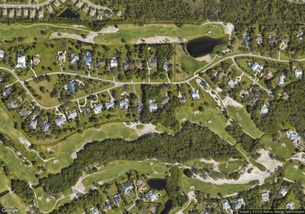
1624 SW Saint Andrews Dr Palm City, FL 34990
Estimated Value: $1,151,000 - $1,534,000
4
Beds
4
Baths
5,532
Sq Ft
$227/Sq Ft
Est. Value
About This Home
This home is located at 1624 SW Saint Andrews Dr, Palm City, FL 34990 and is currently estimated at $1,256,704, approximately $227 per square foot. 1624 SW Saint Andrews Dr is a home located in Martin County with nearby schools including Citrus Grove Elementary School, Hidden Oaks Middle School, and Martin County High School.
Ownership History
Date
Name
Owned For
Owner Type
Purchase Details
Closed on
Feb 10, 2022
Sold by
Hal M Tobias Declaration Of Trust
Bought by
Tobias Hal M and Tobias Shari E
Current Estimated Value
Purchase Details
Closed on
Sep 28, 1999
Sold by
Southtrust Bank
Bought by
Tobias Hal M and Tobias Shari
Home Financials for this Owner
Home Financials are based on the most recent Mortgage that was taken out on this home.
Original Mortgage
$196,000
Interest Rate
8.22%
Mortgage Type
Balloon
Purchase Details
Closed on
Aug 25, 1995
Sold by
Tobias Halm M and Tobias Shari E
Bought by
Tobias Hal M
Purchase Details
Closed on
Mar 10, 1992
Bought by
Tobias Hal M
Purchase Details
Closed on
Feb 11, 1991
Bought by
Tobias Hal M
Create a Home Valuation Report for This Property
The Home Valuation Report is an in-depth analysis detailing your home's value as well as a comparison with similar homes in the area
Home Values in the Area
Average Home Value in this Area
Purchase History
| Date | Buyer | Sale Price | Title Company |
|---|---|---|---|
| Tobias Hal M | -- | Mccarthy Summers Wood Norman M | |
| Tobias Hal M | $155,000 | -- | |
| Tobias Hal M | -- | -- | |
| Tobias Hal M | $301,000 | -- | |
| Tobias Hal M | $100 | -- |
Source: Public Records
Mortgage History
| Date | Status | Borrower | Loan Amount |
|---|---|---|---|
| Previous Owner | Tobias Hal M | $196,000 |
Source: Public Records
Tax History Compared to Growth
Tax History
| Year | Tax Paid | Tax Assessment Tax Assessment Total Assessment is a certain percentage of the fair market value that is determined by local assessors to be the total taxable value of land and additions on the property. | Land | Improvement |
|---|---|---|---|---|
| 2025 | $7,144 | $420,007 | -- | -- |
| 2024 | $7,022 | $408,171 | -- | -- |
| 2023 | $7,022 | $396,283 | $0 | $0 |
| 2022 | $6,796 | $384,741 | $0 | $0 |
| 2021 | $6,817 | $373,535 | $0 | $0 |
| 2020 | $6,703 | $368,378 | $0 | $0 |
| 2019 | $6,630 | $360,096 | $0 | $0 |
| 2018 | $6,481 | $353,381 | $0 | $0 |
| 2017 | $5,164 | $346,113 | $0 | $0 |
| 2016 | $5,389 | $338,994 | $0 | $0 |
| 2015 | $5,121 | $336,636 | $0 | $0 |
| 2014 | $5,121 | $333,965 | $0 | $0 |
Source: Public Records
Map
Nearby Homes
- 1614 SW Saint Andrews Dr
- 4540 SW Scrub Pine Terrace
- 1550 SW Saint Andrews Dr
- 4513 SW Branch Terrace W
- 3767 SW Brassie Way
- 4644 SW Gossamer Cir
- 964 SW Canoe Creek Terrace
- 1171 SW Cherry Blossom Ln
- 1784 SW Saint Andrews Dr
- 1874 SW Saint Andrews Dr
- 4884 SW Gossamer Cir
- 1752 SW Crane Creek Cir
- 1092 SW Scrub Oak Ave
- 1733 SW Crane Creek Ave
- 749 SW Sea Green St
- 4864 SW Sand Ave
- 724 SW Sea Green St
- 4381 SW Gossamer Cir
- 460 SW Sea Green St
- 3751 SW Canoe Creek Terrace
- 1634 SW Saint Andrews Dr
- 1604 SW St Andrews Dr
- 1604 SW Saint Andrews Dr
- 1625 SW Saint Andrews Dr
- 1615 SW Saint Andrews Dr
- 1635 SW Saint Andrews Dr
- 1594 SW Saint Andrews Dr
- 1654 SW Saint Andrews Dr
- 1605 SW Saint Andrews Dr
- 1595 SW Saint Andrews Dr
- 1584 SW Saint Andrews Dr
- 1585 SW Saint Andrews Dr
- 1574 SW Saint Andrews Dr
- 1656 SW Sandtrap Crescent
- 1575 SW Saint Andrews Dr
- 1666 SW Sandtrap Crescent
- 1564 SW Saint Andrews Dr
- 4411 SW Branch Terrace W
- 1566 SW Saint Andrews Dr
- 4451 SW Branch Terrace W
