Estimated Value: $113,000 - $284,000
3
Beds
2
Baths
1,185
Sq Ft
$152/Sq Ft
Est. Value
About This Home
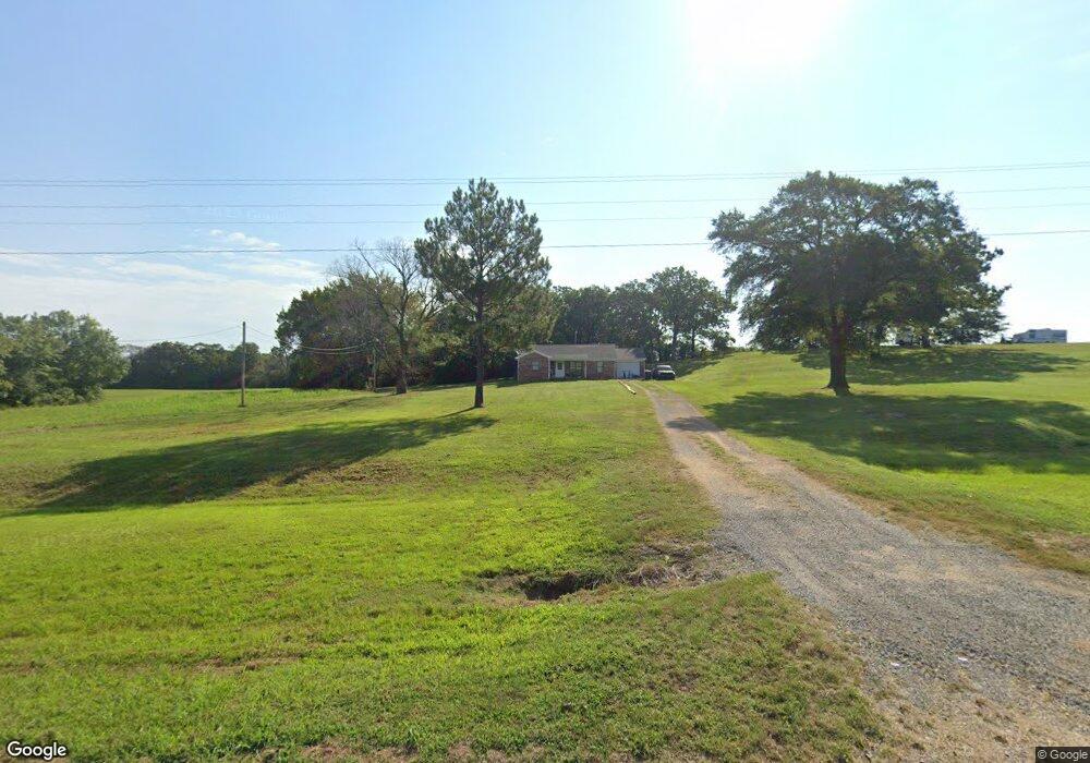
This home is located at 16242 Lock and Dam Rd, Spiro, OK 74959 and is currently estimated at $180,297, approximately $152 per square foot. 16242 Lock and Dam Rd is a home located in Le Flore County with nearby schools including Spiro Elementary School, Spiro Middle School, and Spiro High School.
Ownership History
Date
Name
Owned For
Owner Type
Purchase Details
Closed on
May 14, 2009
Sold by
Triplett Verdie and Triplett Otha
Bought by
Triplett Verdie
Current Estimated Value
Home Financials for this Owner
Home Financials are based on the most recent Mortgage that was taken out on this home.
Original Mortgage
$40,200
Outstanding Balance
$25,276
Interest Rate
4.84%
Mortgage Type
New Conventional
Estimated Equity
$155,021
Purchase Details
Closed on
Aug 8, 2008
Sold by
Triplett Dorothy
Bought by
Triplett Verdie
Purchase Details
Closed on
Jul 27, 2004
Sold by
Triplett Dorothy
Bought by
Triplett Verdie
Create a Home Valuation Report for This Property
The Home Valuation Report is an in-depth analysis detailing your home's value as well as a comparison with similar homes in the area
Home Values in the Area
Average Home Value in this Area
Purchase History
| Date | Buyer | Sale Price | Title Company |
|---|---|---|---|
| Triplett Verdie | -- | -- | |
| Triplett Verdie | -- | -- | |
| Triplett Verdie | -- | -- |
Source: Public Records
Mortgage History
| Date | Status | Borrower | Loan Amount |
|---|---|---|---|
| Open | Triplett Verdie | $40,200 |
Source: Public Records
Tax History Compared to Growth
Tax History
| Year | Tax Paid | Tax Assessment Tax Assessment Total Assessment is a certain percentage of the fair market value that is determined by local assessors to be the total taxable value of land and additions on the property. | Land | Improvement |
|---|---|---|---|---|
| 2024 | $911 | $10,691 | $440 | $10,251 |
| 2023 | $911 | $9,697 | $440 | $9,257 |
| 2022 | $864 | $9,697 | $440 | $9,257 |
| 2021 | $869 | $9,697 | $440 | $9,257 |
| 2020 | $880 | $9,941 | $440 | $9,501 |
| 2019 | $998 | $10,697 | $440 | $10,257 |
| 2018 | $961 | $10,306 | $440 | $9,866 |
| 2017 | $971 | $10,165 | $424 | $9,741 |
| 2016 | $909 | $9,681 | $399 | $9,282 |
| 2015 | $796 | $9,220 | $424 | $8,796 |
| 2014 | $765 | $8,781 | $395 | $8,386 |
Source: Public Records
Map
Nearby Homes
- 15663 Central St
- 18586 1st St
- 17845 Cardinal Ln
- 17172 Hamilton Cir
- TBD Cowshed Crossing Rd
- 0 Cowshed Crossing Rd
- 17953 Old Pocola Hwy
- 18825 Leflore Dr
- 19200 Chloe Layne Rd
- Tbd Deaton Dr
- 709 Anne Dr
- 105 B St
- 0 Carrie Dr
- TBD Carrie Dr
- 719 N Cherry St
- 117214 S 4715 Rd
- H590-31-10N- 26e-0-009-00
- TBD Tbd
- 707 NE 6th St
- 219 N Beech St
- 16296 Lock and Dam Rd
- 16358 Lock and Dam Rd
- 16098 Lock and Dam Rd
- 18188 3rd St
- 18169 2nd St
- 17856 2nd St
- 18128 3rd St
- 18147 2nd St
- 18376 2nd St
- 18194 3rd St
- 16071 Fort Coffee Rd
- 16939 Mcginnis Ln
- 18182 3rd St
- 16802 Fort Coffee Rd
- 17757 3rd St
- 17668 3rd St
- 17642 3rd St
- 15885 Lock and Dam Rd
- 17657 3rd St
- 17578 3rd St