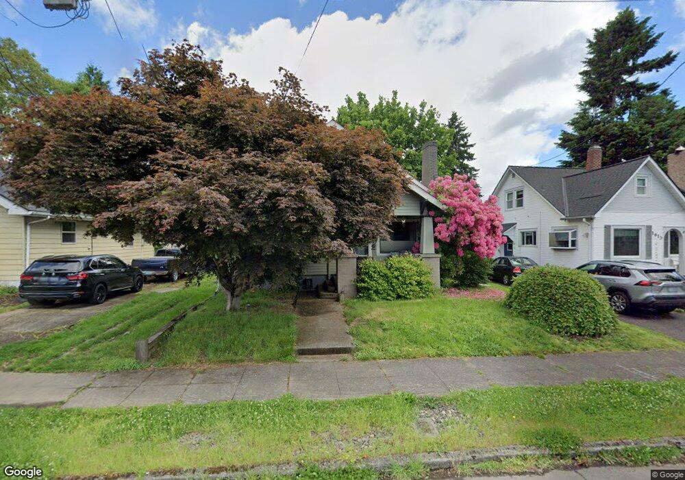
1625 N Schofield St Portland, OR 97217
Kenton NeighborhoodEstimated Value: $574,000 - $736,000
3
Beds
2
Baths
1,648
Sq Ft
$373/Sq Ft
Est. Value
About This Home
This home is located at 1625 N Schofield St, Portland, OR 97217 and is currently estimated at $615,115, approximately $373 per square foot. 1625 N Schofield St is a home located in Multnomah County with nearby schools including Peninsula Elementary School, Ockley Green, and Jefferson High School.
Ownership History
Date
Name
Owned For
Owner Type
Purchase Details
Closed on
Jul 11, 2014
Sold by
Gillespie Matthew A
Bought by
Durham Trina L
Current Estimated Value
Home Financials for this Owner
Home Financials are based on the most recent Mortgage that was taken out on this home.
Original Mortgage
$126,500
Outstanding Balance
$95,855
Interest Rate
4.1%
Mortgage Type
New Conventional
Estimated Equity
$519,260
Purchase Details
Closed on
Jan 10, 2002
Sold by
Gillespie Matthew A
Bought by
Gillespie Matthew A and Durham Trina Louise
Create a Home Valuation Report for This Property
The Home Valuation Report is an in-depth analysis detailing your home's value as well as a comparison with similar homes in the area
Home Values in the Area
Average Home Value in this Area
Purchase History
| Date | Buyer | Sale Price | Title Company |
|---|---|---|---|
| Durham Trina L | -- | Wfg Title | |
| Gillespie Matthew A | -- | Fidelity National Title Co |
Source: Public Records
Mortgage History
| Date | Status | Borrower | Loan Amount |
|---|---|---|---|
| Open | Durham Trina L | $126,500 |
Source: Public Records
Tax History Compared to Growth
Tax History
| Year | Tax Paid | Tax Assessment Tax Assessment Total Assessment is a certain percentage of the fair market value that is determined by local assessors to be the total taxable value of land and additions on the property. | Land | Improvement |
|---|---|---|---|---|
| 2025 | $4,512 | $167,440 | -- | -- |
| 2024 | $4,350 | $162,570 | -- | -- |
| 2023 | $4,183 | $157,840 | $0 | $0 |
| 2022 | $4,092 | $153,250 | $0 | $0 |
| 2021 | $4,023 | $148,790 | $0 | $0 |
| 2020 | $3,691 | $144,460 | $0 | $0 |
| 2019 | $3,555 | $140,260 | $0 | $0 |
| 2018 | $3,451 | $136,180 | $0 | $0 |
| 2017 | $3,307 | $132,220 | $0 | $0 |
| 2016 | $3,027 | $128,370 | $0 | $0 |
| 2015 | $2,559 | $108,210 | $0 | $0 |
| 2014 | $2,520 | $105,060 | $0 | $0 |
Source: Public Records
Map
Nearby Homes
- 1593 N Mcclellan St Unit 3
- 1597 N Mcclellan St Unit 5
- 1307 N Kilpatrick St
- 1312 N Farragut St
- 1315 N Russet St
- 1024 N Farragut St
- 7622 N Brandon Ave
- 854 N Baldwin St
- 2515 N Winchell St
- 7817 N Delaware Ave
- 7387 N Mobile Ave
- 7385 N Mobile Ave
- 7383 N Mobile Ave
- 7379 N Mobile Ave
- 2538 N Watts St
- 2544 N Watts St
- 2620 N Kilpatrick St
- 2622 N Kilpatrick St
- 2624 N Kilpatrick St
- 2504 N Baldwin St
- 1637 N Schofield St
- 1613 N Schofield St
- 1604 N Kilpatrick St
- 1607 N Schofield St
- 1707 N Schofield St
- 1612 N Kilpatrick St
- 1524 N Kilpatrick St Unit 1526
- 1526 N Kilpatrick St
- 1524 N Kilpatrick St
- 1620 N Kilpatrick St
- 1512 N Kilpatrick St
- 1535 N Schofield St
- 1715 N Schofield St
- 1628 N Kilpatrick St
- 1628 N Kilpatrick (Foreclos
- 1620 N Schofield St
- 1634 N Schofield St
- 1612 N Schofield St
- 1510 N Kilpatrick St
- 1706 N Kilpatrick St