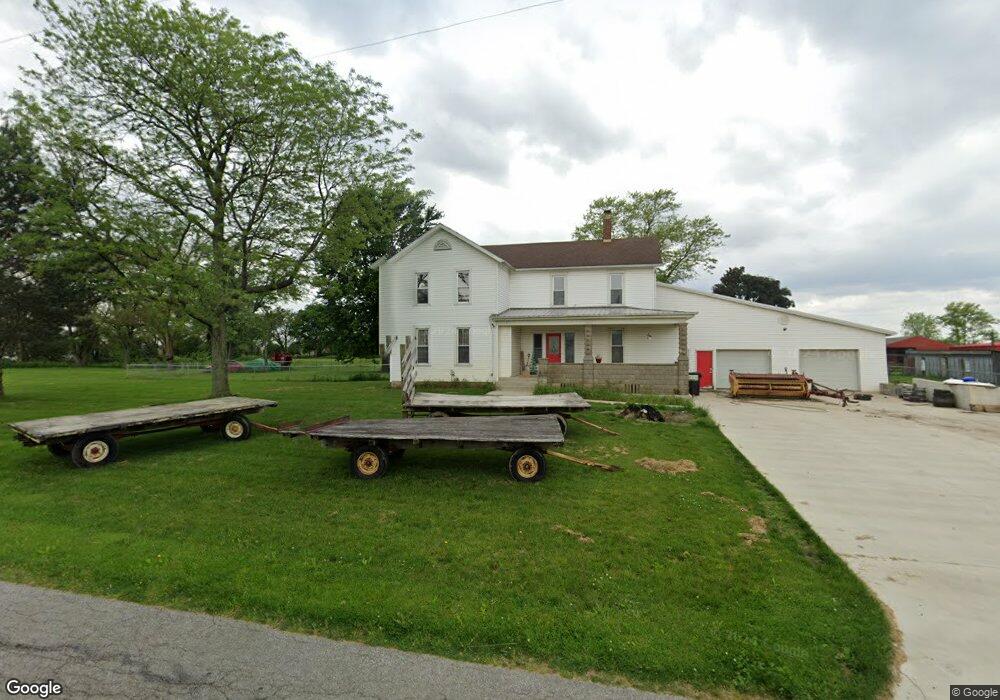
1626 County Road 202 Fremont, OH 43420
Estimated Value: $205,146 - $282,000
3
Beds
1
Bath
2,208
Sq Ft
$111/Sq Ft
Est. Value
About This Home
This home is located at 1626 County Road 202, Fremont, OH 43420 and is currently estimated at $244,787, approximately $110 per square foot. 1626 County Road 202 is a home located in Sandusky County with nearby schools including Fremont Ross High School, Bishop Hoffman Catholic School - This is St Joe's School now, and St. Joseph School.
Ownership History
Date
Name
Owned For
Owner Type
Purchase Details
Closed on
Jul 27, 2018
Sold by
Rufty Kevin M
Bought by
Rufty Kevin M
Current Estimated Value
Purchase Details
Closed on
Jun 21, 2018
Sold by
Rufty Kevin M
Bought by
Rufty Kevin M
Purchase Details
Closed on
Jun 1, 1988
Sold by
Rufty Kevin M and Rufty Crystal
Bought by
Rufty Kevin M and Rufty Crystal L
Purchase Details
Closed on
Feb 1, 1986
Bought by
Rufty Kevin M and Rufty Crystal L
Create a Home Valuation Report for This Property
The Home Valuation Report is an in-depth analysis detailing your home's value as well as a comparison with similar homes in the area
Home Values in the Area
Average Home Value in this Area
Purchase History
| Date | Buyer | Sale Price | Title Company |
|---|---|---|---|
| Rufty Kevin M | -- | -- | |
| Rufty Kevin M | -- | -- | |
| Rufty Kevin M | $40,000 | -- | |
| Rufty Kevin M | -- | -- |
Source: Public Records
Tax History Compared to Growth
Tax History
| Year | Tax Paid | Tax Assessment Tax Assessment Total Assessment is a certain percentage of the fair market value that is determined by local assessors to be the total taxable value of land and additions on the property. | Land | Improvement |
|---|---|---|---|---|
| 2024 | $1,619 | $42,780 | $8,090 | $34,690 |
| 2023 | $1,619 | $42,780 | $8,090 | $34,690 |
| 2022 | $1,706 | $42,780 | $8,090 | $34,690 |
| 2021 | $1,760 | $42,780 | $8,090 | $34,690 |
| 2020 | $1,642 | $39,350 | $7,950 | $31,400 |
| 2019 | $1,640 | $39,350 | $7,950 | $31,400 |
| 2018 | $1,499 | $39,310 | $7,910 | $31,400 |
| 2017 | $1,315 | $30,770 | $3,470 | $27,300 |
| 2016 | $1,161 | $30,770 | $3,470 | $27,300 |
| 2015 | $1,142 | $30,770 | $3,470 | $27,300 |
| 2014 | $1,444 | $37,040 | $3,610 | $33,430 |
| 2013 | $1,414 | $37,040 | $3,610 | $33,430 |
Source: Public Records
Map
Nearby Homes
- 2087 County Road 216
- 2939 County Road 206
- 0 County Road 210
- 711 Bloom Rd
- 263 Saint Paul Dr
- 1730 Port Clinton Rd Unit 41
- 1730 Port Clinton Rd
- 1730 Port Clinton Rd Unit 33
- 251 Saint Paul Dr
- 315 Ethan Dr
- 318 Ethan Dr
- 0 Sean Dr
- Outlot A Sean Dr
- 335 Cottage St
- 612 2nd St
- 199 Saint Thomas Dr
- 533 Sandusky Ave Unit 535
- 2248 E State St
- 230 N Pennsylvania Ave
- 433 Sandusky Ave
- 1613 County Road 202
- 1592 County Road 202
- 1500 Cr 202
- 1484 County Road 202
- 1999 Us Highway 6 E
- 1420 County Road 202
- 1597 N County Road 198
- 2130 Us Highway 6 E
- 1784 County Road 202
- 1838 County Road 202
- 59 Bethany Dr
- 63 Bethany Dr
- 55 Bethany Dr
- 51 Bethany Dr
- 47 Bethany Dr
- 67 Bethany Dr
- 39 Bethany Dr
- 71 Bethany Dr
- 1981 County Road 239
- 60 Bethany Dr