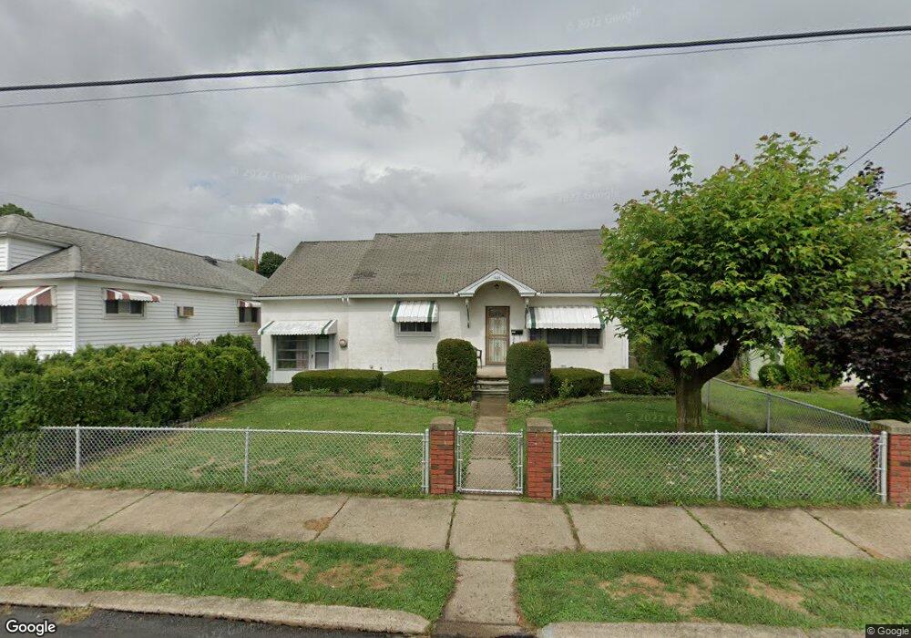
1626 Hawthorne St Scranton, PA 18504
Tripp's Park NeighborhoodEstimated Value: $159,791 - $260,000
3
Beds
1
Bath
1,888
Sq Ft
$114/Sq Ft
Est. Value
About This Home
This home is located at 1626 Hawthorne St, Scranton, PA 18504 and is currently estimated at $214,948, approximately $113 per square foot. 1626 Hawthorne St is a home located in Lackawanna County with nearby schools including Isaac Tripp Elementary School, West Scranton Intrmd School, and West Scranton High School.
Ownership History
Date
Name
Owned For
Owner Type
Purchase Details
Closed on
Oct 11, 2013
Sold by
Armbruster Karen and Armbruster Francis J
Bought by
Shelp Cory R
Current Estimated Value
Home Financials for this Owner
Home Financials are based on the most recent Mortgage that was taken out on this home.
Original Mortgage
$59,946
Outstanding Balance
$45,097
Interest Rate
4.53%
Mortgage Type
New Conventional
Estimated Equity
$169,851
Create a Home Valuation Report for This Property
The Home Valuation Report is an in-depth analysis detailing your home's value as well as a comparison with similar homes in the area
Home Values in the Area
Average Home Value in this Area
Purchase History
| Date | Buyer | Sale Price | Title Company |
|---|---|---|---|
| Shelp Cory R | $60,000 | None Available |
Source: Public Records
Mortgage History
| Date | Status | Borrower | Loan Amount |
|---|---|---|---|
| Open | Shelp Cory R | $59,946 |
Source: Public Records
Tax History Compared to Growth
Tax History
| Year | Tax Paid | Tax Assessment Tax Assessment Total Assessment is a certain percentage of the fair market value that is determined by local assessors to be the total taxable value of land and additions on the property. | Land | Improvement |
|---|---|---|---|---|
| 2025 | $4,292 | $14,000 | $1,150 | $12,850 |
| 2024 | $3,908 | $14,000 | $1,150 | $12,850 |
| 2023 | $3,908 | $14,000 | $1,150 | $12,850 |
| 2022 | $3,822 | $14,000 | $1,150 | $12,850 |
| 2021 | $3,822 | $14,000 | $1,150 | $12,850 |
| 2020 | $3,747 | $14,000 | $1,150 | $12,850 |
| 2019 | $3,520 | $14,000 | $1,150 | $12,850 |
| 2018 | $3,520 | $14,000 | $1,150 | $12,850 |
| 2017 | $3,454 | $14,000 | $1,150 | $12,850 |
| 2016 | $917 | $14,000 | $1,150 | $12,850 |
| 2015 | $2,553 | $14,000 | $1,150 | $12,850 |
| 2014 | -- | $14,000 | $1,150 | $12,850 |
Source: Public Records
Map
Nearby Homes
- 116 Little Spike Way Unit L 40
- 1425 Bulwer St
- 991 N Sumner Ave Unit 1/2 L 13
- 1610-1612 Farr St Unit L3
- 1431 Dorothy St
- 1501 Farr St
- 1235 N Sumner Ave
- 1123 Court St
- 0 Philo St Unit GSBSC4763
- 1008 Mount Vernon Ave
- 1126 W Gibson St
- 2133 Dorothy St
- 1227 Providence Rd
- 1402 N Rebecca Ave
- 1819 Clearview St Unit L 109
- 1327 Oram St
- 656 Philo St
- 833 Powderly Ct
- 1311 Short Ave
- 1436 Church Ave
- 1638 Hawthorne St
- 1622 Hawthorne St
- 1537 Thackery St
- 1704 Hawthorne St
- 1535 Thackery St
- 1541 Thack & Garfield Ave
- 1620 Hawthorne St
- 1533 Thackery St
- 1531 Thackery St
- 1625 Hawthorne St
- 1706 Hawthorne St
- 1030 N Garfield Ave
- 1051 N Garfield Ave
- 1529 Thackery St
- 1621 Hawthorne St
- 1708 Hawthorne St
- 1703 Hawthorne St
- 1525 Thackery St
- 1710 Hawthorne St
- 1055 N Garfield Ave