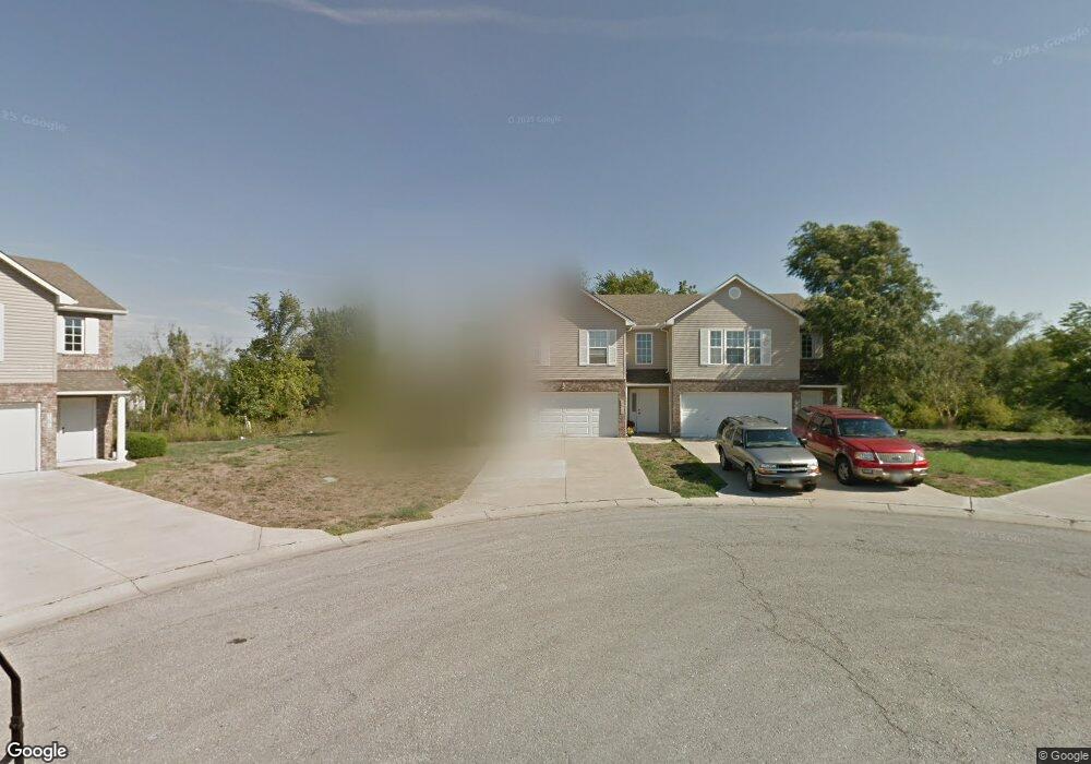
1626 NW Samantha Ct Unit 1621 Blue Springs, MO 64015
Estimated Value: $187,000 - $209,000
3
Beds
3
Baths
1,508
Sq Ft
$130/Sq Ft
Est. Value
About This Home
This home is located at 1626 NW Samantha Ct Unit 1621, Blue Springs, MO 64015 and is currently estimated at $195,567, approximately $129 per square foot. 1626 NW Samantha Ct Unit 1621 is a home located in Jackson County with nearby schools including James Lewis Elementary School, Brittany Hill Middle School, and Blue Springs High School.
Ownership History
Date
Name
Owned For
Owner Type
Purchase Details
Closed on
Sep 2, 2011
Sold by
Us Bank National Associates
Bought by
Angotti Elizabeth E
Current Estimated Value
Home Financials for this Owner
Home Financials are based on the most recent Mortgage that was taken out on this home.
Original Mortgage
$69,690
Outstanding Balance
$47,700
Interest Rate
4.25%
Mortgage Type
FHA
Estimated Equity
$147,867
Purchase Details
Closed on
Mar 21, 2011
Sold by
Rosheim Douglas P and Rosheim Jacqueline M
Bought by
Us Bank National Association
Purchase Details
Closed on
Jul 20, 2006
Sold by
Speer & Tebbe Enterprises Inc
Bought by
Rosheim Douglas P and Rosheim Jacqueline M
Home Financials for this Owner
Home Financials are based on the most recent Mortgage that was taken out on this home.
Original Mortgage
$23,925
Interest Rate
6.66%
Mortgage Type
Commercial
Create a Home Valuation Report for This Property
The Home Valuation Report is an in-depth analysis detailing your home's value as well as a comparison with similar homes in the area
Home Values in the Area
Average Home Value in this Area
Purchase History
| Date | Buyer | Sale Price | Title Company |
|---|---|---|---|
| Angotti Elizabeth E | -- | Continental Title | |
| Us Bank National Association | $63,750 | First American Title Co | |
| Rosheim Douglas P | -- | Stewart Title Of Kansas City |
Source: Public Records
Mortgage History
| Date | Status | Borrower | Loan Amount |
|---|---|---|---|
| Open | Angotti Elizabeth E | $69,690 | |
| Previous Owner | Rosheim Douglas P | $23,925 | |
| Previous Owner | Rosheim Douglas P | $119,625 |
Source: Public Records
Tax History Compared to Growth
Tax History
| Year | Tax Paid | Tax Assessment Tax Assessment Total Assessment is a certain percentage of the fair market value that is determined by local assessors to be the total taxable value of land and additions on the property. | Land | Improvement |
|---|---|---|---|---|
| 2025 | $2,447 | $34,487 | $5,763 | $28,724 |
| 2024 | $2,400 | $29,990 | $3,249 | $26,741 |
| 2023 | $2,400 | $29,990 | $3,538 | $26,452 |
| 2022 | $2,391 | $26,410 | $2,261 | $24,149 |
| 2021 | $2,389 | $26,410 | $2,261 | $24,149 |
| 2020 | $2,056 | $23,117 | $2,261 | $20,856 |
| 2019 | $1,987 | $23,117 | $2,261 | $20,856 |
| 2018 | $1,716,755 | $17,598 | $1,716 | $15,882 |
| 2017 | $1,572 | $17,598 | $1,716 | $15,882 |
| 2016 | $1,528 | $17,157 | $2,356 | $14,801 |
| 2014 | $1,325 | $14,821 | $3,126 | $11,695 |
Source: Public Records
Map
Nearby Homes
- 1618 NW Samantha Ct
- 1604 NW Sunridge Dr
- 4317 NW R D Mize Rd
- 2804 NW Kingsridge Dr
- 1701 NW Duncan Rd
- 1029 NW Berkshire Dr
- 1400 NW Deer Run Trail
- 1389 NW Jefferson Ct
- 3212 NW Canterbury Rd
- 913 NW Camelot Ct
- 3213 NW Canterbury Place
- 1501 NW 18th St
- 4013 NW Sol Dr
- 2916 NW Chelsea Place
- 2317 NW Kensington Ct
- 2508 NW Castle Dr
- 4012 NW Delwood Ct
- 1600 NW Winchester Place
- 516 NW Mill Ct
- 704 NW 39th St
- 1624 NW Samantha Ct
- 1619 NW Samantha Ct
- 1620 NW Samantha Ct
- 1617 NW Samantha Ct
- 1614 NW Samantha Ct
- 1614 NW Samantha Ct Unit 1621
- 1613 NW Samantha Ct
- 1612 NW Samantha Ct Unit 27-B
- 1611 NW Samantha Ct
- 1608 NW Samantha Ct
- 2824 NW Westbrooke Cir
- 1607 NW Samantha Ct
- 1800 NW Westbrooke Dr
- 1606 NW Samantha Ct
- 1605 NW Samantha Ct
- 1801 NW Westbrooke Dr
- 1602 NW Samantha Ct
- 2820 NW Westbrooke Cir
- 1600 NW Samantha Ct Unit 1600
- 1668 NW Garrett Dr