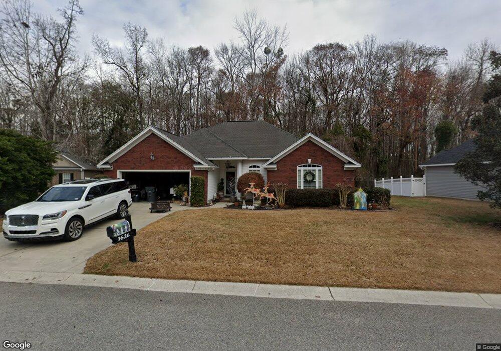
1626 Pheasant Pointe Ct Myrtle Beach, SC 29588
Estimated Value: $298,000 - $313,143
3
Beds
2
Baths
2,200
Sq Ft
$140/Sq Ft
Est. Value
About This Home
This home is located at 1626 Pheasant Pointe Ct, Myrtle Beach, SC 29588 and is currently estimated at $307,036, approximately $139 per square foot. 1626 Pheasant Pointe Ct is a home located in Horry County with nearby schools including Socastee Elementary School, Forestbrook Middle School, and Socastee High School.
Ownership History
Date
Name
Owned For
Owner Type
Purchase Details
Closed on
Mar 18, 2011
Sold by
Federal Home Loan Mortgage Corporation
Bought by
Goforth Amber L
Current Estimated Value
Purchase Details
Closed on
Jul 28, 2010
Sold by
Master In Equity Horry County
Bought by
Federal Home Loan Mortgage Corporation
Purchase Details
Closed on
Jul 17, 2006
Sold by
Pierce Construction Inc
Bought by
Dollriehs John R and Dollriehs Dianne D
Home Financials for this Owner
Home Financials are based on the most recent Mortgage that was taken out on this home.
Original Mortgage
$215,900
Interest Rate
6.6%
Mortgage Type
Purchase Money Mortgage
Purchase Details
Closed on
Sep 20, 2005
Sold by
Independent Builders Development Inc
Bought by
Pierce Construction Inc
Create a Home Valuation Report for This Property
The Home Valuation Report is an in-depth analysis detailing your home's value as well as a comparison with similar homes in the area
Home Values in the Area
Average Home Value in this Area
Purchase History
| Date | Buyer | Sale Price | Title Company |
|---|---|---|---|
| Goforth Amber L | $129,900 | -- | |
| Federal Home Loan Mortgage Corporation | -- | -- | |
| Dollriehs John R | $239,900 | None Available | |
| Pierce Construction Inc | $42,000 | -- |
Source: Public Records
Mortgage History
| Date | Status | Borrower | Loan Amount |
|---|---|---|---|
| Previous Owner | Dollriehs John R | $215,900 |
Source: Public Records
Tax History
| Year | Tax Paid | Tax Assessment Tax Assessment Total Assessment is a certain percentage of the fair market value that is determined by local assessors to be the total taxable value of land and additions on the property. | Land | Improvement |
|---|---|---|---|---|
| 2025 | $789 | $0 | $0 | $0 |
| 2024 | $789 | $12,722 | $2,828 | $9,894 |
| 2023 | $789 | $6,613 | $1,517 | $5,096 |
| 2021 | $715 | $7,775 | $1,603 | $6,172 |
| 2020 | $619 | $7,775 | $1,603 | $6,172 |
| 2019 | $619 | $7,775 | $1,603 | $6,172 |
| 2018 | $0 | $5,750 | $1,318 | $4,432 |
| 2017 | $545 | $5,750 | $1,318 | $4,432 |
| 2016 | -- | $5,750 | $1,318 | $4,432 |
| 2015 | $555 | $5,751 | $1,319 | $4,432 |
| 2014 | $514 | $5,751 | $1,319 | $4,432 |
Source: Public Records
Map
Nearby Homes
- 244 Colby Ct
- 245 Colby Ct
- TBD W Oak Circle Dr
- 13 Smith Blvd
- 188 Governors Loop
- 811 Luttie Rd
- 252 Stonebrook Dr
- 104 Meredith Ct Unit 104 Meredith Court
- 1412 Reid Ct
- 31 Smith Blvd
- 3704 Chapel Ln
- 240 Foxpath Loop
- 525 Sims Dr Unit MB
- 5789 Rosewood Dr
- 708 Luttie Rd
- 4625 Boxwood Dr
- 5867 Rosewood Dr
- 4730 Cottonwood Dr
- 209 Stonebrook Dr
- 205 Stonebrook Dr
- 1618 Pheasant Pointe Ct Unit Lawsons Landing
- 1618 Pheasant Pointe Ct
- 1630 Pheasant Pointe Ct
- 1625 Pheasant Pointe Ct
- 1629 Pheasant Pointe Ct
- 1621 Pheasant Pointe Ct
- 1614 Pheasant Pointe Ct
- 1614 Pheasant Pointe Ct Unit 1614 Pheasant Pointe
- 1617 Pheasant Pointe Ct Unit Lawsons Landing
- 1617 Pheasant Pointe Ct
- 1608 Pheasant Pointe Ct
- 1613 Pheasant Pointe Ct
- 1604 Pheasant Pointe Ct Unit Lawsons Landing
- 1604 Pheasant Pointe Ct
- 1609 Pheasant Pointe Ct
- 224 Colby Ct Unit MB
- 1600 Pheasant Pointe Ct Unit MB
- 1605 Pheasant Pointe Ct
- 220 Colby Ct Unit MB
- 232 Colby Ct
Your Personal Tour Guide
Ask me questions while you tour the home.