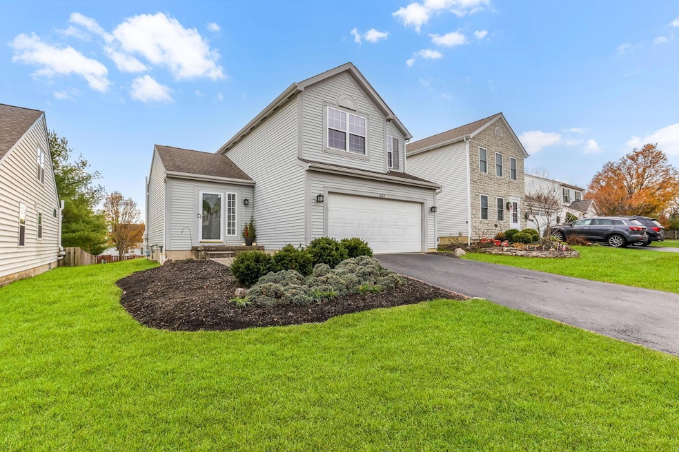
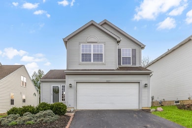
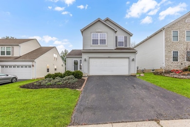
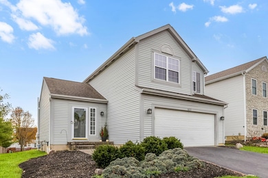
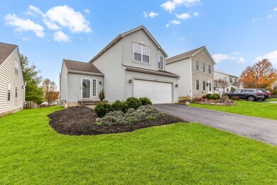
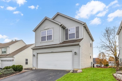
1627 Bristol Commons Place Columbus, OH 43240
Polaris North NeighborhoodEstimated payment $2,549/month
Highlights
- No HOA
- 2 Car Attached Garage
- Forced Air Heating and Cooling System
- Freedom Trail Elementary School Rated A
- Patio
About This Home
Step into this bright and inviting 3-bedroom, 2.5-bath home offering over 1,300 sq ft of comfortable, modern living in one of Delaware County's most desirable communities! Enjoy an open-concept kitchen and living area perfect for hosting, relaxing, and everyday living. A full basement provides endless possibilities—home gym, workshop, playroom, or future finished space.
Outside, the spacious backyard is ideal for gatherings, pets, or a garden oasis. The attached 2-car garage adds convenience and extra storage, while the location puts you just minutes from popular shops, restaurants, top-rated schools, and everyday essentials.
Move-in ready, well-maintained, and packed with value—this one checks all the boxes!
Home Details
Home Type
- Single Family
Est. Annual Taxes
- $5,040
Year Built
- Built in 2001
Parking
- 2 Car Attached Garage
- Garage Door Opener
Home Design
- Block Foundation
Interior Spaces
- 1,338 Sq Ft Home
- 2-Story Property
- Insulated Windows
- Laundry on lower level
- Basement
Bedrooms and Bathrooms
- 3 Bedrooms
Additional Features
- Patio
- 9,148 Sq Ft Lot
- Forced Air Heating and Cooling System
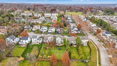
Community Details
- No Home Owners Association
Listing and Financial Details
- Assessor Parcel Number 318-424-12-023-000
Map
Home Values in the Area
Average Home Value in this Area
Tax History
| Year | Tax Paid | Tax Assessment Tax Assessment Total Assessment is a certain percentage of the fair market value that is determined by local assessors to be the total taxable value of land and additions on the property. | Land | Improvement |
|---|---|---|---|---|
| 2024 | $5,040 | $103,610 | $26,640 | $76,970 |
| 2023 | $5,061 | $103,610 | $26,640 | $76,970 |
| 2022 | $4,842 | $78,930 | $18,200 | $60,730 |
| 2021 | $4,869 | $78,930 | $18,200 | $60,730 |
| 2020 | $4,896 | $78,930 | $18,200 | $60,730 |
| 2019 | $3,951 | $67,170 | $16,560 | $50,610 |
| 2018 | $3,970 | $67,170 | $16,560 | $50,610 |
| 2017 | $3,742 | $63,320 | $14,700 | $48,620 |
| 2016 | $3,970 | $63,320 | $14,700 | $48,620 |
| 2015 | $3,562 | $63,320 | $14,700 | $48,620 |
| 2014 | $3,616 | $63,320 | $14,700 | $48,620 |
| 2013 | $3,615 | $61,920 | $14,700 | $47,220 |
Property History
| Date | Event | Price | List to Sale | Price per Sq Ft |
|---|---|---|---|---|
| 12/01/2025 12/01/25 | Pending | -- | -- | -- |
| 11/26/2025 11/26/25 | For Sale | $405,000 | -- | $303 / Sq Ft |
Purchase History
| Date | Type | Sale Price | Title Company |
|---|---|---|---|
| Warranty Deed | $239,000 | None Available | |
| Deed | $182,905 | -- |
Mortgage History
| Date | Status | Loan Amount | Loan Type |
|---|---|---|---|
| Open | $219,000 | New Conventional | |
| Previous Owner | $180,720 | FHA |
Source: Columbus and Central Ohio Regional MLS
MLS Number: 225044200
APN: 318-424-12-023-000
Disclaimer: Certain information contained herein is derived from information provided by parties other than Homes.com. All information provided is deemed reliable, but is not guaranteed to be accurate and should be independently verified.
![]() IDX information is provided exclusively for personal, non-commercial use, and may not be used for any purpose other than to identify prospective properties consumers may be interested in purchasing.
IDX information is provided exclusively for personal, non-commercial use, and may not be used for any purpose other than to identify prospective properties consumers may be interested in purchasing.
Information is deemed reliable but not guaranteed.
- 3138 E Powell Rd
- 3313 Glen Oaks Ct
- 1746 E Powell Rd
- 7631 Pleasant Colony Ct
- 3670 E Powell Rd
- 3679 Birkland Cir
- 2216 Reeves Ave
- 7697 Bale Kenyon Rd
- 7485 Bold Venture Ct
- 1923 Myrtle St
- 8293 Mira St Unit 175
- 2383 Bold Venture Dr
- 1955 Royal Oak Dr
- 758 Parkgrove Way Unit 758
- 8361 Sable Crossing Dr Unit 8361
- 8321 Sable Crossing Dr
- 1143 Little Bear Place
- 9170 Parkbury Ln
- 953 Arcadia Blvd
- 1193 Hollytree Ln Unit 1193
