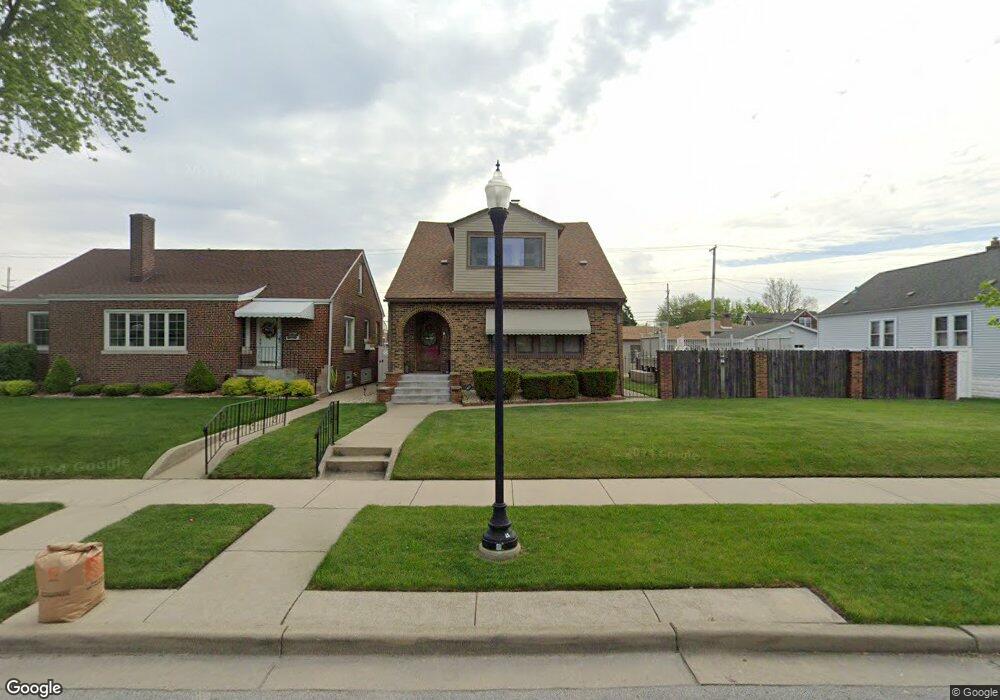
1627 Brown Ave Whiting, IN 46394
Estimated Value: $279,000 - $342,086
4
Beds
3
Baths
2,702
Sq Ft
$111/Sq Ft
Est. Value
About This Home
This home is located at 1627 Brown Ave, Whiting, IN 46394 and is currently estimated at $298,772, approximately $110 per square foot. 1627 Brown Ave is a home located in Lake County with nearby schools including Benjamin Franklin Elementary School, Eggers Middle School, and Hammond High School.
Ownership History
Date
Name
Owned For
Owner Type
Purchase Details
Closed on
Feb 17, 2009
Sold by
Hadean Adrian
Bought by
Tomaka Phillip and Tomaka Melissa G
Current Estimated Value
Purchase Details
Closed on
Apr 26, 2006
Sold by
Czajkowski Mary
Bought by
Hadean Adrian
Home Financials for this Owner
Home Financials are based on the most recent Mortgage that was taken out on this home.
Original Mortgage
$179,000
Interest Rate
9.89%
Mortgage Type
Fannie Mae Freddie Mac
Create a Home Valuation Report for This Property
The Home Valuation Report is an in-depth analysis detailing your home's value as well as a comparison with similar homes in the area
Home Values in the Area
Average Home Value in this Area
Purchase History
| Date | Buyer | Sale Price | Title Company |
|---|---|---|---|
| Tomaka Phillip | -- | Community Title Company | |
| Hadean Adrian | -- | Chicago Title Insurance Co |
Source: Public Records
Mortgage History
| Date | Status | Borrower | Loan Amount |
|---|---|---|---|
| Previous Owner | Hadean Adrian | $179,000 |
Source: Public Records
Tax History
| Year | Tax Paid | Tax Assessment Tax Assessment Total Assessment is a certain percentage of the fair market value that is determined by local assessors to be the total taxable value of land and additions on the property. | Land | Improvement |
|---|---|---|---|---|
| 2025 | $3,330 | $273,600 | $44,500 | $229,100 |
| 2024 | $10,907 | $248,200 | $44,500 | $203,700 |
| 2023 | $3,141 | $228,200 | $45,200 | $183,000 |
| 2022 | $3,141 | $221,600 | $45,200 | $176,400 |
| 2021 | $2,706 | $190,700 | $22,700 | $168,000 |
| 2020 | $2,500 | $176,000 | $22,700 | $153,300 |
| 2019 | $2,394 | $159,500 | $22,700 | $136,800 |
| 2018 | $2,440 | $148,500 | $22,700 | $125,800 |
| 2017 | $2,637 | $142,600 | $22,700 | $119,900 |
| 2016 | $2,301 | $139,800 | $22,700 | $117,100 |
| 2014 | $2,305 | $136,800 | $22,700 | $114,100 |
| 2013 | $2,310 | $143,700 | $22,700 | $121,000 |
Source: Public Records
Map
Nearby Homes
- 1609 Caroline Ave
- 1806 Brown Ave
- 1346 Stanton Ave
- 1409 Lake Ave
- 1643 Roberts Ave
- 1944 Warwick Ave
- 1539 Myrtle Ave
- 1710 Atchison Ave
- 1949 Lake Ave
- 1719 Atchison Ave
- 2024 Lake Ave
- 1631 Cleveland Ave
- 1704 Central Ave
- 1623 Central Ave
- 1711 Central Ave
- 1218 120th St
- 2134 Lincoln Ave
- 2231 Davis Ave
- 1726 Oliver St
- 1314 121st St
- 1625 Brown Ave
- 1633 Brown Ave
- 1647 Brown Ave
- 1637 Brown Ave
- 1619 Brown Ave
- 1639 Brown Ave
- 1644 Brown Ave
- 1630 Calumet Ave
- 1615 Brown Ave
- 1641 Brown Ave
- 1628 Calumet Ave
- 1630 Brown Ave
- 1628 Brown Ave
- 1624 Calumet Ave
- 1636 Calumet Ave
- 1632 Brown Ave
- 1626 Brown Ave
- 1645 Brown Ave
- 1638 Calumet Ave
- 1636 Brown Ave
Your Personal Tour Guide
Ask me questions while you tour the home.