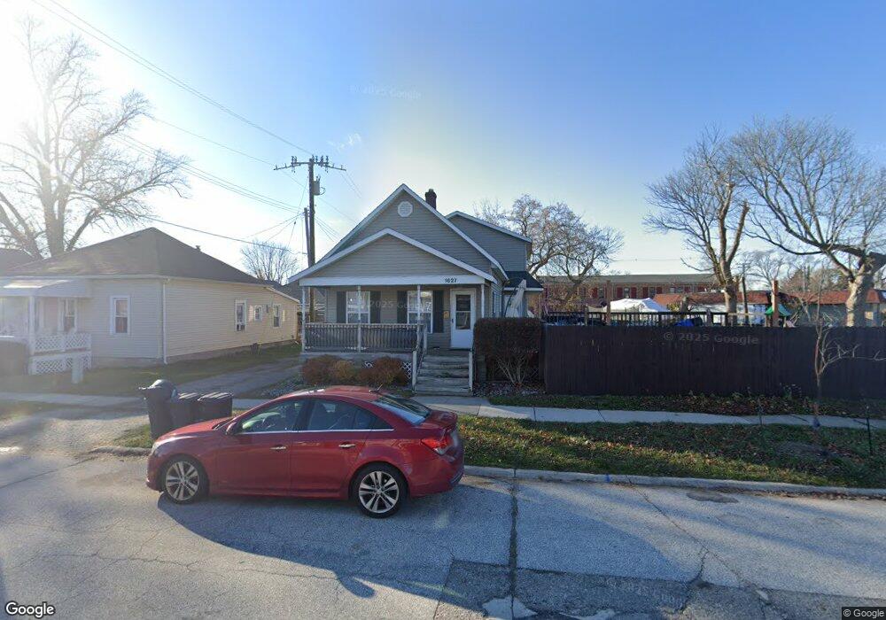
1627 Elk St Unit Bldg-Unit Port Huron, MI 48060
Estimated Value: $155,453 - $170,000
4
Beds
1
Bath
1,992
Sq Ft
$82/Sq Ft
Est. Value
About This Home
This home is located at 1627 Elk St Unit Bldg-Unit, Port Huron, MI 48060 and is currently estimated at $163,363, approximately $82 per square foot. 1627 Elk St Unit Bldg-Unit is a home located in St. Clair County with nearby schools including H.D. Crull Elementary School, Holland Woods Middle School, and Port Huron Northern High School.
Ownership History
Date
Name
Owned For
Owner Type
Purchase Details
Closed on
Dec 28, 2017
Sold by
Burns Kevin
Bought by
Ellis Kyle B
Current Estimated Value
Home Financials for this Owner
Home Financials are based on the most recent Mortgage that was taken out on this home.
Original Mortgage
$85,470
Outstanding Balance
$73,564
Interest Rate
4.75%
Mortgage Type
FHA
Estimated Equity
$89,799
Purchase Details
Closed on
May 27, 2009
Sold by
Bank Of New York
Bought by
Burns Kevin
Purchase Details
Closed on
Aug 15, 2008
Sold by
Mortgage Electronic Registration Systems
Bought by
Bank Of New York
Purchase Details
Closed on
Aug 14, 2008
Sold by
Minke Jeffrey P and Minke Florence A
Bought by
Mortgage Electronic Registration Systems
Create a Home Valuation Report for This Property
The Home Valuation Report is an in-depth analysis detailing your home's value as well as a comparison with similar homes in the area
Home Values in the Area
Average Home Value in this Area
Purchase History
| Date | Buyer | Sale Price | Title Company |
|---|---|---|---|
| Ellis Kyle B | $88,000 | -- | |
| Burns Kevin | $22,900 | Attorneys Title Agency Llc | |
| Bank Of New York | -- | None Available | |
| Mortgage Electronic Registration Systems | $68,600 | None Available |
Source: Public Records
Mortgage History
| Date | Status | Borrower | Loan Amount |
|---|---|---|---|
| Open | Ellis Kyle B | $85,470 |
Source: Public Records
Tax History Compared to Growth
Tax History
| Year | Tax Paid | Tax Assessment Tax Assessment Total Assessment is a certain percentage of the fair market value that is determined by local assessors to be the total taxable value of land and additions on the property. | Land | Improvement |
|---|---|---|---|---|
| 2025 | $1,993 | $74,700 | $0 | $0 |
| 2024 | $1,683 | $69,300 | $0 | $0 |
| 2023 | $1,590 | $61,400 | $0 | $0 |
| 2022 | $1,654 | $52,600 | $0 | $0 |
| 2021 | $1,570 | $48,500 | $0 | $0 |
| 2020 | $1,588 | $44,900 | $44,900 | $0 |
| 2019 | $1,560 | $31,000 | $0 | $0 |
| 2018 | $2,133 | $31,000 | $0 | $0 |
| 2017 | $1,088 | $29,200 | $0 | $0 |
| 2016 | $924 | $29,200 | $0 | $0 |
| 2015 | $907 | $26,600 | $26,600 | $0 |
| 2014 | $907 | $25,300 | $25,300 | $0 |
| 2013 | -- | $25,400 | $0 | $0 |
Source: Public Records
Map
Nearby Homes
- 1433 Poplar St
- 1620 McBrady St
- 1649 Whipple St
- 1417 Kearney St
- 1733 Whipple St
- 1907 Riverside Dr
- 1002 Erie St
- 917 Saint Clair St
- 1819 Riverside Dr
- 2400 Stone St Unit 2414
- 711 Stanton St
- 2419 Cherry St
- 1116 Hancock St
- 805 Pine Grove Ave
- 1321 Nelson St
- 0000 Campau Ave
- 2431 Armour St
- 2534 Forest St
- 29 Taylor St
- 1203 Varney St
- 1627 Elk St
- 1615 Elk St
- 1635 Pine Grove Ave
- 1213 Thomas St
- 1607 Elk St
- 1603 Elk St
- 1615 Pine Grove Ave
- 1703 Pine Grove Ave
- 1605 Pine Grove Ave
- 1700 Poplar St
- 1610 Poplar St
- 1604 Poplar St
- 1531 Elk St
- 1301 Whipple St
- 1532 Poplar St
- 1309 Whipple St
- 1523 Elk St
- 1616 10th Ave
- 1528 Poplar St
- 1723 Pine Grove Ave