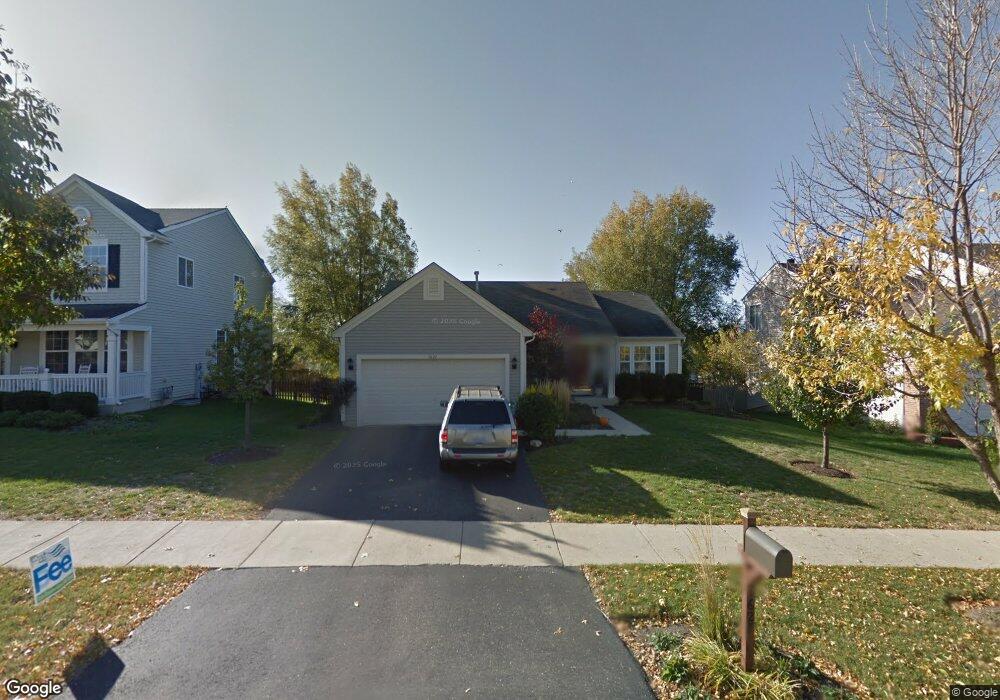
1627 Grantham Ln Aurora, IL 60503
Far Southeast NeighborhoodEstimated Value: $395,648 - $428,000
3
Beds
2
Baths
1,585
Sq Ft
$257/Sq Ft
Est. Value
About This Home
This home is located at 1627 Grantham Ln, Aurora, IL 60503 and is currently estimated at $406,912, approximately $256 per square foot. 1627 Grantham Ln is a home located in Kendall County with nearby schools including The Wheatlands Elementary School, Bednarcik Jr. High School, and Oswego East High School.
Ownership History
Date
Name
Owned For
Owner Type
Purchase Details
Closed on
Dec 21, 2000
Sold by
Drh Cambridge Homes Inc
Bought by
Vandenberg John and Vandenberg Lynnet
Current Estimated Value
Home Financials for this Owner
Home Financials are based on the most recent Mortgage that was taken out on this home.
Original Mortgage
$181,950
Outstanding Balance
$67,533
Interest Rate
7.8%
Estimated Equity
$339,379
Create a Home Valuation Report for This Property
The Home Valuation Report is an in-depth analysis detailing your home's value as well as a comparison with similar homes in the area
Home Values in the Area
Average Home Value in this Area
Purchase History
| Date | Buyer | Sale Price | Title Company |
|---|---|---|---|
| Vandenberg John | $192,000 | -- |
Source: Public Records
Mortgage History
| Date | Status | Borrower | Loan Amount |
|---|---|---|---|
| Open | Vandenberg John | $181,950 |
Source: Public Records
Tax History
| Year | Tax Paid | Tax Assessment Tax Assessment Total Assessment is a certain percentage of the fair market value that is determined by local assessors to be the total taxable value of land and additions on the property. | Land | Improvement |
|---|---|---|---|---|
| 2024 | $9,232 | $109,909 | $28,223 | $81,686 |
| 2023 | $8,460 | $98,133 | $25,199 | $72,934 |
| 2022 | $8,460 | $90,030 | $23,118 | $66,912 |
| 2021 | $7,930 | $81,845 | $21,016 | $60,829 |
| 2020 | $7,855 | $80,240 | $20,604 | $59,636 |
| 2019 | $7,452 | $74,819 | $20,604 | $54,215 |
| 2018 | $7,138 | $72,233 | $19,892 | $52,341 |
| 2017 | $6,914 | $66,575 | $18,334 | $48,241 |
| 2016 | $6,619 | $63,104 | $17,378 | $45,726 |
| 2015 | $6,813 | $60,099 | $16,550 | $43,549 |
| 2014 | -- | $56,697 | $15,613 | $41,084 |
| 2013 | -- | $57,270 | $15,771 | $41,499 |
Source: Public Records
Map
Nearby Homes
- 1633 Fredericksburg Ln Unit 2
- 2208 Grand Pointe Trail
- 2060 Lyndhurst Ln
- 1973 Eastwick Ln
- 552 Lincoln Station Dr Unit 2301
- 2084 Canyon Creek Ct
- 1745 Baler Ave
- 1739 Baler Ave
- 1733 Stable Ln
- 1715 Baler Ave
- 1738 Baler Ave
- 1733 Baler Ave
- 1853 Baler Ave
- 1740 Baler Ave
- 1744 Stable Ln
- 1752 Stable Ln
- 1748 Stable Ln
- 1900 Canyon Creek Dr
- 49 Waterbury Cir
- 1830 Canyon Creek Dr
- 1633 Grantham Ln
- 1621 Grantham Ln
- 2108 Grand Pointe Trail
- 2102 Grand Pointe Trail
- 1639 Grantham Ln
- 2114 Grand Pointe Trail
- 2111 Chesterfield Ln
- 2130 Summerlin Dr Unit 3
- 2130 Summerlin Dr
- 1645 Grantham Ln Unit 3
- 2120 Grand Pointe Trail
- 2103 Chesterfield Ln
- 2120 Summerlin Dr
- 2106 Chesterfield Ln
- 1651 Grantham Ln
- 2126 Grand Pointe Trail
- 2095 Chesterfield Ln Unit 3
- 2107 Grand Pointe Trail
- 2101 Grand Pointe Trail
- 2098 Chesterfield Ln
Your Personal Tour Guide
Ask me questions while you tour the home.