Estimated Value: $112,000 - $181,000
1
Bed
1
Bath
748
Sq Ft
$189/Sq Ft
Est. Value
About This Home
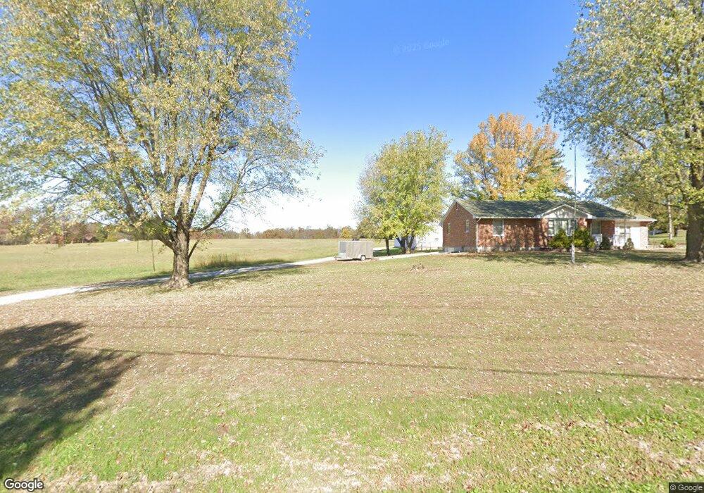
This home is located at 1627 Highway D, Silex, MO 63377 and is currently estimated at $141,656, approximately $189 per square foot. 1627 Highway D is a home located in Lincoln County with nearby schools including Hawk Point Elementary School, Troy Middle School, and Troy Buchanan High School.
Ownership History
Date
Name
Owned For
Owner Type
Purchase Details
Closed on
May 25, 2005
Sold by
Dickherber Floyd A and Dickherber Mary Alice
Bought by
Walters Stephen
Current Estimated Value
Home Financials for this Owner
Home Financials are based on the most recent Mortgage that was taken out on this home.
Original Mortgage
$65,000
Outstanding Balance
$39,444
Interest Rate
8.5%
Mortgage Type
Adjustable Rate Mortgage/ARM
Estimated Equity
$102,212
Create a Home Valuation Report for This Property
The Home Valuation Report is an in-depth analysis detailing your home's value as well as a comparison with similar homes in the area
Home Values in the Area
Average Home Value in this Area
Purchase History
| Date | Buyer | Sale Price | Title Company |
|---|---|---|---|
| Walters Stephen | $65,000 | Davis Title & Abstract Co |
Source: Public Records
Mortgage History
| Date | Status | Borrower | Loan Amount |
|---|---|---|---|
| Open | Walters Stephen | $65,000 |
Source: Public Records
Tax History Compared to Growth
Tax History
| Year | Tax Paid | Tax Assessment Tax Assessment Total Assessment is a certain percentage of the fair market value that is determined by local assessors to be the total taxable value of land and additions on the property. | Land | Improvement |
|---|---|---|---|---|
| 2025 | $720 | $11,894 | $4,380 | $7,514 |
| 2024 | $692 | $11,216 | $4,085 | $7,131 |
| 2023 | $688 | $11,216 | $4,085 | $7,131 |
| 2022 | $671 | $11,007 | $4,085 | $6,922 |
| 2021 | $672 | $57,740 | $0 | $0 |
| 2020 | $624 | $54,510 | $0 | $0 |
| 2019 | $624 | $54,510 | $0 | $0 |
| 2018 | $561 | $9,177 | $0 | $0 |
| 2017 | $562 | $9,177 | $0 | $0 |
| 2016 | $502 | $8,026 | $0 | $0 |
| 2015 | $504 | $8,026 | $0 | $0 |
| 2014 | $493 | $7,845 | $0 | $0 |
| 2013 | -- | $7,218 | $0 | $0 |
Source: Public Records
Map
Nearby Homes
- 0 Cedar Circle Ln Unit MIS25071955
- 100 Otto Ct
- 45 Blue Line Ln
- 106 Otto Ct
- 112 Otto Ct
- 118 Otto Ct
- 10 Big Tom Ct
- 25 Turkey Run Dr
- 404 Deep Forest Dr
- 804 Timber Creek Ct
- 4 Ashley Ln
- 155 Stepanek Rd
- 270 Derek Dr
- 0 Quarry Rd
- 0 Quarry Rd Unit 23201205
- TBD B H Hwy
- 14844 Ralls Dr
- 14633 Dotzler Way
- 000 Cave Farm Rd
- 125 Otto Ct
- 25 Cedar Circle Ln
- 0 Cedar Circle Ln Unit 11022201
- 1601 Highway D
- 1608 Highway D
- 42 Palmer School Ln
- 55 Cedar Circle Ln
- 46 Palmer School Ln
- 0 Palmer School
- 62 Cedar Circle Ln
- 1668 Highway D
- 58 Cedar Circle Ln
- 11 Palmer School Ln
- 55 Palmer School Ln
- 78 Palmer School Ln
- 94 Cedar Circle Ln
- 92 Palmer School Ln
- 0 Hwy D Unit 16078571
- 0 48 54 + - Acres M L Hwy D Unit 16082127
- 1480 Highway D
- 1506 Highway D