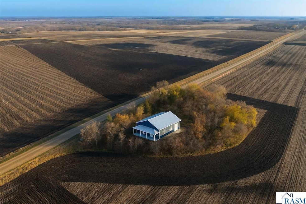
16280 552nd Ave Good Thunder, MN 56037
Estimated payment $2,260/month
Highlights
- Ranch Style House
- Bathroom on Main Level
- Home to be built
- 4 Car Attached Garage
- Forced Air Heating and Cooling System
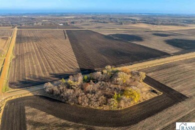
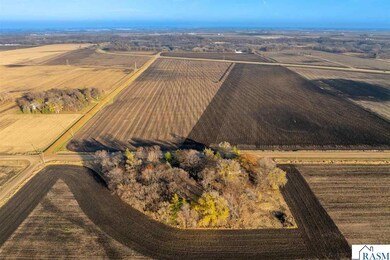
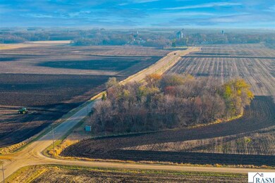
About This Lot
Brand-New Shouse Minutes from Mankato – Modern Living Meets Ultimate Functionality. Discover the perfect blend of comfort, style, and versatility in this brand new 3 bedroom shouse, ideally located just minutes from Mankato. Set in a beautiful, peaceful location, this property offers the rare opportunity to enjoy modern residential living paired with exceptional workspace or storage options. Step inside to an open-concept layout featuring quality construction throughout, spacious living areas, and the convenience of single-level living. Whether youre looking for room to grow, a place to run your hobbies or business, or simply a low-maintenance new build in a great area, this home checks every box. Enjoy the best of rural tranquility while staying close to all the dining, shopping, and amenities of Mankato—truly the ideal combination of privacy and accessibility. Please inquire for more details.

Property Details
Property Type
- Land
Est. Annual Taxes
- $640
Year Built
- Built in 2025
Lot Details
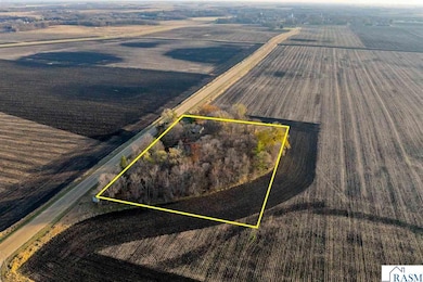
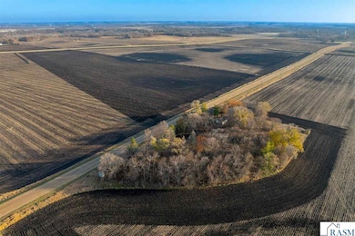
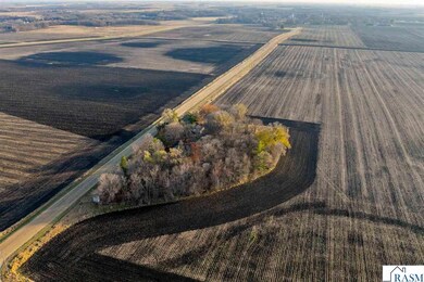
- 2.89 Acre Lot
- Lot Dimensions are 270x466.26
Parking
- 4 Car Attached Garage
Home Design
- Home to be built
- Ranch Style House
- Slab Foundation
- Steel Siding
Bedrooms and Bathrooms
- 3 Bedrooms
- Bathroom on Main Level
- 2 Full Bathrooms
Laundry
- Washer and Dryer Hookup
Utilities
- Forced Air Heating and Cooling System
- Private Water Source
- Private Sewer
Listing and Financial Details
- Assessor Parcel Number R42-18-04-200-010
Map
Home Values in the Area
Average Home Value in this Area
Tax History
| Year | Tax Paid | Tax Assessment Tax Assessment Total Assessment is a certain percentage of the fair market value that is determined by local assessors to be the total taxable value of land and additions on the property. | Land | Improvement |
|---|---|---|---|---|
| 2025 | $640 | $74,000 | $60,000 | $14,000 |
| 2024 | $640 | $72,600 | $60,000 | $12,600 |
| 2023 | $756 | $78,100 | $60,000 | $18,100 |
| 2022 | $866 | $75,500 | $60,000 | $15,500 |
| 2021 | $772 | $76,000 | $60,000 | $16,000 |
| 2020 | $544 | $65,900 | $50,000 | $15,900 |
| 2019 | $552 | $65,900 | $50,000 | $15,900 |
| 2018 | $526 | $64,400 | $50,000 | $14,400 |
| 2017 | $540 | $62,800 | $50,000 | $12,800 |
| 2016 | $534 | $62,400 | $50,000 | $12,400 |
| 2015 | $5 | $61,200 | $50,000 | $11,200 |
| 2014 | $564 | $183,600 | $150,000 | $33,600 |
Property History
| Date | Event | Price | List to Sale | Price per Sq Ft |
|---|---|---|---|---|
| 11/21/2025 11/21/25 | For Sale | $419,000 | -- | -- |
Purchase History
| Date | Type | Sale Price | Title Company |
|---|---|---|---|
| Warranty Deed | $103,000 | Compeer Title | |
| Deed | $103,000 | -- |
Mortgage History
| Date | Status | Loan Amount | Loan Type |
|---|---|---|---|
| Open | $73,000 | New Conventional | |
| Closed | $102,500 | No Value Available |
Source: REALTOR® Association of Southern Minnesota
MLS Number: 7039131
APN: R42-18-04-200-010
Disclaimer: Certain information contained herein is derived from information provided by parties other than Homes.com. All information provided is deemed reliable, but is not guaranteed to be accurate and should be independently verified.
![]() IDX information is provided exclusively for personal, non-commercial use, and may not be used for any purpose other than to identify prospective properties consumers may be interested in purchasing. Information is deemed reliable but not guaranteed.
IDX information is provided exclusively for personal, non-commercial use, and may not be used for any purpose other than to identify prospective properties consumers may be interested in purchasing. Information is deemed reliable but not guaranteed.
- 210 N Halladay St
- 721 Main St
- 217 S Houk St
- 331 S Ewing St
- 16225 563rd Ave
- 57400 178th Ln
- 120 Mapleridge Dr
- 3136 River Meadows Dr
- 57396 181st Ln
- 17172 State 22 Hwy Unit 17172 State Highway
- 0 Tbd E 161st St
- 0 Tbd E Tbd Unit 7038384
- 57868 179th St
- 55997 132nd St
- 305 E Main St
- 277 Red Ridge Rd
- 205 Park Ave N
- 201 Park Ave N
- 55807 River Fort Dr
- 55856 River Fort Dr
- 744 James Ave
- 129 Savannah S
- 520 James Ave
- 1902 Warren St
- 450-470 James Ave
- 301 W Bert St Unit 28
- 321 W Bert St Unit 1
- 311 Bunting Ln
- 1340 Warren St
- 111 Redtail Ct
- 1228 Highland Ave
- 427 W Pleasant St Unit 2
- 202 Balcerzak Dr
- 160-180 Homestead Rd
- 1103 Highland Ave
- 127 Sandpiper Dr
- 429 State St Unit 203
- 200 Briargate Rd
- 303 State St
- 100 Meadow Bloom Ln