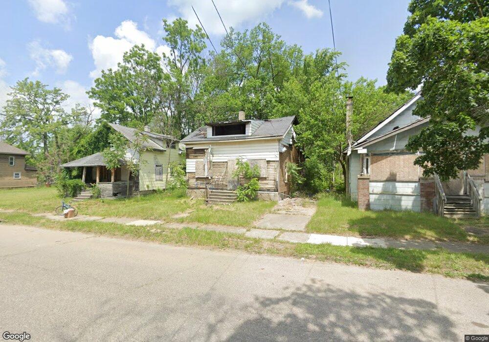
1629 Delaware Ave Flint, MI 48506
Eastside NeighborhoodEstimated Value: $22,603 - $52,000
3
Beds
2
Baths
1,356
Sq Ft
$25/Sq Ft
Est. Value
About This Home
This home is located at 1629 Delaware Ave, Flint, MI 48506 and is currently estimated at $34,201, approximately $25 per square foot. 1629 Delaware Ave is a home located in Genesee County with nearby schools including Potter School, Flint Cultural Center Academy, and WAY Academy of Flint.
Ownership History
Date
Name
Owned For
Owner Type
Purchase Details
Closed on
Aug 5, 2014
Sold by
Ferrin Dora J
Bought by
Shartzer Andrew and Shartzer Daniel
Current Estimated Value
Purchase Details
Closed on
Jul 17, 2001
Sold by
Freeman Duncan
Bought by
Ferrin Dora J
Purchase Details
Closed on
Mar 30, 1999
Sold by
Carrasco Gail A
Bought by
Sterling Bank & Trust Fsb and Sterling Svgs Bank Fsb
Home Financials for this Owner
Home Financials are based on the most recent Mortgage that was taken out on this home.
Original Mortgage
$13,900
Interest Rate
11%
Mortgage Type
Seller Take Back
Create a Home Valuation Report for This Property
The Home Valuation Report is an in-depth analysis detailing your home's value as well as a comparison with similar homes in the area
Home Values in the Area
Average Home Value in this Area
Purchase History
| Date | Buyer | Sale Price | Title Company |
|---|---|---|---|
| Shartzer Andrew | -- | None Available | |
| Ferrin Dora J | $17,500 | Blue Water Title Company | |
| Freeman Duncan | $15,500 | -- | |
| Sterling Bank & Trust Fsb | $15,500 | -- | |
| Freeman Duncan | $15,500 | -- |
Source: Public Records
Mortgage History
| Date | Status | Borrower | Loan Amount |
|---|---|---|---|
| Previous Owner | Freeman Duncan | $13,900 |
Source: Public Records
Tax History
| Year | Tax Paid | Tax Assessment Tax Assessment Total Assessment is a certain percentage of the fair market value that is determined by local assessors to be the total taxable value of land and additions on the property. | Land | Improvement |
|---|---|---|---|---|
| 2025 | -- | $0 | $0 | $0 |
| 2024 | -- | $0 | $0 | $0 |
| 2023 | -- | $0 | $0 | $0 |
| 2022 | $0 | $0 | $0 | $0 |
| 2021 | $0 | $0 | $0 | $0 |
| 2020 | $0 | $0 | $0 | $0 |
| 2019 | $445 | $0 | $0 | $0 |
| 2018 | $284 | $2,200 | $0 | $0 |
| 2017 | $315 | $0 | $0 | $0 |
| 2016 | $445 | $0 | $0 | $0 |
| 2015 | -- | $0 | $0 | $0 |
| 2014 | -- | $0 | $0 | $0 |
| 2012 | -- | $5,300 | $0 | $0 |
Source: Public Records
Map
Nearby Homes
- 1629 New York Ave
- 1721 New York Ave
- 1730 Oklahoma Ave
- 1454 Delaware Ave
- 1513 Jane Ave
- 1733 Oklahoma Ave
- 1445 Maryland Ave
- 1805 Bennett Ave
- 1518 Leith St
- 2506 Arlington Ave
- 1623 Montana Ave
- 1526 Montana Ave
- 1422 Leith St
- 1805 Montana Ave
- 2217 Maryland Ave
- 1529 Broadway Blvd
- 1526 Arizona Ave
- 2321 Levern St
- 1510 Utah Ave
- 2426 Broadway Blvd
- 1625 Delaware Ave
- 1633 Delaware Ave
- 1637 Delaware Ave
- 1615 & 1617 Delaware Ave
- 1617 Delaware Ave
- 1641 Delaware Ave
- 1628 Maryland Ave
- 1632 Maryland Ave
- 1636 Maryland Ave
- 1615 Delaware Ave
- 1620 Maryland Ave
- 1645 Delaware Ave
- 1640 Maryland Ave
- 1630 Delaware Ave
- 1626 Delaware Ave
- 1634 Delaware Ave
- 1609 Delaware Ave
- 1644 Maryland Ave
- 1622 Delaware Ave
- 1647 Delaware Ave
Your Personal Tour Guide
Ask me questions while you tour the home.