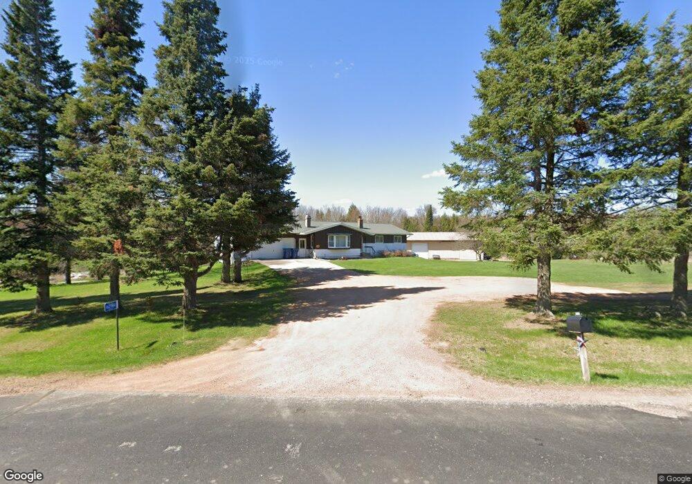
162984 Owl Ridge Rd Wausau, WI 54403
Estimated Value: $276,354 - $337,000
--
Bed
--
Bath
--
Sq Ft
2.74
Acres
About This Home
This home is located at 162984 Owl Ridge Rd, Wausau, WI 54403 and is currently estimated at $315,118. 162984 Owl Ridge Rd is a home located in Marathon County with nearby schools including Hewitt-Texas Elementary School, Horace Mann Middle School, and East High School.
Ownership History
Date
Name
Owned For
Owner Type
Purchase Details
Closed on
Sep 11, 2020
Sold by
Glatczak James M and Glatczak Linda M
Bought by
Stolze Thomas M
Current Estimated Value
Home Financials for this Owner
Home Financials are based on the most recent Mortgage that was taken out on this home.
Original Mortgage
$190,000
Outstanding Balance
$168,612
Interest Rate
2.9%
Mortgage Type
New Conventional
Estimated Equity
$146,506
Purchase Details
Closed on
Oct 21, 1996
Sold by
Glatczak Linda
Bought by
Town Of Wausau
Create a Home Valuation Report for This Property
The Home Valuation Report is an in-depth analysis detailing your home's value as well as a comparison with similar homes in the area
Home Values in the Area
Average Home Value in this Area
Purchase History
| Date | Buyer | Sale Price | Title Company |
|---|---|---|---|
| Stolze Thomas M | $200,000 | Midwest Title | |
| Town Of Wausau | -- | None Available |
Source: Public Records
Mortgage History
| Date | Status | Borrower | Loan Amount |
|---|---|---|---|
| Open | Stolze Thomas M | $190,000 |
Source: Public Records
Tax History Compared to Growth
Tax History
| Year | Tax Paid | Tax Assessment Tax Assessment Total Assessment is a certain percentage of the fair market value that is determined by local assessors to be the total taxable value of land and additions on the property. | Land | Improvement |
|---|---|---|---|---|
| 2024 | $2,511 | $202,700 | $30,000 | $172,700 |
| 2023 | $2,868 | $202,700 | $30,000 | $172,700 |
| 2022 | $2,460 | $119,800 | $13,300 | $106,500 |
| 2021 | $2,383 | $119,800 | $13,300 | $106,500 |
| 2020 | $2,325 | $119,800 | $13,300 | $106,500 |
| 2019 | $2,260 | $119,800 | $13,300 | $106,500 |
| 2018 | $2,304 | $119,800 | $13,300 | $106,500 |
| 2017 | $2,314 | $119,800 | $13,300 | $106,500 |
| 2016 | $2,233 | $119,800 | $13,300 | $106,500 |
| 2015 | $2,280 | $119,800 | $13,300 | $106,500 |
| 2014 | $2,158 | $119,800 | $13,300 | $106,500 |
Source: Public Records
Map
Nearby Homes
- 0 County Road G
- 230912 Clover Creek Rd
- Lot 1 Mercedes Rd
- 230240 Northfork Dr
- 163539 Sandy Banks Dr
- 227881 County Road J
- 229800 County Road J
- 229302 County Road J
- 165590 Junction Rd
- 166004 Junction Rd
- 205 Aspen Grove Ln
- 501 Aspen Grove Ln
- Lot 1 Sideline Rd
- Lot 2 Sideline Rd
- 157471 Land Art Rd
- Lot 4 2.86 Acre Clearview Dr
- Lot 2 2.88 Acre Clearview Dr
- Lot 1 2.86 Acre Clearview Dr
- 6110 Kayak Dr
- 238285 Forest Lawn Rd
- 162827 Owl Ridge Rd
- 162827 Owl Ridge Rd
- 9202 Tower Rd
- 163491 Owl Ridge Rd
- 162347 Owl Ridge Rd
- 8102 Tower Rd Unit 8200
- 162296 Owl Ridge Rd
- 231390 Shenandoah Ridge Rd
- 163781 Owl Ridge Rd
- 1103 Shenandoah Ridge Rd
- 232906 & 232912 Colonial Rd
- 2306 N 97th St
- 231890 Colonial Rd
- 231890 Colonial Rd
- T8835 N 97th St
- T9751 N 97th St
- T9261 N 97th St
- T9322 N 97th St
- T9460 N 97th St
- T10421 N 97th St