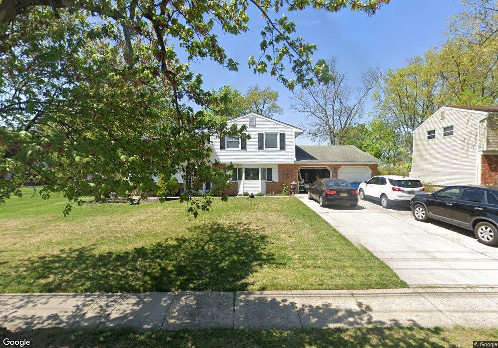
163 Conrow Rd Delran, NJ 08075
Estimated Value: $415,000 - $567,000
Studio
--
Bath
2,116
Sq Ft
$233/Sq Ft
Est. Value
About This Home
This home is located at 163 Conrow Rd, Delran, NJ 08075 and is currently estimated at $492,750, approximately $232 per square foot. 163 Conrow Rd is a home located in Burlington County with nearby schools including Millbridge Elementary School, Delran Intermediate School, and Delran Middle School.
Ownership History
Date
Name
Owned For
Owner Type
Purchase Details
Closed on
Oct 10, 2003
Sold by
Estate Of Alexander S Polonczyk and Polonczyk Alexander A
Bought by
Perry Steven J and Perry Marylou
Current Estimated Value
Home Financials for this Owner
Home Financials are based on the most recent Mortgage that was taken out on this home.
Original Mortgage
$25,000
Outstanding Balance
$11,598
Interest Rate
6.01%
Mortgage Type
Credit Line Revolving
Estimated Equity
$481,152
Create a Home Valuation Report for This Property
The Home Valuation Report is an in-depth analysis detailing your home's value as well as a comparison with similar homes in the area
Home Values in the Area
Average Home Value in this Area
Purchase History
| Date | Buyer | Sale Price | Title Company |
|---|---|---|---|
| Perry Steven J | $200,000 | Security First Title Partner |
Source: Public Records
Mortgage History
| Date | Status | Borrower | Loan Amount |
|---|---|---|---|
| Open | Perry Steven J | $25,000 | |
| Closed | Perry Steven J | $85,000 |
Source: Public Records
Tax History
| Year | Tax Paid | Tax Assessment Tax Assessment Total Assessment is a certain percentage of the fair market value that is determined by local assessors to be the total taxable value of land and additions on the property. | Land | Improvement |
|---|---|---|---|---|
| 2025 | $8,882 | $223,400 | $58,500 | $164,900 |
| 2024 | $8,802 | $223,400 | $58,500 | $164,900 |
| 2023 | $8,802 | $223,400 | $58,500 | $164,900 |
| 2022 | $8,688 | $223,400 | $58,500 | $164,900 |
| 2021 | $8,693 | $223,400 | $58,500 | $164,900 |
| 2020 | $8,675 | $223,400 | $58,500 | $164,900 |
| 2019 | $8,594 | $223,400 | $58,500 | $164,900 |
| 2018 | $8,451 | $223,400 | $58,500 | $164,900 |
| 2017 | $8,317 | $223,400 | $58,500 | $164,900 |
| 2016 | $8,194 | $223,400 | $58,500 | $164,900 |
| 2015 | $8,058 | $223,400 | $58,500 | $164,900 |
| 2014 | $7,707 | $223,400 | $58,500 | $164,900 |
Source: Public Records
Map
Nearby Homes
- 23 Lehigh Dr
- 213 Swedes Run Dr
- 115 Haines Mill Rd
- 1 Echo Ave
- 123 Shelly Ln
- 203 Congressional Ct
- 108 Patricia Ave
- 4304 Bridgeboro Rd
- 98 Red Stone Ridge
- 0 0 Swarthmore Dr
- 4327 Bridgeboro Rd
- 120 Coopers Kill Rd
- 119 Linda Ave
- 101 Tarlton Ct
- 212 Diane Ave
- 139 Coopers Kill Rd
- 51 Suburban Blvd
- 342 Huntington Dr Unit 342
- 121 Congressional Ct
- 115 Congressional Ct
Your Personal Tour Guide
Ask me questions while you tour the home.