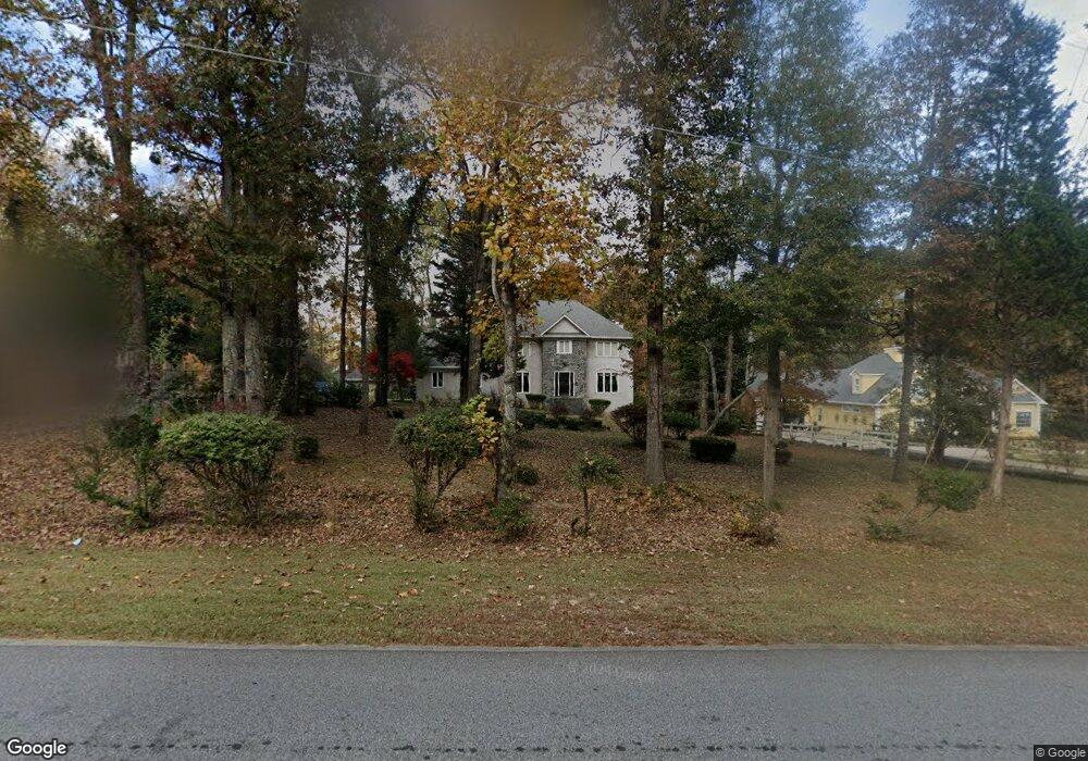
163 Graves Rd Fayetteville, GA 30214
Estimated Value: $421,000 - $510,000
--
Bed
--
Bath
2,656
Sq Ft
$178/Sq Ft
Est. Value
About This Home
This home is located at 163 Graves Rd, Fayetteville, GA 30214 and is currently estimated at $473,482, approximately $178 per square foot. 163 Graves Rd is a home located in Fayette County with nearby schools including Bennett's Mill Middle School, Fayette County High School, and The Forest School: An Acton Academy.
Ownership History
Date
Name
Owned For
Owner Type
Purchase Details
Closed on
Feb 5, 2020
Sold by
Wells William K
Bought by
Wells William K and Wells Edna I
Current Estimated Value
Purchase Details
Closed on
Aug 15, 2012
Sold by
Wells Edna I
Bought by
Wells William K
Home Financials for this Owner
Home Financials are based on the most recent Mortgage that was taken out on this home.
Original Mortgage
$162,250
Interest Rate
2.86%
Mortgage Type
New Conventional
Purchase Details
Closed on
Apr 30, 1999
Sold by
Thacker John E and Thacker Deta W
Bought by
Wells William K and Wells Edna I
Home Financials for this Owner
Home Financials are based on the most recent Mortgage that was taken out on this home.
Original Mortgage
$173,800
Interest Rate
6.87%
Mortgage Type
New Conventional
Create a Home Valuation Report for This Property
The Home Valuation Report is an in-depth analysis detailing your home's value as well as a comparison with similar homes in the area
Home Values in the Area
Average Home Value in this Area
Purchase History
| Date | Buyer | Sale Price | Title Company |
|---|---|---|---|
| Wells William K | -- | None Listed On Document | |
| Wells William K | -- | -- | |
| Wells William K | -- | -- | |
| Wells William K | $183,000 | -- |
Source: Public Records
Mortgage History
| Date | Status | Borrower | Loan Amount |
|---|---|---|---|
| Previous Owner | Wells William K | $162,250 | |
| Previous Owner | Wells William K | $173,800 |
Source: Public Records
Tax History Compared to Growth
Tax History
| Year | Tax Paid | Tax Assessment Tax Assessment Total Assessment is a certain percentage of the fair market value that is determined by local assessors to be the total taxable value of land and additions on the property. | Land | Improvement |
|---|---|---|---|---|
| 2024 | $1,439 | $195,728 | $37,600 | $158,128 |
| 2023 | $1,357 | $187,960 | $37,600 | $150,360 |
| 2022 | $1,102 | $146,000 | $37,600 | $108,400 |
| 2021 | $871 | $117,120 | $22,000 | $95,120 |
| 2020 | $2,774 | $102,000 | $15,000 | $87,000 |
| 2019 | $2,695 | $98,160 | $15,000 | $83,160 |
| 2018 | $2,584 | $91,920 | $15,000 | $76,920 |
| 2017 | $2,427 | $86,160 | $15,000 | $71,160 |
| 2016 | $2,481 | $86,160 | $15,000 | $71,160 |
| 2015 | $2,337 | $79,920 | $15,000 | $64,920 |
| 2014 | $1,971 | $66,640 | $15,000 | $51,640 |
| 2013 | -- | $66,640 | $0 | $0 |
Source: Public Records
Map
Nearby Homes
- 671 Ginger Cake Rd
- 636 Ginger Cake Rd
- 0 Highway 92 N Unit 10594507
- 0 Highway 92 N Unit 7570733
- 145 Woodsong Dr
- 220 Eastmark Way
- 550 Ginger Cake Rd
- 190 Rolison Way
- 234 Stanley Rd
- 140 Rolison Way
- 150 Rolison Way
- 235 Rolison Way
- 170 Liberty Dr
- 150 Bartow St Unit LOT 5
- 140 Bartow St Unit LOT 4
- 130 Reese St
- 615 New Hope Rd
- 615 New Hope Rd Unit NO SUBDIVISION
- 125 Sir Lancelot Ct
- 115 Westside Way
- 167 Graves Rd Unit 3
- 167 Graves Rd
- 157 Graves Rd
- 151 Graves Rd Unit 6
- 151 Graves Rd
- 171 Graves Rd
- 165 Riley Ave
- 162 Graves Rd
- 190 Riley Ave
- 158 Graves Rd
- 647 Ginger Cake Rd
- 147 Graves Rd
- 635 Ginger Cake Rd
- 657 Ginger Cake Rd
- 146 Graves Rd
- 155 Riley Ave
- 180 Riley Ave
- 180 Riley Ave
- 142 Graves Rd
- 0 Graves Rd Unit 20006890