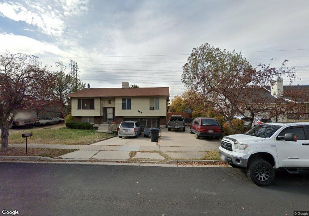
163 N 1400 W Clearfield, UT 84015
Estimated Value: $424,000 - $436,000
3
Beds
2
Baths
1,633
Sq Ft
$263/Sq Ft
Est. Value
About This Home
This home is located at 163 N 1400 W, Clearfield, UT 84015 and is currently estimated at $429,973, approximately $263 per square foot. 163 N 1400 W is a home located in Davis County with nearby schools including Holt Elementary School, North Davis Junior High School, and Syracuse High School.
Ownership History
Date
Name
Owned For
Owner Type
Purchase Details
Closed on
Jan 11, 2022
Sold by
Cook James L
Bought by
Wilma Holler Cook Trust
Current Estimated Value
Purchase Details
Closed on
Jun 14, 2001
Sold by
Lunda Laura L and Lunda Hendry Laura L
Bought by
Cook James L and Cook Wilma J
Purchase Details
Closed on
Jul 9, 1996
Sold by
Hendry Dee W and Bringhurst Brent
Bought by
Hendry Jon Rock and Hendry Laurie L
Purchase Details
Closed on
Nov 28, 1986
Sold by
Lunda Alvin L
Bought by
Lunda Laura L
Create a Home Valuation Report for This Property
The Home Valuation Report is an in-depth analysis detailing your home's value as well as a comparison with similar homes in the area
Home Values in the Area
Average Home Value in this Area
Purchase History
| Date | Buyer | Sale Price | Title Company |
|---|---|---|---|
| Wilma Holler Cook Trust | -- | None Listed On Document | |
| Cook James L | -- | Heritage West Title Insuranc | |
| Hendry Jon Rock | -- | -- | |
| Lunda Laura L | -- | Heritage West Title Insuranc |
Source: Public Records
Tax History Compared to Growth
Tax History
| Year | Tax Paid | Tax Assessment Tax Assessment Total Assessment is a certain percentage of the fair market value that is determined by local assessors to be the total taxable value of land and additions on the property. | Land | Improvement |
|---|---|---|---|---|
| 2025 | -- | $212,850 | $75,133 | $137,717 |
| 2024 | $2,113 | $207,350 | $71,722 | $135,628 |
| 2023 | $2,113 | $350,000 | $113,284 | $236,716 |
| 2022 | $2,197 | $196,900 | $63,463 | $133,437 |
| 2021 | $1,928 | $261,000 | $75,257 | $185,743 |
| 2020 | $1,681 | $226,000 | $64,830 | $161,170 |
| 2019 | $1,642 | $218,000 | $62,428 | $155,572 |
| 2018 | $1,454 | $188,000 | $55,411 | $132,589 |
| 2016 | $1,220 | $82,500 | $22,653 | $59,847 |
| 2015 | $1,165 | $75,075 | $22,653 | $52,422 |
| 2014 | $1,137 | $74,304 | $22,653 | $51,651 |
| 2013 | -- | $71,524 | $28,166 | $43,358 |
Source: Public Records
Map
Nearby Homes
- 16 N 1300 W
- 135 S 1525 W
- 303 N Canterbury Way
- 1648 W 150 S
- 423 N 1250 W Unit 118
- 575 N 1350 W Unit 137
- 47 N 1750 W
- 417 N 1200 W Unit 84
- 1337 W 550 N Unit 195
- 1350 W 300 N Unit 49
- 1350 W 300 N Unit 38
- 1350 W 300 N Unit 29
- 563 N 1350 W Unit 139
- 1828 W 75 S
- 1774 W 400 N
- 1652 W 560 N
- 4284 W 350 S Unit 615
- 4296 W 350 S Unit 614
- 12 N 2000 W Unit 1
- 620 N 1100 W