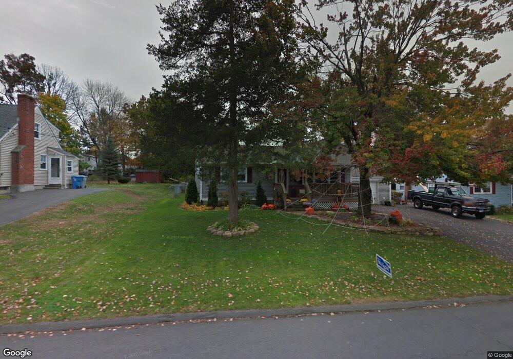
163 Pheasant Run Rd Bristol, CT 06010
Forestville NeighborhoodEstimated Value: $274,000 - $359,000
3
Beds
2
Baths
1,518
Sq Ft
$215/Sq Ft
Est. Value
About This Home
This home is located at 163 Pheasant Run Rd, Bristol, CT 06010 and is currently estimated at $326,274, approximately $214 per square foot. 163 Pheasant Run Rd is a home located in Hartford County with nearby schools including Northeast Middle School, Bristol Eastern High School, and St Matthew School.
Ownership History
Date
Name
Owned For
Owner Type
Purchase Details
Closed on
May 1, 2000
Sold by
Patterson Donna L and Bousquet Douglas P
Bought by
Canfield William E
Current Estimated Value
Home Financials for this Owner
Home Financials are based on the most recent Mortgage that was taken out on this home.
Original Mortgage
$110,500
Interest Rate
8.23%
Purchase Details
Closed on
May 31, 1991
Sold by
Taylor Elizabeth Est
Bought by
Parker Linda
Create a Home Valuation Report for This Property
The Home Valuation Report is an in-depth analysis detailing your home's value as well as a comparison with similar homes in the area
Home Values in the Area
Average Home Value in this Area
Purchase History
| Date | Buyer | Sale Price | Title Company |
|---|---|---|---|
| Canfield William E | $112,000 | -- | |
| Parker Linda | $87,500 | -- |
Source: Public Records
Mortgage History
| Date | Status | Borrower | Loan Amount |
|---|---|---|---|
| Open | Parker Linda | $150,000 | |
| Closed | Parker Linda | $100,000 | |
| Closed | Parker Linda | $52,000 | |
| Closed | Parker Linda | $110,500 |
Source: Public Records
Tax History Compared to Growth
Tax History
| Year | Tax Paid | Tax Assessment Tax Assessment Total Assessment is a certain percentage of the fair market value that is determined by local assessors to be the total taxable value of land and additions on the property. | Land | Improvement |
|---|---|---|---|---|
| 2025 | $6,329 | $187,530 | $39,270 | $148,260 |
| 2024 | $6,512 | $204,470 | $39,270 | $165,200 |
| 2023 | $6,206 | $204,470 | $39,270 | $165,200 |
| 2022 | $5,600 | $146,020 | $31,850 | $114,170 |
| 2021 | $5,600 | $146,020 | $31,850 | $114,170 |
| 2020 | $5,600 | $146,020 | $31,850 | $114,170 |
| 2019 | $5,556 | $146,020 | $31,850 | $114,170 |
| 2018 | $5,385 | $146,020 | $31,850 | $114,170 |
| 2017 | $5,339 | $148,190 | $39,620 | $108,570 |
| 2016 | $5,339 | $148,190 | $39,620 | $108,570 |
| 2015 | $5,129 | $148,190 | $39,620 | $108,570 |
| 2014 | $5,129 | $148,190 | $39,620 | $108,570 |
Source: Public Records
Map
Nearby Homes
- 23 Junior Rd
- 51 Songbird Ln
- 16 Cardinal Dr
- 1469 Farmington Ave Unit 17
- 44 Cabot St
- 245 Mark St
- 109 Glenwood Dr
- 23 Bel Aire Dr
- 9 Murzen Ln
- 43 Hiltbrand Rd Unit 2-11
- 18 Timber Hill Rd
- 0 Overlook Dr Unit Lot 4 24092448
- 0 Overlook Dr Unit Lot 3 24092446
- 27 Farmington Chase Crescent
- 8 Farmington Chase Crescent
- 5 Peach Orchard Hill
- 129 Farmington Chase Crescent Unit 129
- 90 Boardman St Unit A2
- 12 Currey Ct
- 58 Matilda Dr
- 173 Pheasant Run Rd
- 176 Pheasant Run Rd
- 166 Pheasant Run Rd
- 153 Pheasant Run Rd
- 186 Pheasant Run Rd
- 156 Pheasant Run Rd
- 141 Pheasant Run Rd
- 185 Pheasant Run Rd
- 360 Beths Ave
- 17 Quail Hollow Ln
- 131 Pheasant Run Rd
- 350 Beths Ave
- 198 Pheasant Run Rd
- 6 Quail Hollow Ln
- 121 Pheasant Run Rd
- 625 Camp St
- 342 Beths Ave
- 124 Pheasant Run Rd
- 16 Quail Hollow Ln
- 609 Camp St