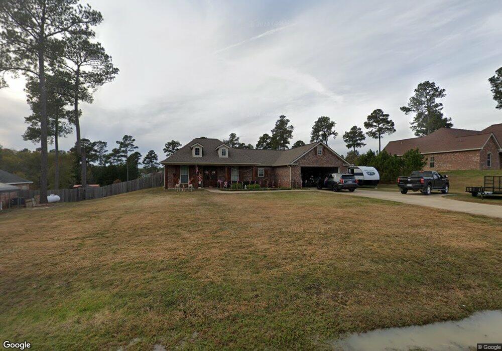
163 Smithbrook Rd Leesville, LA 71446
Estimated Value: $302,000 - $343,000
3
Beds
2
Baths
3,343
Sq Ft
$95/Sq Ft
Est. Value
About This Home
This home is located at 163 Smithbrook Rd, Leesville, LA 71446 and is currently estimated at $318,379, approximately $95 per square foot. 163 Smithbrook Rd is a home located in Vernon Parish.
Ownership History
Date
Name
Owned For
Owner Type
Purchase Details
Closed on
Mar 30, 2020
Sold by
Adams Jason T and Adams Kathy L
Bought by
Mcgrew Derrian M
Current Estimated Value
Home Financials for this Owner
Home Financials are based on the most recent Mortgage that was taken out on this home.
Original Mortgage
$242,000
Outstanding Balance
$212,511
Interest Rate
3.4%
Mortgage Type
Purchase Money Mortgage
Estimated Equity
$105,868
Purchase Details
Closed on
Jun 2, 2010
Sold by
Bass Lance and Bass Glenda H
Bought by
Adams Jason Ty and Adams Kathy Lynn Mitchell
Home Financials for this Owner
Home Financials are based on the most recent Mortgage that was taken out on this home.
Original Mortgage
$214,000
Interest Rate
4.93%
Mortgage Type
VA
Purchase Details
Closed on
Feb 22, 2010
Sold by
Smith Brook Hills Llc
Bought by
Bass Lance and Bass Glenda H
Home Financials for this Owner
Home Financials are based on the most recent Mortgage that was taken out on this home.
Original Mortgage
$165,000
Interest Rate
12%
Mortgage Type
Unknown
Create a Home Valuation Report for This Property
The Home Valuation Report is an in-depth analysis detailing your home's value as well as a comparison with similar homes in the area
Purchase History
| Date | Buyer | Sale Price | Title Company |
|---|---|---|---|
| Mcgrew Derrian M | $242,000 | None Available | |
| Adams Jason Ty | $209,500 | -- | |
| Bass Lance | $18,500 | -- |
Source: Public Records
Mortgage History
| Date | Status | Borrower | Loan Amount |
|---|---|---|---|
| Open | Mcgrew Derrian M | $242,000 | |
| Previous Owner | Adams Jason Ty | $214,000 | |
| Previous Owner | Bass Lance | $165,000 |
Source: Public Records
Tax History
| Year | Tax Paid | Tax Assessment Tax Assessment Total Assessment is a certain percentage of the fair market value that is determined by local assessors to be the total taxable value of land and additions on the property. | Land | Improvement |
|---|---|---|---|---|
| 2025 | $853 | $30,510 | $2,000 | $28,510 |
| 2024 | $860 | $30,510 | $2,000 | $28,510 |
| 2023 | $857 | $23,310 | $2,000 | $21,310 |
| 2022 | $2,619 | $23,310 | $2,000 | $21,310 |
| 2021 | $2,790 | $23,310 | $2,000 | $21,310 |
| 2020 | $2,887 | $23,310 | $2,000 | $21,310 |
| 2019 | $2,702 | $21,210 | $2,000 | $19,210 |
| 2018 | $2,691 | $21,210 | $2,000 | $19,210 |
| 2017 | $2,694 | $21,210 | $2,000 | $19,210 |
| 2015 | $2,628 | $21,210 | $2,000 | $19,210 |
| 2014 | $2,701 | $21,060 | $1,850 | $19,210 |
| 2013 | $2,750 | $21,060 | $1,850 | $19,210 |
Source: Public Records
Map
Nearby Homes
- 0 Stanley Rd Lot 10 Unit Lot 10 45-543
- 0 Stanley Rd Unit SWL24003949
- 0 Stanley Rd Unit SWL25102343
- 0 Stanley Rd Unit SWL25001843
- 0 Stanley Rd Unit 45-707
- 0 Stanley Rd Unit SWL25001841
- 0 Stanley Rd Unit 45-598
- 0 Stanley Rd Unit SWL25001842
- 0 Stanley Rd Unit SWL24003947
- 0 Stanley Rd Lot 9 Unit Lot 9 45-544
- 8 Stanley Rd Unit Lot 8
- 2477 Belview Rd
- 0 Small Oaks Rd
- 139 Cochran Rd
- 0 Tbd Roy Bridges Rd
- 0 Castor Lake Rd
- 0 Tbd La-184 Tract 1
- 0 Tbd La- 184
- 0 Slagle Rd
- 0 0 Hwy 8 Unit 26-5192
- 227 Smithbrook Rd
- 144 James Dr
- 147 Smithbrook Rd
- 110 James Dr
- 239 Smithbrook Rd
- 245 Smithbrook Rd
- 221 Smithbrook Rd Unit Rd
- 157 Smithbrook Rd
- 244 Smithbrook Rd
- 240 Smithbrook Rd
- 240 Smithbrook Rd Unit Rd.
- 119 James Dr
- 119 James Dr Unit Drive
- 232 Smithbrook Rd
- 248 Smithbrook Rd
- 248 Smithbrook Rd Unit rd
- 116 James Dr
- 114 James Dr
- 114 James Dr Unit LOT 15 PHASE 2 SMITH
- 120 James Dr
Your Personal Tour Guide
Ask me questions while you tour the home.