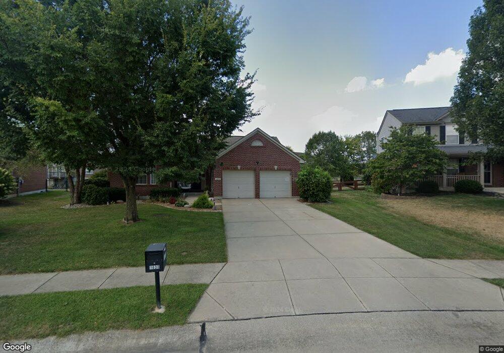
1630 Battery Cir Unit 111NP Hebron, KY 41048
Estimated Value: $353,000 - $361,000
3
Beds
2
Baths
1,552
Sq Ft
$229/Sq Ft
Est. Value
About This Home
This home is located at 1630 Battery Cir Unit 111NP, Hebron, KY 41048 and is currently estimated at $355,578, approximately $229 per square foot. 1630 Battery Cir Unit 111NP is a home located in Boone County with nearby schools including North Pointe Elementary School, Conner Middle School, and Conner High School.
Ownership History
Date
Name
Owned For
Owner Type
Purchase Details
Closed on
Aug 4, 2020
Sold by
Wright Frank W and Wright Dorothy A
Bought by
Williams Kimberly R and Williams Gary R
Current Estimated Value
Home Financials for this Owner
Home Financials are based on the most recent Mortgage that was taken out on this home.
Original Mortgage
$199,900
Outstanding Balance
$177,653
Interest Rate
3.1%
Mortgage Type
Future Advance Clause Open End Mortgage
Estimated Equity
$177,925
Purchase Details
Closed on
Jul 25, 2013
Sold by
Landwehr Eric P and Landwehr Reena I
Bought by
Wright Frank W and Wright Dorothy A
Purchase Details
Closed on
Sep 26, 2005
Sold by
Arlinghaus Buidlers Llc
Bought by
Landwehr Eric P and Landwehr Reena I
Home Financials for this Owner
Home Financials are based on the most recent Mortgage that was taken out on this home.
Original Mortgage
$152,794
Interest Rate
6.04%
Mortgage Type
New Conventional
Create a Home Valuation Report for This Property
The Home Valuation Report is an in-depth analysis detailing your home's value as well as a comparison with similar homes in the area
Home Values in the Area
Average Home Value in this Area
Purchase History
| Date | Buyer | Sale Price | Title Company |
|---|---|---|---|
| Williams Kimberly R | $249,900 | Prominent Title Agency | |
| Wright Frank W | $175,000 | B&B Title Agency Inc | |
| Landwehr Eric P | $190,993 | None Available |
Source: Public Records
Mortgage History
| Date | Status | Borrower | Loan Amount |
|---|---|---|---|
| Open | Williams Kimberly R | $199,900 | |
| Previous Owner | Landwehr Eric P | $152,794 |
Source: Public Records
Tax History Compared to Growth
Tax History
| Year | Tax Paid | Tax Assessment Tax Assessment Total Assessment is a certain percentage of the fair market value that is determined by local assessors to be the total taxable value of land and additions on the property. | Land | Improvement |
|---|---|---|---|---|
| 2024 | $2,826 | $264,900 | $40,000 | $224,900 |
| 2023 | $2,669 | $249,900 | $35,000 | $214,900 |
| 2022 | $2,681 | $249,900 | $35,000 | $214,900 |
| 2021 | $2,751 | $249,900 | $35,000 | $214,900 |
| 2020 | $2,498 | $229,000 | $35,000 | $194,000 |
| 2019 | $1,492 | $175,000 | $25,000 | $150,000 |
| 2018 | $1,562 | $175,000 | $25,000 | $150,000 |
| 2017 | $1,498 | $175,000 | $25,000 | $150,000 |
| 2015 | $1,894 | $175,000 | $25,000 | $150,000 |
| 2013 | -- | $190,993 | $190,993 | $0 |
Source: Public Records
Map
Nearby Homes
- 1843 Emory Ct
- 1195 Breckenridge Ln
- 1218 Breckenridge Ln
- 1215 Breckenridge Ln
- 803 N Bend Rd Unit 6
- 1963 Greyfield Trail
- 803 Lot 6 N Bend Rd Unit 6
- 1353 Dominion Trail
- 765 N Bend Rd
- 2320 Summerwoods Dr
- 1977 Coachtrail Dr
- 1516 Bloomin Spring Ct
- 1437 Windyoak Ln
- The Jefferson Plan at North Pointe
- The Bristol Plan at North Pointe
- The Austin Plan at North Pointe
- The Rosewood Plan at North Pointe
- The Ella Marie Plan at North Pointe
- The Lancaster Plan at North Pointe
- The Morgan Plan at North Pointe
- 1630 Battery Cir
- 1634 Battery Cir
- 1626 Battery Cir
- 1626 Battery Cir Unit 110NP
- 1690 Bingham Cir
- 1686 Bingham Cir
- 1686 Bingham Cir Unit 159NP
- 1638 Battery Cir
- 1638 Battery Cir Unit 113NP
- 1622 Battery Cir
- 1694 Bingham Cir
- 1686 Binghan Cir
- 1619 Battery Cir
- 1682 Bingham Cir
- 1682 Bingham Cir Unit 158NP
- 1698 Bingham Cir
- 1618 Battery Cir
- 1618 Battery Cir Unit 108NP
- 1627 Battery Cir
- 1627 Battery Cir Unit 114NP