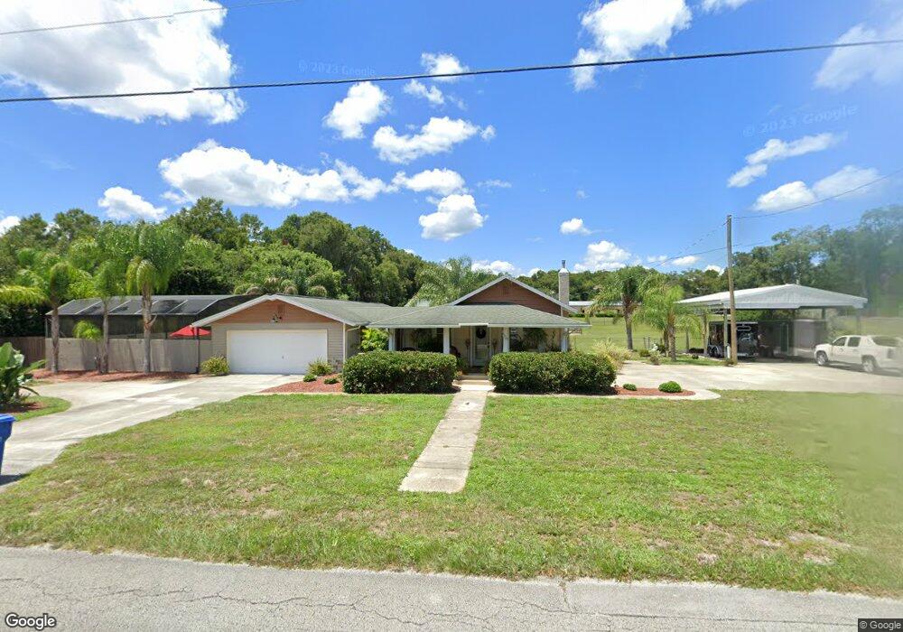
1630 N Stone St Deland, FL 32720
North DeLand NeighborhoodEstimated Value: $306,000 - $532,000
2
Beds
2
Baths
2,935
Sq Ft
$129/Sq Ft
Est. Value
About This Home
This home is located at 1630 N Stone St, Deland, FL 32720 and is currently estimated at $379,442, approximately $129 per square foot. 1630 N Stone St is a home located in Volusia County with nearby schools including Citrus Grove Elementary, Deland High School, and Southwestern Middle School.
Ownership History
Date
Name
Owned For
Owner Type
Purchase Details
Closed on
Feb 17, 2023
Sold by
Calkins Frederick J and Calkins Tracey D
Bought by
Calkins Frederick J and Calkins Tracey D
Current Estimated Value
Purchase Details
Closed on
Feb 4, 2014
Sold by
Calkins Mary Kay
Bought by
Calkins Frederick J
Purchase Details
Closed on
Jan 19, 2012
Sold by
Reynolds Mary Hester and Reynolds Carl
Bought by
Calkins Frederick J
Home Financials for this Owner
Home Financials are based on the most recent Mortgage that was taken out on this home.
Original Mortgage
$170,000
Interest Rate
7%
Mortgage Type
Seller Take Back
Purchase Details
Closed on
Jul 25, 2008
Sold by
Reynolds Carl and Reynolds Mary Hester
Bought by
Davis Dale A and Davis Frances Jean
Create a Home Valuation Report for This Property
The Home Valuation Report is an in-depth analysis detailing your home's value as well as a comparison with similar homes in the area
Home Values in the Area
Average Home Value in this Area
Purchase History
| Date | Buyer | Sale Price | Title Company |
|---|---|---|---|
| Calkins Frederick J | -- | -- | |
| Calkins Frederick J | $100 | None Listed On Document | |
| Calkins Frederick J | -- | Attorney | |
| Calkins Frederick J | $180,000 | Volusia Title Services | |
| Davis Dale A | -- | Attorney |
Source: Public Records
Mortgage History
| Date | Status | Borrower | Loan Amount |
|---|---|---|---|
| Previous Owner | Calkins Frederick J | $170,000 |
Source: Public Records
Tax History Compared to Growth
Tax History
| Year | Tax Paid | Tax Assessment Tax Assessment Total Assessment is a certain percentage of the fair market value that is determined by local assessors to be the total taxable value of land and additions on the property. | Land | Improvement |
|---|---|---|---|---|
| 2025 | $2,301 | $160,645 | -- | -- |
| 2024 | $2,301 | $156,118 | -- | -- |
| 2023 | $2,301 | $151,571 | $0 | $0 |
| 2022 | $2,242 | $147,156 | $0 | $0 |
| 2021 | $2,309 | $142,870 | $0 | $0 |
| 2020 | $2,272 | $140,897 | $0 | $0 |
| 2019 | $2,332 | $137,729 | $0 | $0 |
| 2018 | $2,316 | $135,161 | $0 | $0 |
| 2017 | $2,304 | $132,381 | $0 | $0 |
| 2016 | $2,196 | $129,658 | $0 | $0 |
| 2015 | $2,237 | $128,757 | $0 | $0 |
| 2014 | $2,214 | $127,735 | $0 | $0 |
Source: Public Records
Map
Nearby Homes
- 0 Greens Dairy Rd Unit 1216610
- 865 Asterfield Ln
- 0 Vacant Land Unit MFRA4667659
- 0 Vacant Land Unit MFRGC533353
- 882 Asterfield Ln
- 887 Asterfield Ln
- 897 Honey Petal Ln
- 580 Mercers Fernery Rd
- 1346 Rolling River Rd
- 903 Honey Petal Ln
- 905 Cascade Falls Ln
- 909 Cascades Park Trail
- 305 Violetwood Rd
- 2312 Litchfield Loop
- #18 North St
- 00 North St
- 2249 Litchfield Loop
- 1937 N Spring Garden Ave
- 1221 Bramley Ln
- 0 Lots 22 & 23 Unit 11447502
- 1634 N Stone St
- 745 Greens Dairy Rd
- 1615 Miller Dr
- 1640 N Stone St
- 1635 Miller Dr
- 1620 Miller Dr
- 625 Greens Dairy Rd
- 1647 Miller Dr
- 1660 N Stone St
- 1640 Miller Dr
- 1665 Miller Dr
- 1666 N Stone St
- 1650 Miller Dr
- 895 Greens Dairy Rd
- 1664 Miller Dr
- 1675 Miller Dr
- 595 Greens Dairy Rd
- 1409 N Stone St
- 1672 N Stone St
- 1676 Miller Dr