Estimated Value: $563,000 - $675,350
4
Beds
3
Baths
1,120
Sq Ft
$564/Sq Ft
Est. Value
About This Home
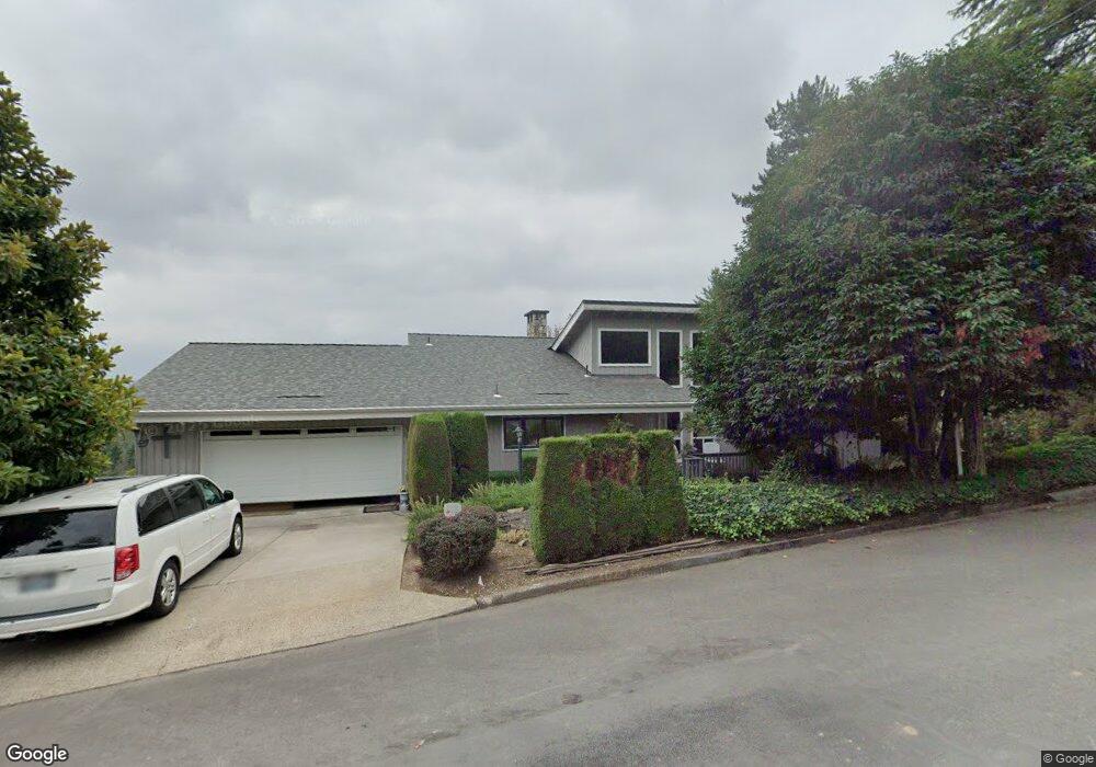
This home is located at 1630 NW 10th Ave, Camas, WA 98607 and is currently estimated at $631,588, approximately $563 per square foot. 1630 NW 10th Ave is a home located in Clark County with nearby schools including Prune Hill Elementary School, Skyridge Middle School, and Camas High School.
Ownership History
Date
Name
Owned For
Owner Type
Purchase Details
Closed on
Oct 4, 1999
Sold by
Parker Arthur L and Parker Debra K
Bought by
Smith Vicki L
Current Estimated Value
Home Financials for this Owner
Home Financials are based on the most recent Mortgage that was taken out on this home.
Original Mortgage
$145,000
Outstanding Balance
$41,844
Interest Rate
7.25%
Estimated Equity
$589,744
Purchase Details
Closed on
Jun 10, 1998
Sold by
Parker Arthur L
Bought by
Parker Arthur L and Parker Debra K
Home Financials for this Owner
Home Financials are based on the most recent Mortgage that was taken out on this home.
Original Mortgage
$155,500
Interest Rate
7.11%
Purchase Details
Closed on
Apr 5, 1995
Sold by
Johnson Robert Oscar
Bought by
Parker Arthur L
Home Financials for this Owner
Home Financials are based on the most recent Mortgage that was taken out on this home.
Original Mortgage
$157,000
Interest Rate
8.44%
Create a Home Valuation Report for This Property
The Home Valuation Report is an in-depth analysis detailing your home's value as well as a comparison with similar homes in the area
Home Values in the Area
Average Home Value in this Area
Purchase History
| Date | Buyer | Sale Price | Title Company |
|---|---|---|---|
| Smith Vicki L | $218,000 | Charter Title Corporation | |
| Parker Arthur L | -- | Charter Title Corporation | |
| Parker Arthur L | $197,000 | Charter Title Corp |
Source: Public Records
Mortgage History
| Date | Status | Borrower | Loan Amount |
|---|---|---|---|
| Open | Smith Vicki L | $145,000 | |
| Previous Owner | Parker Arthur L | $155,500 | |
| Previous Owner | Parker Arthur L | $157,000 |
Source: Public Records
Tax History Compared to Growth
Tax History
| Year | Tax Paid | Tax Assessment Tax Assessment Total Assessment is a certain percentage of the fair market value that is determined by local assessors to be the total taxable value of land and additions on the property. | Land | Improvement |
|---|---|---|---|---|
| 2025 | $6,404 | $572,453 | $135,075 | $437,378 |
| 2024 | $5,598 | $671,821 | $199,517 | $472,304 |
| 2023 | $6,168 | $631,321 | $194,914 | $436,407 |
| 2022 | $5,788 | $661,595 | $194,914 | $466,681 |
| 2021 | $5,888 | $518,971 | $155,789 | $363,182 |
| 2020 | $5,738 | $489,311 | $146,583 | $342,728 |
| 2019 | $5,821 | $442,129 | $135,075 | $307,054 |
| 2018 | $5,731 | $477,798 | $0 | $0 |
| 2017 | $5,019 | $395,397 | $0 | $0 |
| 2016 | $4,730 | $377,136 | $0 | $0 |
| 2015 | $4,507 | $353,606 | $0 | $0 |
| 2014 | -- | $317,670 | $0 | $0 |
| 2013 | -- | $286,433 | $0 | $0 |
Source: Public Records
Map
Nearby Homes
- 1945 NW 7th Ave
- 1938 NW Sierra Ln
- 907 NW Greeley St
- 802 NW 5th Cir Unit 802
- 715 NW 10th Ave
- 2012 NW Sierra Ln
- 2534 NW 16th Ave
- 2546 NW 16th Ave
- 2458 NW 16th Ave
- 912 NW Fargo St
- 2229 NW 6th Place
- 634 NW 5th Ave
- 615 NW 7th Ave
- 541 NW 8th Ave
- 536 NW 10th Ave
- 535 NW 9th Ave
- 1911 NW Astor Ct
- 2311 SW 6th Ave Unit 8B
- 2311 SW 6th Ave Unit D2
- 2311 SW 6th Ave Unit 9
- 1621 NW 9th Ave
- 1618 NW 10th Ave
- 1609 NW 9th Ave
- 1708 NW 10th Ave
- 1617 NW 10th Ave
- 1522 NW 10th Ave
- 1610 NW 9th Ave
- 1626 NW 9th Ave
- 1657 NW 10th Ave
- 1506 NW 10th Ave
- 1511 NW 10th Ave
- 900 NW Norwood St
- 844 NW Norwood St
- 1639 NW 8th Ave
- 830 NW Norwood St
- 809 NW Norwood St
- 1657 NW 8th Ave
- 1750 NW 10th Ave
- 1623 NW 8th Ave
- 1505 NW 10th Ave Unit 1505 A