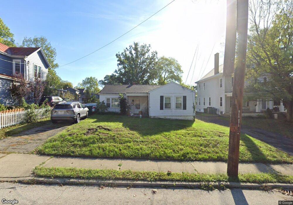
1630 Sutton Ave Cincinnati, OH 45230
Mount Washington NeighborhoodEstimated Value: $195,233 - $242,000
3
Beds
1
Bath
1,154
Sq Ft
$189/Sq Ft
Est. Value
About This Home
This home is located at 1630 Sutton Ave, Cincinnati, OH 45230 and is currently estimated at $218,308, approximately $189 per square foot. 1630 Sutton Ave is a home located in Hamilton County with nearby schools including Mt. Washington Elementary School, Clark Montessori High School, and Shroder High School.
Ownership History
Date
Name
Owned For
Owner Type
Purchase Details
Closed on
Oct 16, 2006
Sold by
Hill Jody K
Bought by
Hissong Yvonne L
Current Estimated Value
Home Financials for this Owner
Home Financials are based on the most recent Mortgage that was taken out on this home.
Original Mortgage
$88,900
Outstanding Balance
$52,061
Interest Rate
6.5%
Mortgage Type
Unknown
Estimated Equity
$166,247
Purchase Details
Closed on
Dec 24, 2003
Sold by
Hill Thomas E
Bought by
Hill Jody K
Home Financials for this Owner
Home Financials are based on the most recent Mortgage that was taken out on this home.
Original Mortgage
$68,000
Interest Rate
4.87%
Mortgage Type
Unknown
Purchase Details
Closed on
Sep 13, 1999
Sold by
Hill Delvera A
Bought by
Hill Thomas E and Delvera A Hill Irrevocable Trust Of 1999
Create a Home Valuation Report for This Property
The Home Valuation Report is an in-depth analysis detailing your home's value as well as a comparison with similar homes in the area
Home Values in the Area
Average Home Value in this Area
Purchase History
| Date | Buyer | Sale Price | Title Company |
|---|---|---|---|
| Hissong Yvonne L | -- | Attorney | |
| Hill Jody K | $85,000 | -- | |
| Hill Thomas E | -- | -- |
Source: Public Records
Mortgage History
| Date | Status | Borrower | Loan Amount |
|---|---|---|---|
| Open | Hissong Yvonne L | $88,900 | |
| Previous Owner | Hill Jody K | $68,000 |
Source: Public Records
Tax History
| Year | Tax Paid | Tax Assessment Tax Assessment Total Assessment is a certain percentage of the fair market value that is determined by local assessors to be the total taxable value of land and additions on the property. | Land | Improvement |
|---|---|---|---|---|
| 2025 | $2,703 | $42,466 | $8,313 | $34,153 |
| 2023 | $2,704 | $42,466 | $8,313 | $34,153 |
| 2022 | $2,262 | $31,914 | $6,983 | $24,931 |
| 2021 | $2,219 | $31,914 | $6,983 | $24,931 |
| 2020 | $2,226 | $31,914 | $6,983 | $24,931 |
| 2019 | $2,145 | $27,993 | $6,125 | $21,868 |
| 2018 | $2,147 | $27,993 | $6,125 | $21,868 |
| 2017 | $2,067 | $27,993 | $6,125 | $21,868 |
| 2016 | $2,106 | $27,825 | $7,000 | $20,825 |
| 2015 | $1,883 | $27,825 | $7,000 | $20,825 |
| 2014 | $1,893 | $27,825 | $7,000 | $20,825 |
| 2013 | $1,926 | $27,825 | $7,000 | $20,825 |
Source: Public Records
Map
Nearby Homes
- 6123 Cambridge Ave
- 1508 Beth Ln
- 6029 Lockard Ave
- 1741 Mears Ave
- 6050 Colter Ave
- 6952 Shadow Ridge Rd
- 1944 Rockland Ave
- 1341 Mayland Dr
- 5965 Wayside Ave
- 1190 Linden Hill Ln
- 1627 Alcor Terrace
- 3 Salem Rd
- 2 Salem Rd
- 4 Salem Rd
- 1 Salem Rd
- 1229 Meadowbright Ln
- 2111 Sutton Ave
- 6122 Corbly Rd
- 2133 Ronaldson Ave
- 6263 Corbly Rd
- 1632 Sutton Ave
- 1626 Sutton Ave
- 1636 Sutton Ave
- 1617 Brandon Ave
- 1638 Sutton Ave
- 1621 Brandon Ave
- 1611 Brandon Ave
- 1620 Sutton Ave
- 1625 Brandon Ave
- 1625 Sutton Ave
- 1607 Brandon Ave
- 1629 Sutton Ave
- 1642 Sutton Ave
- 1619 Sutton Ave
- 1629 Brandon Ave
- 1635 Sutton Ave
- 1618 Sutton Ave
- 1639 Sutton Ave
- 1633 Brandon Ave
- 1603 Brandon Ave
Your Personal Tour Guide
Ask me questions while you tour the home.