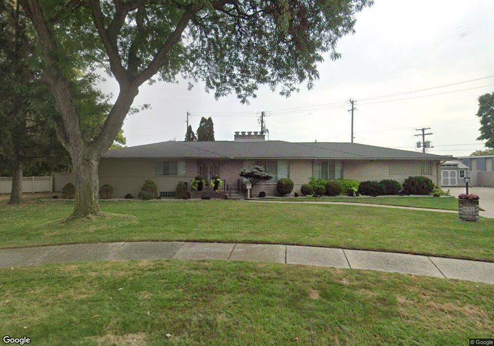
16302 Westland Ave Southfield, MI 48075
Estimated Value: $287,303 - $333,000
3
Beds
4
Baths
2,539
Sq Ft
$124/Sq Ft
Est. Value
About This Home
This home is located at 16302 Westland Ave, Southfield, MI 48075 and is currently estimated at $314,076, approximately $123 per square foot. 16302 Westland Ave is a home located in Oakland County with nearby schools including Agbu Alex-Marie Manoogian School, Pembroke Academy, and Dr. Joseph F. Pollack Academic Center Of Excellence.
Ownership History
Date
Name
Owned For
Owner Type
Purchase Details
Closed on
Jan 21, 2003
Sold by
Peterson Terrell
Bought by
U S Bank
Current Estimated Value
Purchase Details
Closed on
Oct 19, 2001
Sold by
Winfrey Marsha L
Bought by
Peterson Terrell
Home Financials for this Owner
Home Financials are based on the most recent Mortgage that was taken out on this home.
Original Mortgage
$178,500
Interest Rate
6.93%
Mortgage Type
Purchase Money Mortgage
Purchase Details
Closed on
Dec 22, 1995
Sold by
Winfrey Suzanne
Bought by
Winfrey Marsha L
Purchase Details
Closed on
Dec 18, 1995
Sold by
Frankel Mark S
Bought by
Winfrey Marsha L
Create a Home Valuation Report for This Property
The Home Valuation Report is an in-depth analysis detailing your home's value as well as a comparison with similar homes in the area
Home Values in the Area
Average Home Value in this Area
Purchase History
| Date | Buyer | Sale Price | Title Company |
|---|---|---|---|
| U S Bank | $190,447 | -- | |
| U S Bank Na | $190,447 | -- | |
| Peterson Terrell | $255,000 | -- | |
| Winfrey Marsha L | -- | -- | |
| Winfrey Marsha L | -- | -- |
Source: Public Records
Mortgage History
| Date | Status | Borrower | Loan Amount |
|---|---|---|---|
| Previous Owner | Peterson Terrell | $178,500 |
Source: Public Records
Tax History Compared to Growth
Tax History
| Year | Tax Paid | Tax Assessment Tax Assessment Total Assessment is a certain percentage of the fair market value that is determined by local assessors to be the total taxable value of land and additions on the property. | Land | Improvement |
|---|---|---|---|---|
| 2022 | $1,408 | $65,630 | $12,120 | $53,510 |
| 2021 | $1,383 | $57,990 | $11,930 | $46,060 |
| 2020 | $1,218 | $64,510 | $11,380 | $53,130 |
| 2018 | $1,434 | $42,830 | $11,380 | $31,450 |
| 2015 | -- | $19,980 | $0 | $0 |
| 2014 | -- | $18,940 | $0 | $0 |
| 2011 | -- | $20,960 | $0 | $0 |
Source: Public Records
Map
Nearby Homes
- 20575 Rutherford St
- 20536 Ferguson St
- 20569 Biltmore St
- 20285 Prevost St
- 20236 Ferguson St
- 20300 Gilchrist St
- 20248 Prevost St
- 20235 Ferguson St
- 20266 Forrer St
- 20558 Oakfield St
- 20542 Oakfield St
- 16400 N Park Dr Unit 414
- 16400 N Park Dr Unit 1218
- 16400 N Park Dr Unit 810
- 20108 Ferguson St
- 20090 Asbury Park
- 20108 Biltmore St
- 20210 Winthrop St
- 20091 Biltmore St
- 20200 Lindsay St
- 16302 Westland Ave
- 16318 Westland Ave
- 16317 Westland Ave
- 16332 Westland Ave
- 16331 Westland Ave
- 16313 Melrose St
- 16349 Westland Ave
- 16352 Westland Ave
- 16333 Melrose St
- 16370 Westland Ave
- 16367 Westland Ave
- 16345 Melrose St
- LOT 74 Melrose
- LOT 68 Melrose
- 16200 Northland Dr Unit Bldg-Unit
- 16200 Northland Dr
- 0 Westhampton Rd
- 16395 Westland Ave
- 16369 Melrose St
- 16366 Melrose St