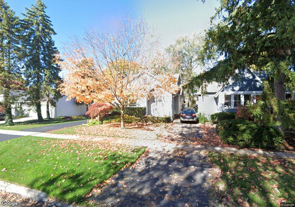
16308 Birwood Ave Beverly Hills, MI 48025
Estimated Value: $334,000 - $507,000
3
Beds
2
Baths
1,054
Sq Ft
$371/Sq Ft
Est. Value
About This Home
This home is located at 16308 Birwood Ave, Beverly Hills, MI 48025 and is currently estimated at $391,012, approximately $370 per square foot. 16308 Birwood Ave is a home located in Oakland County with nearby schools including Wylie E. Groves High School, Greenfield Elementary School, and Berkshire Middle School.
Ownership History
Date
Name
Owned For
Owner Type
Purchase Details
Closed on
Mar 24, 2000
Sold by
Roomian Saundra
Bought by
Hopper Raymond R
Current Estimated Value
Home Financials for this Owner
Home Financials are based on the most recent Mortgage that was taken out on this home.
Original Mortgage
$197,600
Outstanding Balance
$67,065
Interest Rate
8.31%
Estimated Equity
$323,947
Purchase Details
Closed on
Oct 23, 1997
Sold by
Martinez Ronda M
Bought by
Roomian Saundra
Create a Home Valuation Report for This Property
The Home Valuation Report is an in-depth analysis detailing your home's value as well as a comparison with similar homes in the area
Home Values in the Area
Average Home Value in this Area
Purchase History
| Date | Buyer | Sale Price | Title Company |
|---|---|---|---|
| Hopper Raymond R | $208,000 | -- | |
| Roomian Saundra | $167,500 | -- |
Source: Public Records
Mortgage History
| Date | Status | Borrower | Loan Amount |
|---|---|---|---|
| Open | Hopper Raymond R | $197,600 |
Source: Public Records
Tax History Compared to Growth
Tax History
| Year | Tax Paid | Tax Assessment Tax Assessment Total Assessment is a certain percentage of the fair market value that is determined by local assessors to be the total taxable value of land and additions on the property. | Land | Improvement |
|---|---|---|---|---|
| 2024 | $2,534 | $141,270 | $0 | $0 |
| 2023 | $2,432 | $129,730 | $0 | $0 |
| 2022 | $2,638 | $121,180 | $0 | $0 |
| 2021 | $2,659 | $112,130 | $0 | $0 |
| 2020 | $2,228 | $104,660 | $0 | $0 |
| 2019 | $1,760 | $99,620 | $0 | $0 |
| 2018 | $2,619 | $88,820 | $0 | $0 |
| 2017 | $2,602 | $88,820 | $0 | $0 |
| 2016 | $2,605 | $82,480 | $0 | $0 |
| 2015 | -- | $71,740 | $0 | $0 |
| 2014 | -- | $64,490 | $0 | $0 |
| 2011 | -- | $57,190 | $0 | $0 |
Source: Public Records
Map
Nearby Homes
- 16217 Birwood Ave
- 1886 Henrietta St
- 1828 Henrietta St
- 1859 Stanley Blvd
- 32210 Sheridan Dr
- 16927 Beverly Rd
- 350 Catalpa Dr
- 17455 Kinross Ave
- 32463 Sheridan Dr
- 410 Catalpa Dr
- 1748 Stanley Blvd
- 870 Davis Ave
- 986 Smith Ave
- 1109 Bird Ave
- 1723 Birmingham Blvd
- 1268 Davis Ave
- 1541 Shipman Blvd
- 1451 E 14 Mile Rd
- 31607 Auburn Dr
- 4218 Normandy Rd
- 16300 Birwood Ave
- 16320 Birwood Ave
- 32730 Pierce St
- 16292 Birwood Ave
- 16309 Kirkshire Ave
- 32742 Pierce St
- 16301 Kirkshire Ave
- 16293 Kirkshire Ave
- 16284 Birwood Ave
- 32750 Pierce St
- 16285 Kirkshire Ave
- 16276 Birwood Ave
- 16277 Kirkshire Ave
- 16313 Birwood Ave
- 16321 Birwood Ave
- 16305 Birwood Ave
- 16908 Birwood Ave
- 16329 Birwood Ave
- 16289 Birwood Ave
- 16297 Birwood Ave