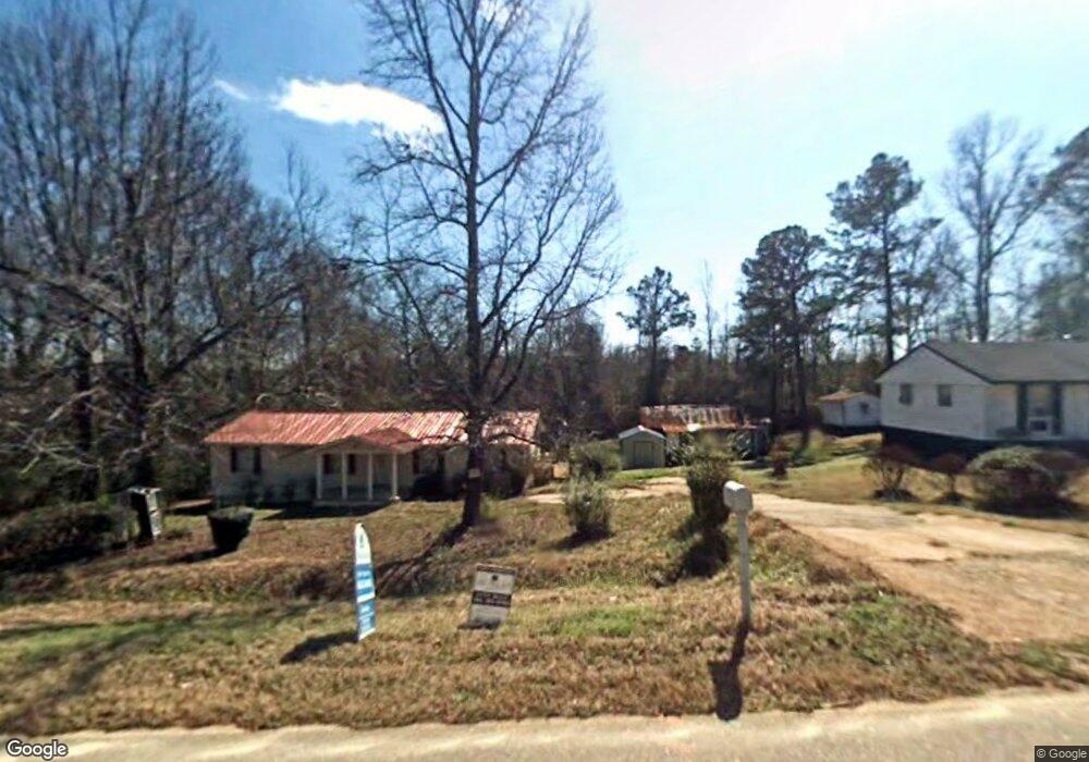
1631 Airport Rd Greensboro, GA 30642
Estimated Value: $119,386 - $224,000
3
Beds
1
Bath
1,025
Sq Ft
$155/Sq Ft
Est. Value
About This Home
This home is located at 1631 Airport Rd, Greensboro, GA 30642 and is currently estimated at $159,347, approximately $155 per square foot. 1631 Airport Rd is a home located in Greene County with nearby schools including Greene County High School.
Ownership History
Date
Name
Owned For
Owner Type
Purchase Details
Closed on
Jun 19, 2017
Sold by
Giles Mamie Ruth
Bought by
Brown Georgia M and Brown Viondi R
Current Estimated Value
Purchase Details
Closed on
Aug 1, 2006
Sold by
Giles Mamie Ruth and Kati Mae
Bought by
Giles Mamie Ruth and Kati Mae
Purchase Details
Closed on
Apr 23, 2002
Sold by
Giles Brooks and Mamie Ruth
Bought by
Giles Mamie Ruth and Kati Mae
Purchase Details
Closed on
Jan 2, 1974
Sold by
Giles Brooks and Mamie Ruth
Bought by
Giles Brooks and Mamie Ruth
Purchase Details
Closed on
Jan 1, 1974
Bought by
Giles Brooks and Mamie Ruth
Create a Home Valuation Report for This Property
The Home Valuation Report is an in-depth analysis detailing your home's value as well as a comparison with similar homes in the area
Home Values in the Area
Average Home Value in this Area
Purchase History
| Date | Buyer | Sale Price | Title Company |
|---|---|---|---|
| Brown Georgia M | -- | -- | |
| Giles Mamie Ruth | -- | -- | |
| Giles Mamie Ruth | -- | -- | |
| Giles Brooks | -- | -- | |
| Giles Brooks | -- | -- |
Source: Public Records
Tax History Compared to Growth
Tax History
| Year | Tax Paid | Tax Assessment Tax Assessment Total Assessment is a certain percentage of the fair market value that is determined by local assessors to be the total taxable value of land and additions on the property. | Land | Improvement |
|---|---|---|---|---|
| 2024 | $564 | $20,440 | $2,000 | $18,440 |
| 2023 | $533 | $19,120 | $2,000 | $17,120 |
| 2022 | $482 | $17,560 | $2,000 | $15,560 |
| 2021 | $464 | $15,840 | $2,000 | $13,840 |
| 2020 | $403 | $11,560 | $5,080 | $6,480 |
| 2019 | $409 | $11,560 | $5,080 | $6,480 |
| 2018 | $387 | $11,560 | $5,080 | $6,480 |
| 2017 | $174 | $11,588 | $5,100 | $6,488 |
| 2016 | $181 | $11,941 | $5,100 | $6,841 |
| 2015 | -- | $11,941 | $5,100 | $6,841 |
| 2014 | -- | $11,938 | $5,100 | $6,838 |
Source: Public Records
Map
Nearby Homes
- 0 Cunningham Rd
- 2260 Cunningham Rd
- 0 Union Point Hwy Unit 69532
- 0 Union Point Hwy Unit 7607786
- 0 Union Point Hwy Unit 10555176
- 0 Shady Side Ln
- 1141 Planing Mill Rd
- 1641 Bowden Pond Rd
- 1131 Planing Mill Rd
- 0 Old Union Point Rd Unit 1 10557753
- 1251 Brickhouse Rd
- 1251 Brick House Rd
- LOT 1 Penfield
- 1531 E Broad St
- 1681 Sibley School Rd
- 3021 Penfield Rd
- 0 Railroad St Unit 218854
- 0 Railroad St Unit 10578007
- 0 Railroad St Unit 531919
- 1020 Horton Dr
- 1661 Airport Rd
- 1650 Airport Rd Unit 1
- 1650 Airport Rd
- 1630 Airport Rd
- 1681 Airport Rd
- 1590 Airport Rd
- 1580 Airport Rd
- 1570 Airport Rd
- 1560 Airport Rd
- 1550 Airport Rd
- 2060 Old Union Point Rd
- 1020 Cunningham Rd
- 1850 Old Union Point Rd
- 1040 Cunningham Rd
- 1498 Airport Rd
- 1781 Airport Rd
- Parcel 1 Cunningham Rd
- N/A Cunningham Rd
- 1080 Cunningham Rd
- 1031 Cunningham Rd