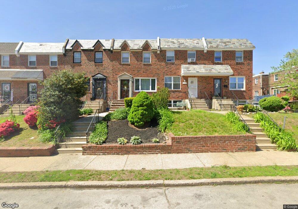
1631 Andrews Ave Philadelphia, PA 19138
West Oak Lane NeighborhoodEstimated Value: $228,000 - $236,631
3
Beds
2
Baths
1,148
Sq Ft
$202/Sq Ft
Est. Value
About This Home
This home is located at 1631 Andrews Ave, Philadelphia, PA 19138 and is currently estimated at $231,408, approximately $201 per square foot. 1631 Andrews Ave is a home located in Philadelphia County with nearby schools including Pennypacker Samuel School, Martin Luther King High School, and West Oak Lane Charter School.
Ownership History
Date
Name
Owned For
Owner Type
Purchase Details
Closed on
Dec 13, 2022
Sold by
Stacy William C
Bought by
Bomid Llc
Current Estimated Value
Home Financials for this Owner
Home Financials are based on the most recent Mortgage that was taken out on this home.
Original Mortgage
$100,800
Interest Rate
6.95%
Mortgage Type
Construction
Purchase Details
Closed on
Jul 14, 2014
Sold by
Hudson Darnell S
Bought by
Stacy William C
Home Financials for this Owner
Home Financials are based on the most recent Mortgage that was taken out on this home.
Original Mortgage
$88,369
Interest Rate
4.37%
Mortgage Type
FHA
Purchase Details
Closed on
Nov 25, 1996
Sold by
Horowitz Gary and Horowitz Loretta
Bought by
Hudson Darnell S
Purchase Details
Closed on
Mar 1, 1996
Sold by
Kelly Eileen M
Bought by
Horowitz Gary and Horowitz Loretta
Create a Home Valuation Report for This Property
The Home Valuation Report is an in-depth analysis detailing your home's value as well as a comparison with similar homes in the area
Home Values in the Area
Average Home Value in this Area
Purchase History
| Date | Buyer | Sale Price | Title Company |
|---|---|---|---|
| Bomid Llc | $110,000 | -- | |
| Stacy William C | $90,000 | None Available | |
| Hudson Darnell S | $61,900 | -- | |
| Horowitz Gary | $32,000 | -- |
Source: Public Records
Mortgage History
| Date | Status | Borrower | Loan Amount |
|---|---|---|---|
| Closed | Bomid Llc | $100,800 | |
| Previous Owner | Stacy William C | $88,369 |
Source: Public Records
Tax History Compared to Growth
Tax History
| Year | Tax Paid | Tax Assessment Tax Assessment Total Assessment is a certain percentage of the fair market value that is determined by local assessors to be the total taxable value of land and additions on the property. | Land | Improvement |
|---|---|---|---|---|
| 2025 | $2,318 | $254,600 | $50,920 | $203,680 |
| 2024 | $2,318 | $254,600 | $50,920 | $203,680 |
| 2023 | $2,318 | $165,600 | $33,120 | $132,480 |
| 2022 | $2,318 | $165,600 | $33,120 | $132,480 |
| 2021 | $1,674 | $0 | $0 | $0 |
| 2020 | $1,674 | $0 | $0 | $0 |
| 2019 | $1,748 | $0 | $0 | $0 |
| 2018 | $1,562 | $0 | $0 | $0 |
| 2017 | $1,562 | $0 | $0 | $0 |
| 2016 | $1,562 | $0 | $0 | $0 |
| 2015 | $1,415 | $0 | $0 | $0 |
| 2014 | -- | $105,600 | $20,405 | $85,195 |
| 2012 | -- | $16,992 | $2,147 | $14,845 |
Source: Public Records
Map
Nearby Homes
- 7349 E Walnut Ln
- 7277 E Walnut Ln
- 1544 Beverly Rd
- 7001 Limekiln Pike
- 1521 E Walnut Ln
- 2070 E Haines St
- 1520 Beverly Rd
- 6635 Hollis St
- 1559 E Pastorius St
- 1537 Beverly Rd
- 6824 Rodney St
- 1536 E Pastorius St
- 2029 Eastburn Ave
- 6313 E Wister St
- 6332 E Wister St
- 6661 Cornelius St
- 2056 Eastburn Ave
- 1505 Beverly Rd
- 6733 N Woodstock St
- 6620 Cornelius St
- 1629 Andrews Ave
- 1633 Andrews Ave
- 1627 Andrews Ave
- 1625 Andrews Ave
- 1623 Andrews Ave
- 1621 Andrews Ave
- 7008 Woolston Ave
- 7006 Woolston Ave
- 7010 Woolston Ave
- 7004 Woolston Ave
- 7012 Woolston Ave
- 1619 Andrews Ave
- 7002 Woolston Ave
- 7016 Woolston Ave
- 7014 Woolston Ave
- 7000 Woolston Ave
- 1617 Andrews Ave
- 1636 Middleton St
- 1640 Middleton St
- 1634 Middleton St