Estimated Value: $987,000
8
Beds
6
Baths
5,909
Sq Ft
$167/Sq Ft
Est. Value
About This Home
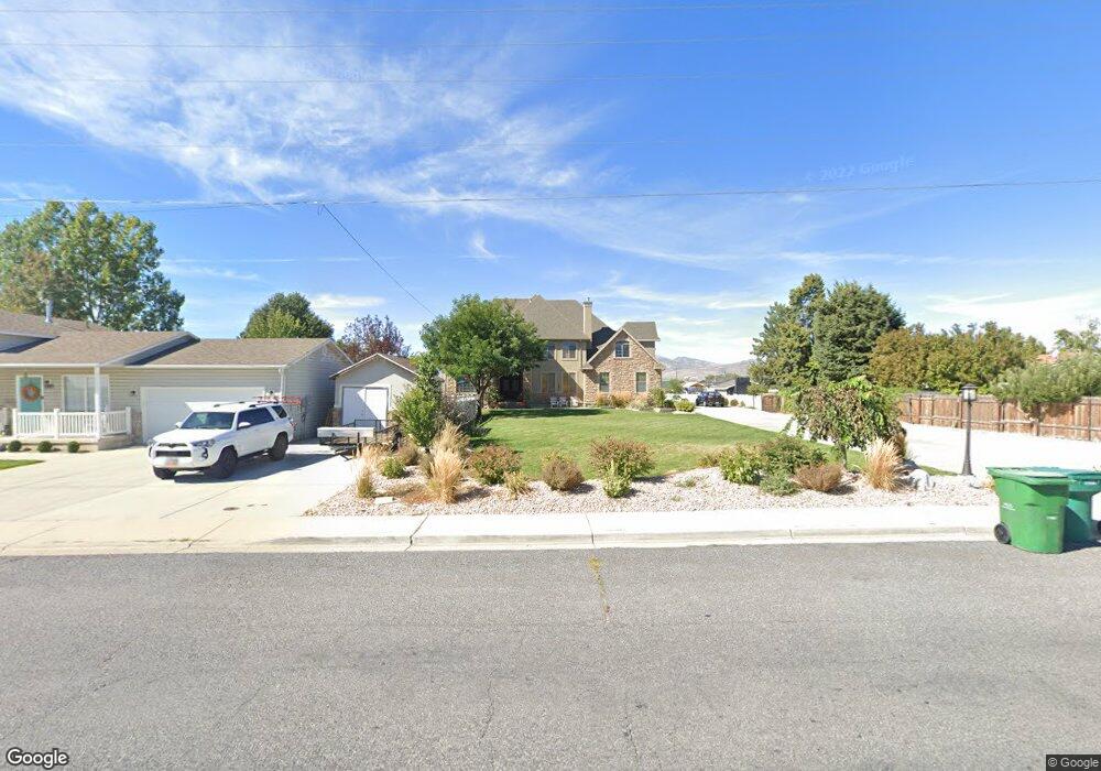
This home is located at 1631 N 300 W, Lehi, UT 84043 and is currently priced at $987,000, approximately $167 per square foot. 1631 N 300 W is a home located in Utah County with nearby schools including Eaglecrest Elementary School, Lehi Junior High School, and Skyridge High School.
Ownership History
Date
Name
Owned For
Owner Type
Purchase Details
Closed on
May 6, 2014
Sold by
The Bank Of New York Mellon
Bought by
Robinson Ty S and Robinson Jamie D
Current Estimated Value
Home Financials for this Owner
Home Financials are based on the most recent Mortgage that was taken out on this home.
Original Mortgage
$336,000
Interest Rate
4.13%
Mortgage Type
New Conventional
Purchase Details
Closed on
Feb 16, 2014
Sold by
Anderson Duane Brent
Bought by
The Bank Of New York Mellon
Purchase Details
Closed on
May 17, 2010
Sold by
Freestone Stenson
Bought by
Anderson Duane Brent
Purchase Details
Closed on
Feb 7, 2007
Sold by
Freestone Stenson
Bought by
Anderson Duane Brent
Home Financials for this Owner
Home Financials are based on the most recent Mortgage that was taken out on this home.
Original Mortgage
$650,000
Interest Rate
6.17%
Mortgage Type
New Conventional
Purchase Details
Closed on
Dec 2, 2005
Sold by
Blake Tami L
Bought by
Wellard Brand H
Home Financials for this Owner
Home Financials are based on the most recent Mortgage that was taken out on this home.
Original Mortgage
$520,000
Interest Rate
8.85%
Mortgage Type
Fannie Mae Freddie Mac
Purchase Details
Closed on
Jun 22, 2005
Sold by
Berry Shane C and Berry Rachel
Bought by
Blake Tami L
Home Financials for this Owner
Home Financials are based on the most recent Mortgage that was taken out on this home.
Original Mortgage
$448,000
Interest Rate
6.12%
Mortgage Type
Fannie Mae Freddie Mac
Purchase Details
Closed on
Aug 25, 2000
Sold by
Salisbury Development Lc
Bought by
Berry Shane C
Home Financials for this Owner
Home Financials are based on the most recent Mortgage that was taken out on this home.
Original Mortgage
$25,300
Interest Rate
8.2%
Create a Home Valuation Report for This Property
The Home Valuation Report is an in-depth analysis detailing your home's value as well as a comparison with similar homes in the area
Home Values in the Area
Average Home Value in this Area
Purchase History
| Date | Buyer | Sale Price | Title Company |
|---|---|---|---|
| Robinson Ty S | -- | None Available | |
| The Bank Of New York Mellon | -- | None Available | |
| Anderson Duane Brent | -- | Trustees Title & Escrow | |
| Anderson Duane Brent | -- | Security Title & Abstract | |
| Wellard Brand H | -- | Westland Title Insurance Ag | |
| Blake Tami L | -- | Monument Title Insurance | |
| Berry Shane C | -- | Provo Land Title Company |
Source: Public Records
Mortgage History
| Date | Status | Borrower | Loan Amount |
|---|---|---|---|
| Previous Owner | Robinson Ty S | $336,000 | |
| Previous Owner | Anderson Duane Brent | $650,000 | |
| Previous Owner | Wellard Brand H | $520,000 | |
| Previous Owner | Blake Tami L | $448,000 | |
| Previous Owner | Berry Shane C | $25,300 |
Source: Public Records
Tax History Compared to Growth
Tax History
| Year | Tax Paid | Tax Assessment Tax Assessment Total Assessment is a certain percentage of the fair market value that is determined by local assessors to be the total taxable value of land and additions on the property. | Land | Improvement |
|---|---|---|---|---|
| 2021 | $3,231 | $0 | $0 | $0 |
| 2020 | $3,049 | $561,200 | $122,300 | $438,900 |
| 2019 | $2,864 | $548,000 | $122,300 | $425,700 |
| 2018 | $2,945 | $532,700 | $107,000 | $425,700 |
| 2017 | $2,641 | $254,045 | $0 | $0 |
| 2016 | $2,729 | $243,540 | $0 | $0 |
| 2015 | $2,809 | $237,985 | $0 | $0 |
| 2014 | $2,826 | $237,985 | $0 | $0 |
Source: Public Records
Map
Nearby Homes
- 1755 N 250 W
- 1817 W Bad Rock Cir
- 902 W 1500 N
- 497 W 2200 N
- 4333 N Baiken Ridge Dr Unit 1020
- 1329 N 100 E Unit 21
- 1150 N 200 W Unit 6
- 595 W 2200 N
- 1295 N 190 E
- 1301 N 900 W Unit 12
- 1011 W Mountain Way Unit 316
- 497 W 2280 N
- 996 N 200 W
- 155 W State St Unit TRLR 3
- 1610 N 1125 W
- 1094 W 1425 N
- 68 W State St
- 2287 N 750 W
- 192 E 2200 N
- 7 E State St