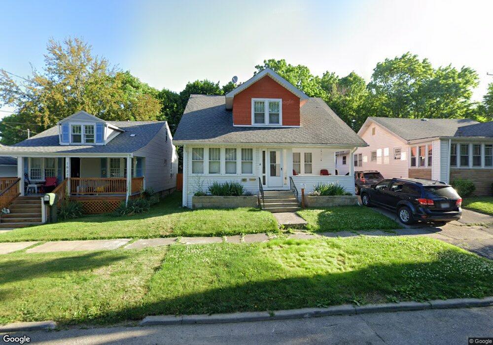
1631 Nebraska Ave Flint, MI 48506
Eastside NeighborhoodEstimated Value: $45,000 - $68,579
3
Beds
2
Baths
1,459
Sq Ft
$38/Sq Ft
Est. Value
About This Home
This home is located at 1631 Nebraska Ave, Flint, MI 48506 and is currently estimated at $55,145, approximately $37 per square foot. 1631 Nebraska Ave is a home located in Genesee County with nearby schools including Doyle/Ryder School, Flint Cultural Center Academy, and WAY Academy of Flint.
Ownership History
Date
Name
Owned For
Owner Type
Purchase Details
Closed on
Feb 27, 2023
Sold by
Richardson Daniel S
Bought by
Johnson Thomas D
Current Estimated Value
Purchase Details
Closed on
Oct 23, 2012
Sold by
Rapcka Ronald C
Bought by
Richardson Daniel S
Purchase Details
Closed on
May 14, 2010
Sold by
Richardson Thomas L and Estate Of Lois Y Richardson
Bought by
Rapcka Ronald C
Purchase Details
Closed on
Mar 27, 2009
Sold by
Estate Of Lois Y Richardson
Bought by
Rapcka Ronald C
Purchase Details
Closed on
Apr 21, 2003
Sold by
Richardson Daniel S
Bought by
Richardson Lois Y
Create a Home Valuation Report for This Property
The Home Valuation Report is an in-depth analysis detailing your home's value as well as a comparison with similar homes in the area
Home Values in the Area
Average Home Value in this Area
Purchase History
| Date | Buyer | Sale Price | Title Company |
|---|---|---|---|
| Johnson Thomas D | -- | -- | |
| Richardson Daniel S | $8,000 | None Available | |
| Rapcka Ronald C | $5,000 | None Available | |
| Rapcka Ronald C | -- | Guaranty Title Company | |
| Richardson Lois Y | $40,000 | -- |
Source: Public Records
Tax History
| Year | Tax Paid | Tax Assessment Tax Assessment Total Assessment is a certain percentage of the fair market value that is determined by local assessors to be the total taxable value of land and additions on the property. | Land | Improvement |
|---|---|---|---|---|
| 2025 | $1,673 | $20,400 | $0 | $0 |
| 2024 | $1,538 | $19,700 | $0 | $0 |
| 2023 | $860 | $15,500 | $0 | $0 |
| 2022 | $0 | $14,900 | $0 | $0 |
| 2021 | $718 | $13,100 | $0 | $0 |
| 2020 | $656 | $12,800 | $0 | $0 |
| 2019 | $644 | $11,200 | $0 | $0 |
| 2018 | $656 | $11,600 | $0 | $0 |
| 2017 | $751 | $0 | $0 | $0 |
| 2016 | $608 | $0 | $0 | $0 |
| 2015 | -- | $0 | $0 | $0 |
| 2014 | -- | $0 | $0 | $0 |
| 2012 | -- | $10,400 | $0 | $0 |
Source: Public Records
Map
Nearby Homes
- 1216 Minnesota Ave
- 1734 Missouri Ave
- 1318 Cronk Ave
- 1609 Ohio Ave
- 1540 Illinois Ave
- 1445 Kearsley Park Blvd Kearsley Park Blvd
- 1379 Washington Ave
- 1622 Arlington Ave
- 2301 Missouri Ave
- 1510 N Vernon Ave
- 2415 Pennsylvania Ave
- 1529 Broadway Blvd
- 2605 Nebraska Ave
- 2610 Pennsylvania Ave
- 1805 Bennett Ave
- 434 Chalmers St
- 2601 Illinois Ave
- 2119 Mountain Ave
- 2013 E Court St
- 605 S Lynch St
- 1627 Nebraska Ave
- 1635 Nebraska Ave
- 1625 Nebraska Ave
- 1639 Nebraska Ave
- 1644 Kentucky Ave
- 1643 Nebraska Ave
- 1648 Kentucky Ave
- 1636 Kentucky Ave
- 1652 Kentucky Ave
- 1656 Kentucky Ave
- 1624 Nebraska Ave
- 1620 Nebraska Ave
- 1628 Nebraska Ave
- 1634 Nebraska Ave
- 1118 Minnesota Ave
- 1643 Kentucky Ave
- 1647 Kentucky Ave
- 1716 Kentucky Ave
- 1653 Kentucky Ave
- 1657 Kentucky Ave
Your Personal Tour Guide
Ask me questions while you tour the home.