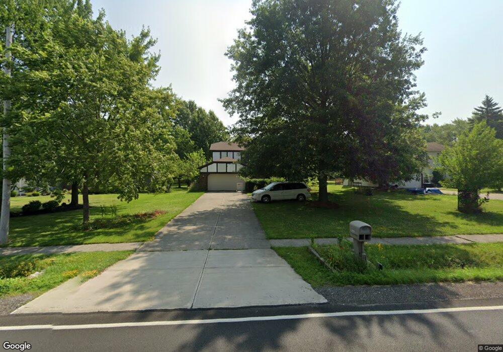
16319 Howe Rd Strongsville, OH 44136
Estimated Value: $325,000 - $384,000
4
Beds
3
Baths
2,072
Sq Ft
$170/Sq Ft
Est. Value
About This Home
This home is located at 16319 Howe Rd, Strongsville, OH 44136 and is currently estimated at $352,832, approximately $170 per square foot. 16319 Howe Rd is a home located in Cuyahoga County with nearby schools including Strongsville High School and Sts Joseph & John Interparochial School.
Ownership History
Date
Name
Owned For
Owner Type
Purchase Details
Closed on
Aug 28, 1996
Sold by
Walker Charles F
Bought by
Askew Michael J
Current Estimated Value
Home Financials for this Owner
Home Financials are based on the most recent Mortgage that was taken out on this home.
Original Mortgage
$123,600
Outstanding Balance
$10,707
Interest Rate
8.3%
Mortgage Type
New Conventional
Estimated Equity
$342,125
Purchase Details
Closed on
Jun 4, 1992
Sold by
Mcdonald Kenneth M
Bought by
Walker Charles F
Purchase Details
Closed on
Feb 29, 1988
Bought by
Mcdonald Kenneth M
Purchase Details
Closed on
Jan 1, 1987
Bought by
Dennis Financial Corp
Create a Home Valuation Report for This Property
The Home Valuation Report is an in-depth analysis detailing your home's value as well as a comparison with similar homes in the area
Home Values in the Area
Average Home Value in this Area
Purchase History
| Date | Buyer | Sale Price | Title Company |
|---|---|---|---|
| Askew Michael J | $154,500 | -- | |
| Walker Charles F | $133,900 | -- | |
| Mcdonald Kenneth M | $122,000 | -- | |
| Dennis Financial Corp | -- | -- |
Source: Public Records
Mortgage History
| Date | Status | Borrower | Loan Amount |
|---|---|---|---|
| Open | Askew Michael J | $123,600 |
Source: Public Records
Tax History Compared to Growth
Tax History
| Year | Tax Paid | Tax Assessment Tax Assessment Total Assessment is a certain percentage of the fair market value that is determined by local assessors to be the total taxable value of land and additions on the property. | Land | Improvement |
|---|---|---|---|---|
| 2024 | $4,912 | $104,615 | $21,490 | $83,125 |
| 2023 | $4,813 | $76,860 | $16,520 | $60,340 |
| 2022 | $4,778 | $76,860 | $16,520 | $60,340 |
| 2021 | $4,740 | $76,860 | $16,520 | $60,340 |
| 2020 | $4,392 | $63,000 | $13,550 | $49,460 |
| 2019 | $4,264 | $180,000 | $38,700 | $141,300 |
| 2018 | $3,869 | $63,000 | $13,550 | $49,460 |
| 2017 | $4,231 | $63,780 | $12,220 | $51,560 |
| 2016 | $4,197 | $63,780 | $12,220 | $51,560 |
| 2015 | $4,256 | $63,780 | $12,220 | $51,560 |
| 2014 | $4,256 | $63,780 | $12,220 | $51,560 |
Source: Public Records
Map
Nearby Homes
- 16450 Howe Rd
- 16650 Lanier Ave
- 17159 Turkey Meadow Ln
- 17130 Golden Star Dr
- 16969 Antler Ln
- 14826 Lenox Dr
- 14703 Lenox Dr Unit 103
- 18229 Howe Rd
- 14558 Drake Rd
- 17029 Eagles Nest Cir
- 0 Shurmer Rd Unit 5108190
- 17069 Partridge Dr
- 17682 Drake Rd
- 0 Mill Hollow Ln Unit 5069608
- 14132 Walking Stick Way
- 18162 Fawn Cir
- 18294 Drake Rd
- 18630 Shurmer Rd
- 18987 Laurell Cir
- 16711 Beech Cir