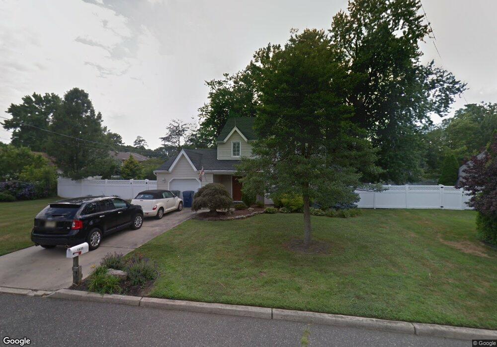
1632 Holbrook St Oakhurst, NJ 07755
Estimated Value: $647,000 - $816,000
3
Beds
2
Baths
1,540
Sq Ft
$474/Sq Ft
Est. Value
About This Home
This home is located at 1632 Holbrook St, Oakhurst, NJ 07755 and is currently estimated at $729,604, approximately $473 per square foot. 1632 Holbrook St is a home located in Monmouth County with nearby schools including Ocean Township High School, St. Mary of the Assumption School, and Bet Yaakov of the Jersey Shore.
Ownership History
Date
Name
Owned For
Owner Type
Purchase Details
Closed on
Nov 29, 2005
Sold by
Ba Patricia Hayes Fka Patricia
Bought by
Hayes Patricia and Hayes Keith J
Current Estimated Value
Create a Home Valuation Report for This Property
The Home Valuation Report is an in-depth analysis detailing your home's value as well as a comparison with similar homes in the area
Home Values in the Area
Average Home Value in this Area
Purchase History
| Date | Buyer | Sale Price | Title Company |
|---|---|---|---|
| Hayes Patricia | -- | -- |
Source: Public Records
Tax History Compared to Growth
Tax History
| Year | Tax Paid | Tax Assessment Tax Assessment Total Assessment is a certain percentage of the fair market value that is determined by local assessors to be the total taxable value of land and additions on the property. | Land | Improvement |
|---|---|---|---|---|
| 2025 | $8,972 | $689,000 | $466,000 | $223,000 |
| 2024 | $9,585 | $629,200 | $406,000 | $223,200 |
| 2023 | $9,585 | $626,900 | $410,000 | $216,900 |
| 2022 | $7,994 | $543,100 | $320,000 | $223,100 |
| 2021 | $7,994 | $439,800 | $240,000 | $199,800 |
| 2020 | $8,665 | $435,200 | $240,000 | $195,200 |
| 2019 | $9,139 | $448,200 | $220,000 | $228,200 |
| 2018 | $9,059 | $432,600 | $215,000 | $217,600 |
| 2017 | $8,845 | $420,600 | $215,000 | $205,600 |
| 2016 | $7,248 | $310,000 | $170,000 | $140,000 |
| 2015 | $7,306 | $316,400 | $180,000 | $136,400 |
| 2014 | $7,782 | $341,600 | $200,000 | $141,600 |
Source: Public Records
Map
Nearby Homes
- 130 Woolley Ct
- 1903 Melville St
- 123 Woolley Ct
- 179 Woolley Ct
- 710 Dow Ave
- 1904 Waverly St
- 149 Jefferson Dr
- 55 Cotswold Cir
- 514 Deal Rd
- 4 Rothbury Ct
- 2025 Lesser Pkwy
- 6 Lotus Ct
- 6 Arlington St
- 116 Cotswold Cir
- 1630-1636 Poplar Rd
- 186 Whalepond Rd
- 8 Ross Ct
- 221 Harrison Ave
- 408 Deal Rd
- 120 Whalepond Rd
- 1636 Holbrook St
- 1627 Westfield St
- 709 Harvey Ave
- 1635 Westfield St
- 1633 Holbrook St
- 711 Harvey Ave
- 1631 Holbrook St
- 1637 Holbrook St
- 1638 Holbrook St
- 1637 Westfield St
- 718 Harvey Ave
- 710 Harvey Ave
- 1632 Finderne St
- 1632 Westfield St
- 1634 Finderne St
- 1630 Finderne St
- 712 Harvey Ave
- 713 Harvey Ave
- 1634 Westfield St
- 1639 Holbrook St