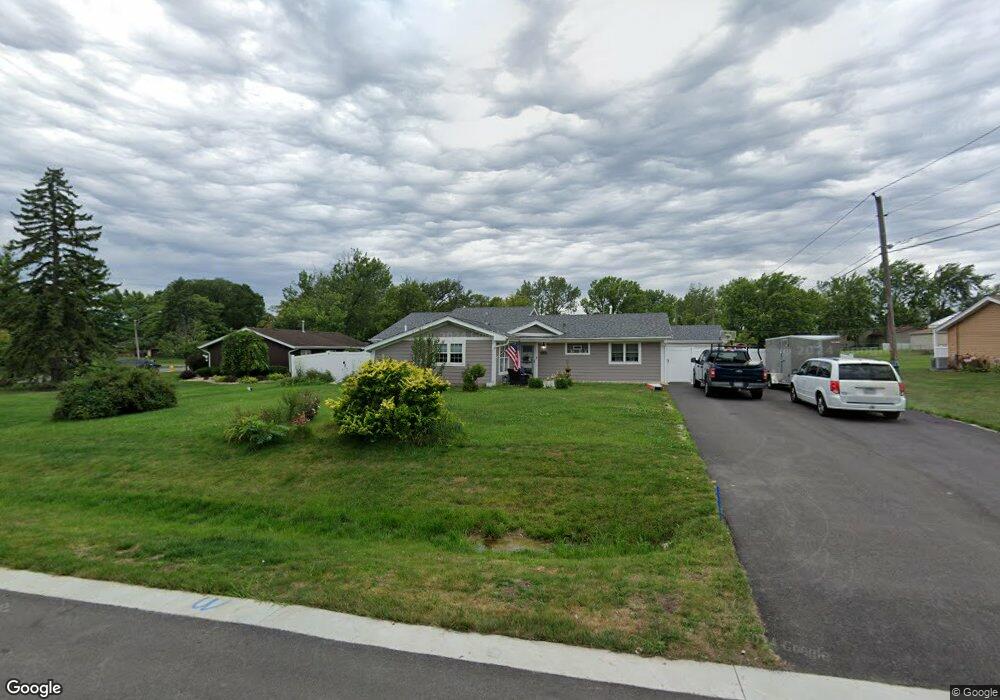
16320 Byron Dr Orland Park, IL 60462
Fernway Park NeighborhoodEstimated Value: $305,000 - $368,386
3
Beds
2
Baths
2,291
Sq Ft
$148/Sq Ft
Est. Value
About This Home
This home is located at 16320 Byron Dr, Orland Park, IL 60462 and is currently estimated at $339,347, approximately $148 per square foot. 16320 Byron Dr is a home located in Cook County with nearby schools including Fernway Park Elementary School, Prairie View Middle School, and Victor J Andrew High School.
Ownership History
Date
Name
Owned For
Owner Type
Purchase Details
Closed on
Feb 5, 2016
Sold by
Simonek Michael R and Simonek Catherine M
Bought by
Simonek Randall and Simonek Catherine A
Current Estimated Value
Purchase Details
Closed on
Apr 12, 2012
Sold by
Simonek Michael R and Simonek Catherine M
Bought by
Simonek Michael R and Simonek Catherine M
Purchase Details
Closed on
Jun 27, 2008
Sold by
Evans William Walter and Busha Dianna Jo
Bought by
Simonek Michael and Simonek Catherine
Purchase Details
Closed on
Jun 28, 2001
Sold by
Evans Dianne D
Bought by
Evans Carroll D
Home Financials for this Owner
Home Financials are based on the most recent Mortgage that was taken out on this home.
Original Mortgage
$72,000
Interest Rate
7.27%
Create a Home Valuation Report for This Property
The Home Valuation Report is an in-depth analysis detailing your home's value as well as a comparison with similar homes in the area
Home Values in the Area
Average Home Value in this Area
Purchase History
| Date | Buyer | Sale Price | Title Company |
|---|---|---|---|
| Simonek Randall | -- | None Available | |
| Simonek Michael R | -- | None Available | |
| Simonek Michael | $195,000 | Ticor | |
| Evans Carroll D | -- | Midwest Land Title Company I |
Source: Public Records
Mortgage History
| Date | Status | Borrower | Loan Amount |
|---|---|---|---|
| Previous Owner | Evans Carroll D | $72,000 |
Source: Public Records
Tax History Compared to Growth
Tax History
| Year | Tax Paid | Tax Assessment Tax Assessment Total Assessment is a certain percentage of the fair market value that is determined by local assessors to be the total taxable value of land and additions on the property. | Land | Improvement |
|---|---|---|---|---|
| 2024 | $7,581 | $33,228 | $10,000 | $23,228 |
| 2023 | $8,825 | $33,228 | $10,000 | $23,228 |
| 2022 | $8,825 | $28,554 | $8,500 | $20,054 |
| 2021 | $8,582 | $28,553 | $8,500 | $20,053 |
| 2020 | $5,158 | $18,787 | $8,500 | $10,287 |
| 2019 | $5,479 | $20,548 | $7,500 | $13,048 |
| 2018 | $5,356 | $20,548 | $7,500 | $13,048 |
| 2017 | $5,249 | $20,548 | $7,500 | $13,048 |
| 2016 | $4,359 | $15,724 | $7,000 | $8,724 |
| 2015 | $4,277 | $15,724 | $7,000 | $8,724 |
| 2014 | $4,245 | $15,724 | $7,000 | $8,724 |
| 2013 | $4,330 | $17,126 | $7,000 | $10,126 |
Source: Public Records
Map
Nearby Homes
- 16510 Sussex Dr
- 16101 Haven Ave
- 16231 92nd Ave
- 8735 Golden Rose Dr
- 9215 Fox Ct
- 8564 Cherry Stone Place
- 9298 Meadowview Dr Unit 9298
- 16701 Highview Ave
- 16753 Hilltop Ave
- 16753 91st Ave
- 16813 89th Ave
- 16121 S 94th Ave
- 16805 Hilltop Ave
- 8534 Westberry Ln Unit 8534
- 16779 92nd Ave
- 8710 W 168th St
- 9411 Albany Ct
- 15826 Orlan Brook Dr Unit 3S
- 8750 W 169th St
- 9430 Georgetown Square
- 16330 Byron Dr
- 16310 Byron Dr
- 8920 W 164th St
- 8901 W 163rd St
- 8921 W 163rd St
- 8930 W 164th St
- 16311 Byron Dr
- 8840 W 164th St
- 16401 S 89th Ct
- 8931 W 163rd St
- 8841 W 163rd St
- 16400 S 89th Ct
- 8901 W 164th St
- 8940 W 164th St
- 8923 Marshfield Ln
- 8927 Marshfield Ln
- 8905 Marshfield Ln
- 8915 Marshfield Ln
- 16411 S 89th Ct
- 8941 W 163rd St