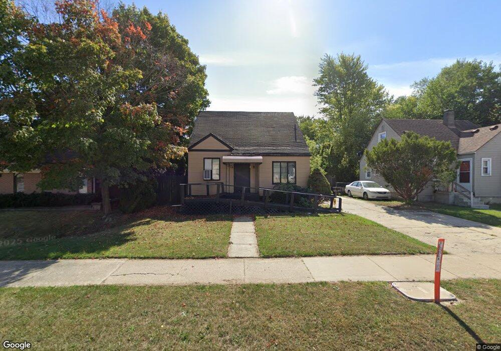
16325 W 12 Mile Rd Southfield, MI 48076
Estimated Value: $155,308 - $211,000
3
Beds
1
Bath
914
Sq Ft
$202/Sq Ft
Est. Value
About This Home
This home is located at 16325 W 12 Mile Rd, Southfield, MI 48076 and is currently estimated at $185,077, approximately $202 per square foot. 16325 W 12 Mile Rd is a home located in Oakland County with nearby schools including Vandenberg Elementary School, Thompson K-8 International Baccalaureate Academy, and Crescent Academy Pk-1.
Ownership History
Date
Name
Owned For
Owner Type
Purchase Details
Closed on
Jul 10, 2006
Sold by
Conselyea Franklin W
Bought by
Conselyea Phyllis
Current Estimated Value
Home Financials for this Owner
Home Financials are based on the most recent Mortgage that was taken out on this home.
Original Mortgage
$53,500
Outstanding Balance
$32,059
Interest Rate
6.82%
Mortgage Type
Purchase Money Mortgage
Estimated Equity
$153,018
Purchase Details
Closed on
Mar 14, 1995
Sold by
Krupa Thomas
Bought by
Conselyea Franklin W
Purchase Details
Closed on
Mar 11, 1995
Sold by
Wieland Judith
Bought by
Conselyea Franklin W
Create a Home Valuation Report for This Property
The Home Valuation Report is an in-depth analysis detailing your home's value as well as a comparison with similar homes in the area
Home Values in the Area
Average Home Value in this Area
Purchase History
| Date | Buyer | Sale Price | Title Company |
|---|---|---|---|
| Conselyea Phyllis | -- | Multiple | |
| Conselyea Franklin W | $57,000 | -- | |
| Conselyea Franklin W | $52,500 | -- |
Source: Public Records
Mortgage History
| Date | Status | Borrower | Loan Amount |
|---|---|---|---|
| Open | Conselyea Phyllis | $53,500 |
Source: Public Records
Tax History Compared to Growth
Tax History
| Year | Tax Paid | Tax Assessment Tax Assessment Total Assessment is a certain percentage of the fair market value that is determined by local assessors to be the total taxable value of land and additions on the property. | Land | Improvement |
|---|---|---|---|---|
| 2022 | $1,267 | $53,480 | $11,380 | $42,100 |
| 2021 | $1,233 | $42,580 | $6,650 | $35,930 |
| 2020 | $1,088 | $37,140 | $6,650 | $30,490 |
| 2018 | $1,279 | $26,710 | $6,650 | $20,060 |
| 2015 | -- | $22,120 | $0 | $0 |
| 2014 | -- | $19,250 | $0 | $0 |
| 2011 | -- | $21,930 | $0 | $0 |
Source: Public Records
Map
Nearby Homes
- 28521 Sutherland St
- 28723 Everett St
- 28775 Glasgow St
- 28760 Everett St
- 28426 Sutherland St
- 28740 Fairfax St
- 28530 Fairfax St
- 28464 Stuart Ave
- 28580 Red Leaf Ln
- 28405 Stuart Ave
- 28174 Sutherland St
- 28115 Everett St
- 28080 Pierce St
- 28091 Everett St
- 28060 Aberdeen St
- 28466 Brentwood St
- 28249 Red Leaf Ln
- 3560 Greenfield Rd
- 29641 Fairfax St
- 29512 Brentwood St
- 16335 W 12 Mile Rd
- 16355 W 12 Mile Rd
- 28785 Sutherland St
- 28786 Pierce St
- 16365 W 12 Mile Rd
- 28784 Sutherland St
- 28765 Sutherland St
- 28770 Pierce St
- 16261 W 12 Mile Rd
- 28764 Sutherland St
- 16215 W 12 Mile Rd
- 28745 Sutherland St
- 28754 Pierce St
- 16240 W 12 Mile Rd
- 28785 Pierce St
- 28785 Aberdeen St
- 28744 Sutherland St
- 28771 Pierce St
- 28725 Sutherland St
- 28724 Pierce St