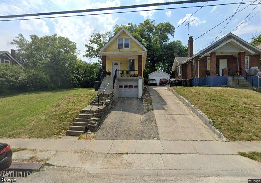
1633 1st Ave Cincinnati, OH 45205
West Price Hill NeighborhoodEstimated Value: $92,911 - $146,000
2
Beds
1
Bath
752
Sq Ft
$155/Sq Ft
Est. Value
About This Home
This home is located at 1633 1st Ave, Cincinnati, OH 45205 and is currently estimated at $116,228, approximately $154 per square foot. 1633 1st Ave is a home located in Hamilton County with nearby schools including Carson School, Gilbert A. Dater High School, and Western Hills High School.
Ownership History
Date
Name
Owned For
Owner Type
Purchase Details
Closed on
Aug 14, 2020
Sold by
Judy Property Group Llc
Bought by
Soriano Kalec B Umanzor and Oliva Juana M
Current Estimated Value
Purchase Details
Closed on
Jul 28, 2020
Sold by
Doll Angela
Bought by
Judy Property Group Llc
Purchase Details
Closed on
Jan 26, 2011
Sold by
Brien Thomas H O and Brien Patricia O
Bought by
Brien Denise O
Home Financials for this Owner
Home Financials are based on the most recent Mortgage that was taken out on this home.
Original Mortgage
$400,000
Interest Rate
4.82%
Mortgage Type
New Conventional
Create a Home Valuation Report for This Property
The Home Valuation Report is an in-depth analysis detailing your home's value as well as a comparison with similar homes in the area
Home Values in the Area
Average Home Value in this Area
Purchase History
| Date | Buyer | Sale Price | Title Company |
|---|---|---|---|
| Soriano Kalec B Umanzor | $21,000 | None Available | |
| Judy Property Group Llc | $8,250 | None Available | |
| Brien Denise O | -- | Attorney | |
| Brien Thomas H O | -- | None Available |
Source: Public Records
Mortgage History
| Date | Status | Borrower | Loan Amount |
|---|---|---|---|
| Previous Owner | Brien Denise O | $400,000 |
Source: Public Records
Tax History Compared to Growth
Tax History
| Year | Tax Paid | Tax Assessment Tax Assessment Total Assessment is a certain percentage of the fair market value that is determined by local assessors to be the total taxable value of land and additions on the property. | Land | Improvement |
|---|---|---|---|---|
| 2024 | $1,338 | $22,320 | $2,604 | $19,716 |
| 2023 | $1,368 | $22,320 | $2,604 | $19,716 |
| 2022 | $693 | $10,091 | $2,587 | $7,504 |
| 2021 | $665 | $10,091 | $2,587 | $7,504 |
| 2020 | $985 | $10,091 | $2,587 | $7,504 |
| 2019 | $680 | $9,174 | $2,352 | $6,822 |
| 2018 | $681 | $9,174 | $2,352 | $6,822 |
| 2017 | $647 | $9,174 | $2,352 | $6,822 |
| 2016 | $217 | $2,975 | $2,275 | $700 |
| 2015 | $196 | $2,975 | $2,275 | $700 |
| 2014 | $197 | $2,975 | $2,275 | $700 |
| 2013 | $200 | $2,975 | $2,275 | $700 |
Source: Public Records
Map
Nearby Homes
- 1645 Iliff Ave
- 4000 W Liberty St
- 3910 W Liberty St
- 3810 W Liberty St
- 1273 Iliff Ave
- 1634 Dewey Ave
- 1646 Dewey Ave
- 1618 Dewey Ave
- 1616 Dewey Ave
- 1660 Dewey Ave
- 1318 Beech Ave
- 1438 Manss Ave
- 1617 Dewey Ave
- 1709 Wyoming Ave
- 1506 Beech Ave
- 1702 Wyoming Ave
- 2403 Glenway Ave
- 3744 Mayfield Ave
- 1239 Sliker Ave
- 3742 Mayfield Ave