If you see this ad, then this home is still available.
All applications will be considered.
3 Bed/2.5 Bath.
Two (2)-car garage attached.
Washer & dryer in unit.
Manicured exterior landscaping included.
Trash removal and sewage included.
High-speed internet available, though, not included.
Unfurnished.
No cats or dogs.
No smoking.
Avoid highway I-5 traffic and enjoy a short
10-minute drive to Joint Base Lewis-McChord (JBLM), WA.
Enjoy being fit on neighborhood walking/running trails.
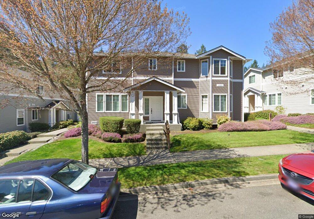
Don't miss this rare opportunity to make this mint condition townhouse-style condo the home that you deserve. Everyday, drive to work overlooking magnificent Mount Rainier. Then come home to two (2) top-ranked golf courses within walking distance of your front door.
Refined and spacious rooms situated on two (2) levels. This model unit features seven (7) rooms. It also includes a dramatic, open-living and dining space combination with bay window, perfect for entertaining or intimate enjoyment. You and your guests will enjoy more natural sunlight because your home is a corner unit. You also won't have to leave your home to do laundry, as a washer and dryer are included inside the condo.
Three (3) bedrooms and 2.5 baths. Master bedroom includes generous walk-in closet, private master bath with dual sink vanity cabinets, and luxurious, curved shower rod, allowing for a spacious and comfortable showers.
Chef's kitchen features countertop dining space, refrigerator, stove range oven, microwave, dishwasher, garbage disposal, and rich, walnut finish cabinets.
Parking:
Includes attached two (2)-car garage with inside access - never walk outside in the cold or rain to your car again. Plenty of free guest parking is available in the 2-car driveway and street-side.
Free of cost, home includes:
Manicured exterior landscaping, trash removal, and sewage. Don't pay for these services somewhere else.
Walking distance from your front door - 2 luxury, 18-hole golf courses:
1) The Home Course, Overlooking Puget Sound: Ranked #2 "Best Public Course in Washington" by Golfweek Magazine and planned to become the home of golf in the Northwest.
2) Eagles Pride Golf Course: Voted in worldwide top 10 military golf courses by Travel and Leisure magazine; one of the best courses in Western Washington and open to the general public (27-hole summer course/ 18-hole winter course).
Ideal location:
- 1 exit away from Joint Base Lewis-McChord - you can literally bike to work.
- 2 mile short bike ride or drive to Dupont Center, featuring restaurants, bars, Starbucks, 24-hour gym, hotel, banking, medical clinics, hair and nail salons, etc.
- 25 mins to Washington State Capitol Dome, Olympia, WA.
- 30 mins to downtown Tacoma, WA for museums, concerts, theater, entertainment.
- 30 mins to Point Defiance Zoo & Aquarium.
- 1 hr to downtown Seattle, WA for museums, concerts, theater, entertainment.
- 1 hr to Mount Rainier Scenic Railroad Tours.
School District: Steilacoom Historical School District
Neighborhood: Dupont
Elementary School: Chloe Clark Elementary
- GreatSchools rating: 7/10.
Middle School: Pioneer Middle School
- SchoolDigger Rank: 4/5.
High School: Steilacoom High School
- GreatSchools rating: 8/10.