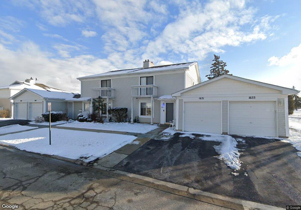
1633 Cornell Dr Unit 19C Hoffman Estates, IL 60169
South Hoffman Estates NeighborhoodEstimated Value: $197,486 - $241,000
2
Beds
--
Bath
1,000
Sq Ft
$229/Sq Ft
Est. Value
About This Home
This home is located at 1633 Cornell Dr Unit 19C, Hoffman Estates, IL 60169 and is currently estimated at $229,122, approximately $229 per square foot. 1633 Cornell Dr Unit 19C is a home located in Cook County with nearby schools including Neil Armstrong Elementary School, Dwight D Eisenhower Junior High School, and Hoffman Estates High School.
Ownership History
Date
Name
Owned For
Owner Type
Purchase Details
Closed on
Feb 16, 1994
Sold by
Ng Michael S
Bought by
Borkowski Mark B
Current Estimated Value
Home Financials for this Owner
Home Financials are based on the most recent Mortgage that was taken out on this home.
Original Mortgage
$68,400
Interest Rate
7.05%
Create a Home Valuation Report for This Property
The Home Valuation Report is an in-depth analysis detailing your home's value as well as a comparison with similar homes in the area
Home Values in the Area
Average Home Value in this Area
Purchase History
| Date | Buyer | Sale Price | Title Company |
|---|---|---|---|
| Borkowski Mark B | $48,000 | -- |
Source: Public Records
Mortgage History
| Date | Status | Borrower | Loan Amount |
|---|---|---|---|
| Closed | Borkowski Mark B | $68,400 |
Source: Public Records
Tax History
| Year | Tax Paid | Tax Assessment Tax Assessment Total Assessment is a certain percentage of the fair market value that is determined by local assessors to be the total taxable value of land and additions on the property. | Land | Improvement |
|---|---|---|---|---|
| 2025 | $3,343 | $20,113 | $4,492 | $15,621 |
| 2024 | $3,343 | $14,210 | $4,083 | $10,127 |
| 2023 | $3,204 | $14,210 | $4,083 | $10,127 |
| 2022 | $3,204 | $14,210 | $4,083 | $10,127 |
| 2021 | $2,520 | $10,853 | $6,431 | $4,422 |
| 2020 | $2,536 | $10,853 | $6,431 | $4,422 |
| 2019 | $2,545 | $12,121 | $6,431 | $5,690 |
| 2018 | $1,583 | $8,291 | $5,614 | $2,677 |
| 2017 | $1,574 | $8,291 | $5,614 | $2,677 |
| 2016 | $1,726 | $8,291 | $5,614 | $2,677 |
| 2015 | $983 | $5,684 | $4,899 | $785 |
| 2014 | $983 | $5,684 | $4,899 | $785 |
| 2013 | $939 | $5,684 | $4,899 | $785 |
Source: Public Records
Map
Nearby Homes
- 2222 Seaver Ln
- 1792 Williamsburg Dr
- 1576 Poplar Creek Dr
- 1880 Bonnie Ln Unit 112
- 1475 Rebecca Dr Unit 213
- 2080 Sutherland Place Unit 1
- 1797 Queensbury Cir Unit 5764
- 1500 Robin Cir Unit 314
- 1776 Bristol Walk Unit 1776
- 1800 Monterey Ct
- 1836 Stockton Dr Unit 3312
- 1760 Bristol Walk Unit F
- 1840 Huntington Blvd Unit BW511
- 1840 Huntington Blvd Unit 203
- 1722 Fayette Walk Unit E
- 1769 Sessions Walk Unit C
- 1975 Windsong Dr Unit 333E1
- 2051 Kettering Rd Unit 2
- 1965 Blackberry Ln Unit 101
- 2267 Briar Ct Unit 65
- 1635 Cornell Dr Unit 19D
- 1635 Cornell Dr Unit 1
- 1637 Cornell Dr Unit 19A
- 1631 Cornell Dr Unit 19B
- 1623 Cornell Place Unit 18D
- 1625 Cornell Place Unit 18A
- 1617 Cornell Place Unit 17B
- 1605 Cornell Place Unit 16C
- 1627 Cornell Place Unit 18B
- 1615 Cornell Place Unit 17A
- 1611 Cornell Place Unit 17C
- 1603 Cornell Place Unit 16B
- 1607 Cornell Place Unit 16D
- 1601 Cornell Place Unit 16A
- 1613 Cornell Place Unit 17D
- 1662 Cornell Dr Unit 27B
- 1664 Cornell Dr Unit 27C
- 1660 Cornell Dr Unit 27A
- 1666 Cornell Dr Unit 27D
- 1641 Cornell Dr Unit 194
Your Personal Tour Guide
Ask me questions while you tour the home.