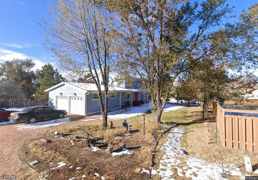
1633 Cragin Rd Colorado Springs, CO 80920
Falcon Estates NeighborhoodEstimated Value: $549,140 - $707,000
5
Beds
3
Baths
2,696
Sq Ft
$228/Sq Ft
Est. Value
About This Home
This home is located at 1633 Cragin Rd, Colorado Springs, CO 80920 and is currently estimated at $614,035, approximately $227 per square foot. 1633 Cragin Rd is a home located in El Paso County with nearby schools including Pioneer Elementary School, Mountain Ridge Middle School, and Rampart High School.
Ownership History
Date
Name
Owned For
Owner Type
Purchase Details
Closed on
Dec 10, 1997
Sold by
Oday John E and Oday Marie R
Bought by
Natali Dennis J and Natali Alison M
Current Estimated Value
Home Financials for this Owner
Home Financials are based on the most recent Mortgage that was taken out on this home.
Original Mortgage
$159,120
Outstanding Balance
$26,849
Interest Rate
7.2%
Mortgage Type
VA
Estimated Equity
$587,186
Purchase Details
Closed on
Jul 24, 1997
Sold by
Falcon Estates Llc
Bought by
Oday John E and Oday Marie R
Create a Home Valuation Report for This Property
The Home Valuation Report is an in-depth analysis detailing your home's value as well as a comparison with similar homes in the area
Home Values in the Area
Average Home Value in this Area
Purchase History
| Date | Buyer | Sale Price | Title Company |
|---|---|---|---|
| Natali Dennis J | $156,000 | Stewart Title | |
| Oday John E | -- | -- |
Source: Public Records
Mortgage History
| Date | Status | Borrower | Loan Amount |
|---|---|---|---|
| Open | Natali Dennis J | $159,120 |
Source: Public Records
Tax History Compared to Growth
Tax History
| Year | Tax Paid | Tax Assessment Tax Assessment Total Assessment is a certain percentage of the fair market value that is determined by local assessors to be the total taxable value of land and additions on the property. | Land | Improvement |
|---|---|---|---|---|
| 2025 | $2,177 | $37,710 | -- | -- |
| 2024 | $2,147 | $40,130 | $5,580 | $34,550 |
| 2023 | $2,147 | $40,130 | $5,580 | $34,550 |
| 2022 | $1,954 | $29,530 | $4,640 | $24,890 |
| 2021 | $2,171 | $30,380 | $4,770 | $25,610 |
| 2020 | $1,885 | $24,490 | $4,150 | $20,340 |
| 2019 | $1,865 | $24,490 | $4,150 | $20,340 |
| 2018 | $1,600 | $20,640 | $3,630 | $17,010 |
| 2017 | $1,594 | $20,640 | $3,630 | $17,010 |
| 2016 | $1,641 | $21,220 | $4,010 | $17,210 |
| 2015 | $1,637 | $21,220 | $4,010 | $17,210 |
| 2014 | -- | $19,130 | $3,770 | $15,360 |
Source: Public Records
Map
Nearby Homes
- 1880 Independence Dr
- 1907 Independence Dr
- 1884 Fuller Rd
- 7191 Ross Dr
- 7424 Bell Dr
- 7137 Murdoch Dr
- 1275 Berglind Rd
- 2110 Whitehorn Dr N
- 1160 Berglind Rd
- 1932 Silkwood Dr
- 2068 Silkwood Dr
- 1510 York Rd Unit 101
- 1871 Brookwood Dr
- 2006 Summerset Dr
- 866 Venhorst Rd
- 1263 York Rd
- 6699 Bethesda Point Unit B
- 6598 Bethesda Point Unit B
- 2114 Summerset Dr
- 6678 Bethesda Point Unit C
- 1593 Cragin Rd
- 1643 Cragin Rd
- 1563 Cragin Rd
- 1564 Fuller Rd
- 1602 Fuller Rd
- 1533 Cragin Rd
- 1503 Cragin Rd
- 1526 Fuller Rd
- 1642 Fuller Rd
- 1610 Cragin Rd
- 1663 Cragin Rd
- 1571 Fuller Rd
- 1551 Fuller Rd
- 1590 Cragin Rd
- 1678 Fuller Rd
- 1633 Fuller Rd
- 1620 Cragin Rd
- 7604 Grashio Dr
- 1598 Collins Rd
- 1556 Collins Rd