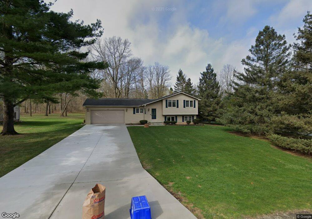
1633 Lockwood Highland, MI 48356
Estimated Value: $308,000 - $341,000
3
Beds
2
Baths
1,349
Sq Ft
$243/Sq Ft
Est. Value
About This Home
This home is located at 1633 Lockwood, Highland, MI 48356 and is currently estimated at $327,662, approximately $242 per square foot. 1633 Lockwood is a home located in Oakland County with nearby schools including Brooks Elementary School.
Ownership History
Date
Name
Owned For
Owner Type
Purchase Details
Closed on
Dec 12, 2001
Sold by
Hesse Aaron
Bought by
Wilfong Thomas E
Current Estimated Value
Home Financials for this Owner
Home Financials are based on the most recent Mortgage that was taken out on this home.
Original Mortgage
$53,000
Interest Rate
7.26%
Purchase Details
Closed on
Jul 27, 1998
Sold by
Shelly Matthew S
Bought by
Hesse Aaron
Home Financials for this Owner
Home Financials are based on the most recent Mortgage that was taken out on this home.
Original Mortgage
$134,900
Interest Rate
6.99%
Purchase Details
Closed on
May 9, 1995
Sold by
Duffy Edward J
Bought by
Shelly Matthew S and Shelly Kristie L
Home Financials for this Owner
Home Financials are based on the most recent Mortgage that was taken out on this home.
Original Mortgage
$100,800
Interest Rate
8.13%
Mortgage Type
New Conventional
Create a Home Valuation Report for This Property
The Home Valuation Report is an in-depth analysis detailing your home's value as well as a comparison with similar homes in the area
Home Values in the Area
Average Home Value in this Area
Purchase History
| Date | Buyer | Sale Price | Title Company |
|---|---|---|---|
| Wilfong Thomas E | $173,000 | -- | |
| Hesse Aaron | $154,900 | -- | |
| Shelly Matthew S | $126,000 | -- |
Source: Public Records
Mortgage History
| Date | Status | Borrower | Loan Amount |
|---|---|---|---|
| Previous Owner | Wilfong Thomas E | $53,000 | |
| Previous Owner | Hesse Aaron | $134,900 | |
| Previous Owner | Shelly Matthew S | $100,800 |
Source: Public Records
Tax History Compared to Growth
Tax History
| Year | Tax Paid | Tax Assessment Tax Assessment Total Assessment is a certain percentage of the fair market value that is determined by local assessors to be the total taxable value of land and additions on the property. | Land | Improvement |
|---|---|---|---|---|
| 2024 | $2,084 | $149,950 | $0 | $0 |
| 2023 | $1,988 | $139,500 | $0 | $0 |
| 2022 | $2,867 | $127,910 | $0 | $0 |
| 2021 | $2,714 | $121,560 | $0 | $0 |
| 2020 | $1,820 | $117,470 | $0 | $0 |
| 2019 | $2,643 | $112,600 | $0 | $0 |
| 2018 | $2,590 | $106,150 | $0 | $0 |
| 2017 | $2,485 | $106,150 | $0 | $0 |
| 2016 | $2,460 | $95,380 | $0 | $0 |
| 2015 | -- | $88,240 | $0 | $0 |
| 2014 | -- | $80,610 | $0 | $0 |
| 2011 | -- | $71,510 | $0 | $0 |
Source: Public Records
Map
Nearby Homes
- 1664 La Salle Blvd
- 3154 Lake Dr
- 1739 Ridge Rd
- 1745 Ridge Rd
- 1820 Ridge Rd
- 1625 Highland Park Dr
- 2525 Sherlock Trail
- 1412 Ormond Rd
- 1000 Waterbury Rd
- 3175 Oakridge Dr
- 2300 Canyon Ridge Dr Unit 18
- 1716 E Wardlow Rd
- 4031 Hillcrest
- 3453 Ormond Rd
- 3831 Woodland Dr
- 2525 Davista Dr
- 2160 Dean Dr
- 2286 Davista Dr
- 2295 Davista Dr
- 5246 Wayne Rd
