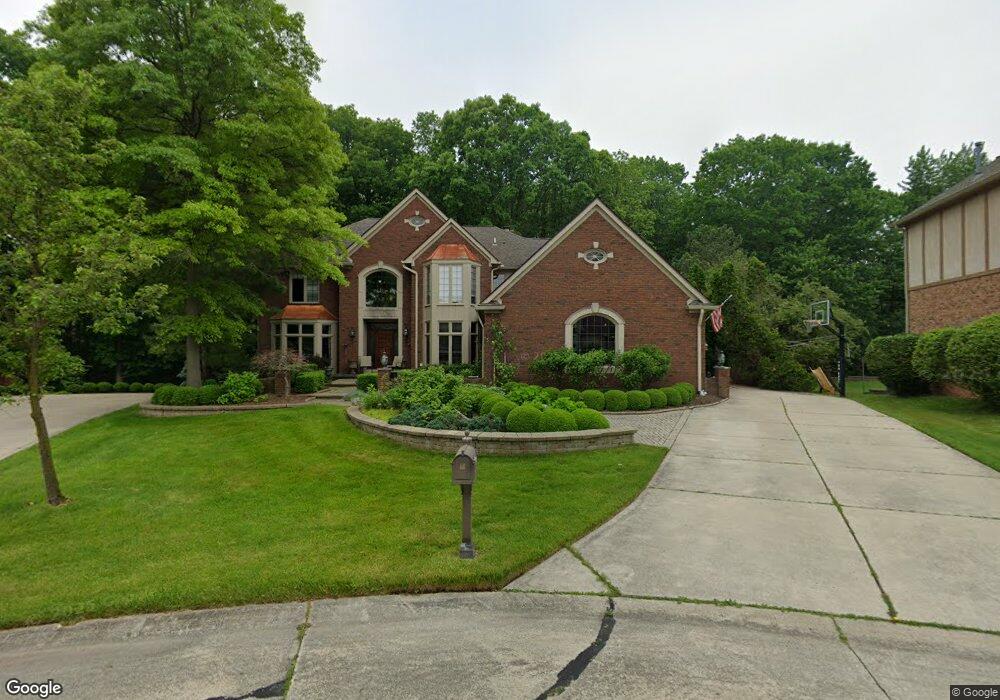
1633 Newcastle Ct Rochester Hills, MI 48306
Estimated Value: $900,000 - $1,033,000
4
Beds
6
Baths
4,762
Sq Ft
$203/Sq Ft
Est. Value
About This Home
This home is located at 1633 Newcastle Ct, Rochester Hills, MI 48306 and is currently estimated at $967,406, approximately $203 per square foot. 1633 Newcastle Ct is a home located in Oakland County with nearby schools including Musson Elementary School, Van Hoosen Middle School, and Rochester Adams High School.
Ownership History
Date
Name
Owned For
Owner Type
Purchase Details
Closed on
Mar 12, 2024
Sold by
Walsh Leslie L
Bought by
Walsh Leslie L and Fuller-Walsh Lisa
Current Estimated Value
Purchase Details
Closed on
Dec 30, 1999
Sold by
Nicholson Christine M
Bought by
Walsh Leslie L
Home Financials for this Owner
Home Financials are based on the most recent Mortgage that was taken out on this home.
Original Mortgage
$15,250
Interest Rate
7.81%
Purchase Details
Closed on
Dec 29, 1999
Sold by
Christine M Nicholson Tr
Bought by
Walsh Leslie L
Home Financials for this Owner
Home Financials are based on the most recent Mortgage that was taken out on this home.
Original Mortgage
$15,250
Interest Rate
7.81%
Create a Home Valuation Report for This Property
The Home Valuation Report is an in-depth analysis detailing your home's value as well as a comparison with similar homes in the area
Home Values in the Area
Average Home Value in this Area
Purchase History
| Date | Buyer | Sale Price | Title Company |
|---|---|---|---|
| Walsh Leslie L | -- | None Listed On Document | |
| Walsh Leslie L | -- | None Listed On Document | |
| Walsh Leslie L | $640,000 | -- | |
| Walsh Leslie L | -- | -- |
Source: Public Records
Mortgage History
| Date | Status | Borrower | Loan Amount |
|---|---|---|---|
| Previous Owner | Walsh Leslie L | $15,250 |
Source: Public Records
Tax History Compared to Growth
Tax History
| Year | Tax Paid | Tax Assessment Tax Assessment Total Assessment is a certain percentage of the fair market value that is determined by local assessors to be the total taxable value of land and additions on the property. | Land | Improvement |
|---|---|---|---|---|
| 2022 | $5,023 | $357,500 | $0 | $0 |
| 2018 | $8,321 | $317,590 | $0 | $0 |
| 2017 | $8,155 | $317,470 | $0 | $0 |
| 2015 | -- | $302,120 | $0 | $0 |
| 2014 | -- | $259,290 | $0 | $0 |
| 2011 | -- | $236,350 | $0 | $0 |
Source: Public Records
Map
Nearby Homes
- 3674 Merriweather Ln
- 3640 Camden Ct
- 3634 Camden Ct
- 1906 Independence Ct
- 3633 Thornwood Dr
- 4035 Hillsdale Dr Unit 275
- 3273 Salem Dr
- 3534 Riverside Dr Unit 141
- 3879 Teakwood Ln
- 5700 Rolling Hills Dr
- 1609 Kilburn Rd N
- 2935 Woodford Cir
- 423 Silvervale Dr
- 3780 Bald Mountain Rd
- 3095 Bridgewater Rd Unit 30
- 5826 Murfield Dr
- 2700 Mohawk Ln
- 3057 Bridgewater Rd
- 3185 Saint James Ct
- 3639 Heatherwood Ct
- 1639 Newcastle Ct
- 1625 Newcastle Ct
- 3687 Newcastle Dr
- 1626 Newcastle Ct
- 3693 Newcastle Dr
- 3681 Newcastle Dr
- 1632 Newcastle Ct
- 3699 Newcastle Dr
- 1638 Newcastle Ct
- 3260 Parkwood Dr
- 3266 Parkwood Dr
- 3254 Parkwood Dr
- 3272 Parkwood Dr
- 1624 Wakefield Ct
- 0 Newcastle Dr
- 1644 Newcastle Ct
- 3705 Newcastle Dr
- 3248 Parkwood Dr
- 1632 Wakefield Ct Unit Bldg-Unit
- 1632 Wakefield Ct