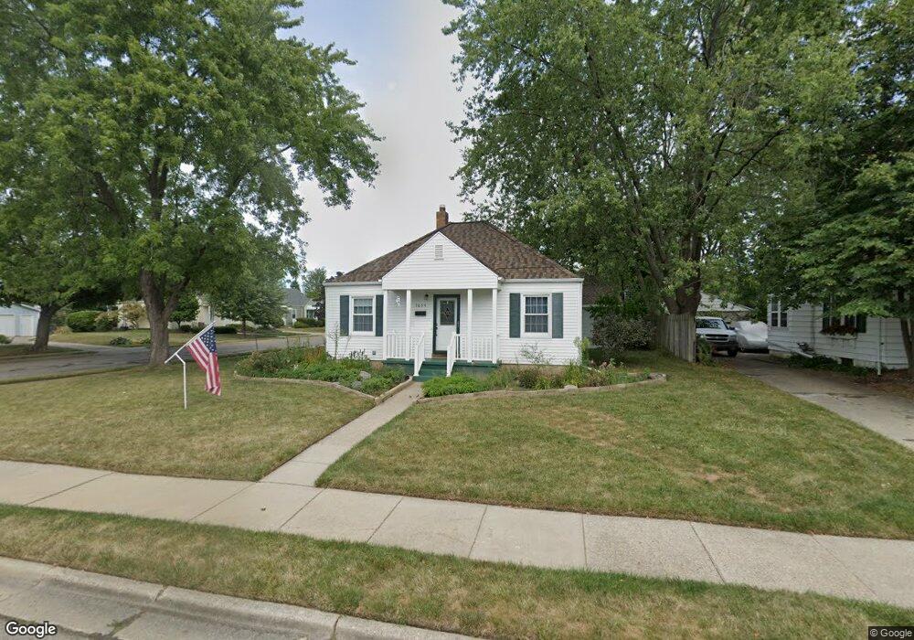
1634 Berkeley Dr Lansing, MI 48910
Quentin Park NeighborhoodEstimated Value: $125,614 - $163,000
2
Beds
2
Baths
1,480
Sq Ft
$98/Sq Ft
Est. Value
About This Home
This home is located at 1634 Berkeley Dr, Lansing, MI 48910 and is currently estimated at $144,904, approximately $97 per square foot. 1634 Berkeley Dr is a home located in Ingham County with nearby schools including Averill Elementary School, Pattengill Academy, and J.W. Sexton High School.
Ownership History
Date
Name
Owned For
Owner Type
Purchase Details
Closed on
Mar 29, 2007
Sold by
Grondine M Monell
Bought by
Eubank Steven A and Eubank Robin L
Current Estimated Value
Home Financials for this Owner
Home Financials are based on the most recent Mortgage that was taken out on this home.
Original Mortgage
$95,500
Outstanding Balance
$58,059
Interest Rate
6.25%
Mortgage Type
Purchase Money Mortgage
Estimated Equity
$86,845
Purchase Details
Closed on
Oct 12, 2001
Sold by
Bush Steven and Bush Shannon
Bought by
Grondine M Monell
Home Financials for this Owner
Home Financials are based on the most recent Mortgage that was taken out on this home.
Original Mortgage
$74,400
Interest Rate
6.88%
Mortgage Type
Purchase Money Mortgage
Purchase Details
Closed on
Jun 30, 1998
Sold by
Greenwood Cynthia A
Bought by
Bush Steve and Bush Shannon
Purchase Details
Closed on
Dec 1, 1993
Create a Home Valuation Report for This Property
The Home Valuation Report is an in-depth analysis detailing your home's value as well as a comparison with similar homes in the area
Home Values in the Area
Average Home Value in this Area
Purchase History
| Date | Buyer | Sale Price | Title Company |
|---|---|---|---|
| Eubank Steven A | $95,500 | None Available | |
| Grondine M Monell | $93,000 | Midstate Title Company | |
| Bush Steve | $67,700 | -- | |
| -- | $57,000 | -- |
Source: Public Records
Mortgage History
| Date | Status | Borrower | Loan Amount |
|---|---|---|---|
| Open | Eubank Steven A | $95,500 | |
| Previous Owner | Grondine M Monell | $74,400 |
Source: Public Records
Tax History
| Year | Tax Paid | Tax Assessment Tax Assessment Total Assessment is a certain percentage of the fair market value that is determined by local assessors to be the total taxable value of land and additions on the property. | Land | Improvement |
|---|---|---|---|---|
| 2025 | $2,972 | $58,700 | $11,900 | $46,800 |
| 2024 | $24 | $56,600 | $11,900 | $44,700 |
| 2023 | $2,787 | $51,700 | $11,900 | $39,800 |
| 2022 | $2,513 | $48,000 | $12,000 | $36,000 |
| 2021 | $2,460 | $46,400 | $12,000 | $34,400 |
| 2020 | $2,445 | $44,500 | $12,000 | $32,500 |
| 2019 | $2,344 | $40,600 | $12,000 | $28,600 |
| 2018 | $2,197 | $39,500 | $12,000 | $27,500 |
| 2017 | $2,103 | $39,500 | $12,000 | $27,500 |
| 2016 | $2,011 | $37,300 | $12,000 | $25,300 |
| 2015 | $2,011 | $36,400 | $24,082 | $12,318 |
| 2014 | $2,011 | $35,600 | $24,082 | $11,518 |
Source: Public Records
Map
Nearby Homes
- 1740 Wellington Rd Unit 103
- 1534 Lenore Ave
- 1517 Lenore Ave
- 1312 W Mount Hope Ave
- 1323 Cooper Ave
- 1511 Pattengill Ave
- 1309 Hammond St
- 1116 George St
- 1114 Goodrich St
- 2001 S Martin Luther King Junior Blvd
- 1327 Moores River Dr
- 1618 Loraine Ave
- 1120 Alsdorf St
- 1017 W Barnes Ave
- 1221 Moores River Dr
- 1516 Moores River Dr
- 2505 Fairfax Rd
- 2519 Marion Ave
- 900 W Mount Hope Ave
- 1912 Moores River Dr
- 1628 Berkeley Dr
- 1624 Berkeley Dr
- 1739 Boston Blvd
- 1635 Berkeley Dr
- 1746 Boston Blvd
- 1740 Boston Blvd
- 1618 Berkeley Dr
- 1735 Boston Blvd
- 1809 Boston Blvd
- 1734 Boston Blvd
- 1800 Boston Blvd
- 1612 Berkeley Dr
- 1629 Berkeley Dr
- 1745 Wellington Rd
- 1730 Boston Blvd
- 1731 Boston Blvd
- 1815 Boston Blvd
- 1625 Berkeley Dr
- 1810 Boston Blvd
- 1608 Berkeley Dr
Your Personal Tour Guide
Ask me questions while you tour the home.