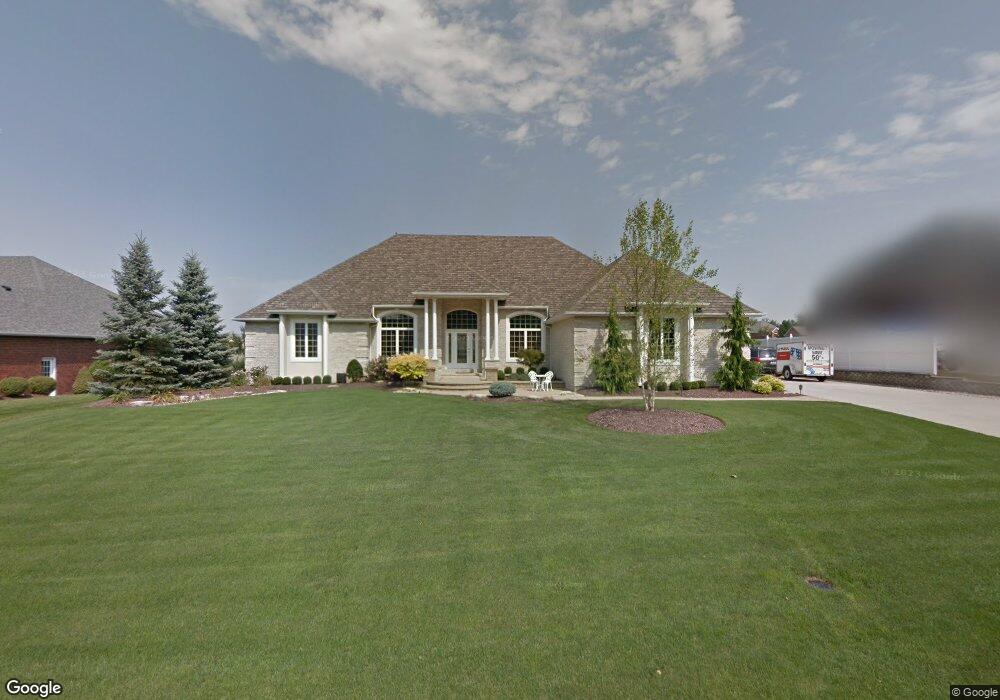
1634 Pinehurst Dr Findlay, OH 45840
Estimated Value: $523,898 - $605,000
4
Beds
4
Baths
2,558
Sq Ft
$218/Sq Ft
Est. Value
About This Home
This home is located at 1634 Pinehurst Dr, Findlay, OH 45840 and is currently estimated at $556,725, approximately $217 per square foot. 1634 Pinehurst Dr is a home located in Hancock County with nearby schools including Liberty-Benton Elementary School, Liberty-Benton Middle School, and Liberty-Benton High School.
Ownership History
Date
Name
Owned For
Owner Type
Purchase Details
Closed on
Sep 18, 2021
Sold by
Martin Thomas C and Martin Celia S
Bought by
Franklin Samantha and Thomas C Martin Map Trust
Current Estimated Value
Purchase Details
Closed on
Sep 17, 2009
Sold by
Vansky Michael D and Vansky Ann J
Bought by
Martin Thomas C and Martin Celia S
Home Financials for this Owner
Home Financials are based on the most recent Mortgage that was taken out on this home.
Original Mortgage
$130,000
Interest Rate
4.66%
Mortgage Type
New Conventional
Create a Home Valuation Report for This Property
The Home Valuation Report is an in-depth analysis detailing your home's value as well as a comparison with similar homes in the area
Purchase History
| Date | Buyer | Sale Price | Title Company |
|---|---|---|---|
| Franklin Samantha | -- | None Available | |
| Martin Thomas C | $405,000 | Mid Am Title Agency |
Source: Public Records
Mortgage History
| Date | Status | Borrower | Loan Amount |
|---|---|---|---|
| Closed | Martin Thomas C | $130,000 |
Source: Public Records
Tax History
| Year | Tax Paid | Tax Assessment Tax Assessment Total Assessment is a certain percentage of the fair market value that is determined by local assessors to be the total taxable value of land and additions on the property. | Land | Improvement |
|---|---|---|---|---|
| 2024 | $5,205 | $149,830 | $25,020 | $124,810 |
| 2023 | $5,105 | $149,830 | $25,020 | $124,810 |
| 2022 | $5,070 | $149,830 | $25,020 | $124,810 |
| 2021 | $4,796 | $126,550 | $25,020 | $101,530 |
| 2020 | $4,837 | $126,550 | $25,020 | $101,530 |
| 2019 | $4,641 | $126,550 | $25,020 | $101,530 |
| 2018 | $3,906 | $118,210 | $16,680 | $101,530 |
| 2017 | $2,015 | $118,210 | $16,680 | $101,530 |
| 2016 | $3,904 | $118,210 | $16,680 | $101,530 |
| 2015 | $4,215 | $123,860 | $14,400 | $109,460 |
| 2014 | $4,253 | $123,860 | $14,400 | $109,460 |
| 2012 | $4,442 | $123,860 | $14,400 | $109,460 |
Source: Public Records
Map
Nearby Homes
- 3106 Saddlebrook
- 6535 Silver Lake Dr
- 3018 Gleneagle Dr
- 0 County Road 95 Unit 6097574
- 3237 Gleneagle Dr
- 9894 Smokies Way
- 0 Bushwillow Dr Or Rock Candy Rd Unit Lot 157
- 0 Rock Candy Rd Or Bushwillow Dr Unit Lot 173
- 0 Rock Candy Rd Unit Lot 159
- 0 Rock Candy Rd Unit Lot 170
- 0 Rock Candy Rd Unit Lot 172 206819
- 0 Rock Candy Rd Unit Lot 162
- 0 Rock Candy Rd Unit Lot 171
- 0 Rock Candy Rd Unit Lot 168
- 0 Bearcat Way Or Rock Candy Rd Unit Lot 167
- 0 County Road 140
- 925 W Melrose Ave
- 0 Allen Township 142
- 0 Township Highway 99
- 12325 Township Highway 99
- 1624 Pinehurst Dr
- 56 Pinehurst Dr
- 66 Pinehurst Dr
- 0 Pinehurst Dr
- 1631 Pinehurst Dr
- 1708 Pinehurst Dr
- 1614 Pinehurst Dr
- 1701 Pinehurst Dr
- 1621 Pinehurst Dr
- 1709 Pinehurst Dr
- 1714 Pinehurst Dr
- 1611 Pinehurst Dr
- 1604 Pinehurst Dr
- 1628 Bay Hill Dr
- 1702 Bay Hill Dr
- 1717 Pinehurst Dr
- 1620 Bay Hill Dr
- 1607 Cypress Lake
- 1615 Cypress Lake
- 1710 Bay Hill Dr
Your Personal Tour Guide
Ask me questions while you tour the home.