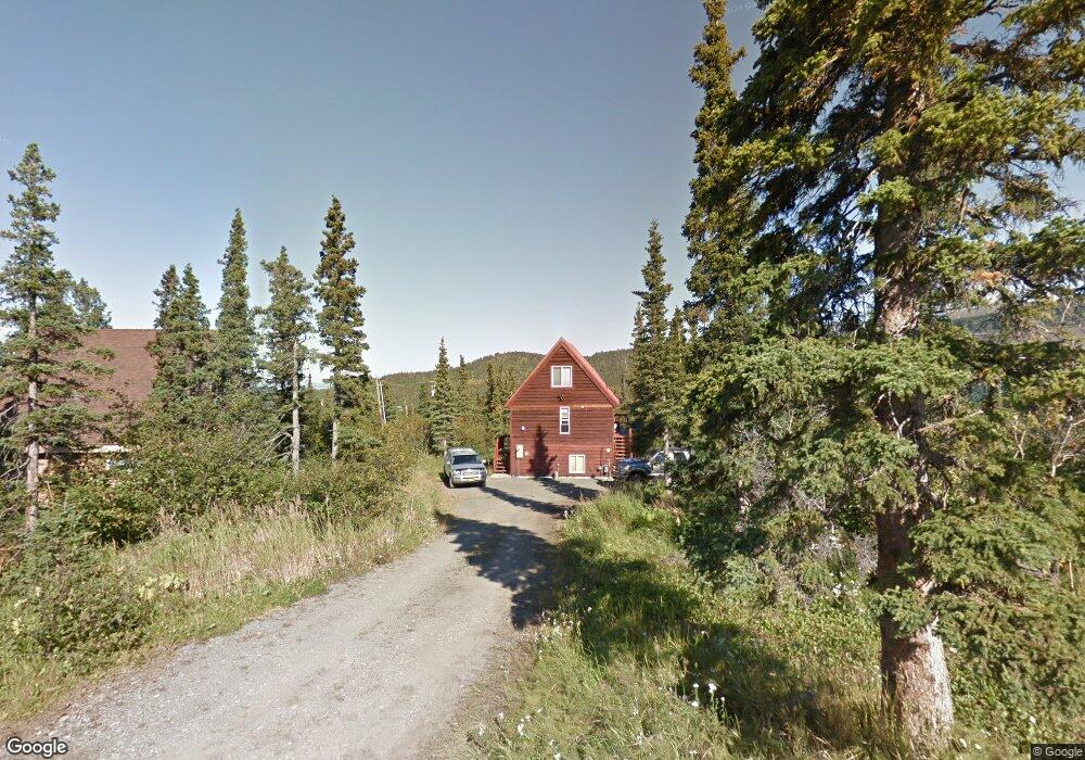
16345 Carl St Anchorage, AK 99516
Bear Valley NeighborhoodEstimated Value: $238,000 - $314,964
2
Beds
1
Bath
832
Sq Ft
$332/Sq Ft
Est. Value
About This Home
This home is located at 16345 Carl St, Anchorage, AK 99516 and is currently estimated at $276,482, approximately $332 per square foot. 16345 Carl St is a home located in Anchorage Municipality with nearby schools including Bear Valley Elementary School, Goldenview Middle School, and South Anchorage High School.
Ownership History
Date
Name
Owned For
Owner Type
Purchase Details
Closed on
Dec 22, 1993
Sold by
Metsker Lisa A
Bought by
Sarafin David R
Current Estimated Value
Home Financials for this Owner
Home Financials are based on the most recent Mortgage that was taken out on this home.
Original Mortgage
$78,850
Interest Rate
7.2%
Mortgage Type
New Conventional
Create a Home Valuation Report for This Property
The Home Valuation Report is an in-depth analysis detailing your home's value as well as a comparison with similar homes in the area
Home Values in the Area
Average Home Value in this Area
Purchase History
| Date | Buyer | Sale Price | Title Company |
|---|---|---|---|
| Sarafin David R | -- | -- |
Source: Public Records
Mortgage History
| Date | Status | Borrower | Loan Amount |
|---|---|---|---|
| Closed | Sarafin David R | $78,850 |
Source: Public Records
Tax History Compared to Growth
Tax History
| Year | Tax Paid | Tax Assessment Tax Assessment Total Assessment is a certain percentage of the fair market value that is determined by local assessors to be the total taxable value of land and additions on the property. | Land | Improvement |
|---|---|---|---|---|
| 2025 | $3,407 | $221,200 | $60,200 | $161,000 |
| 2024 | $3,407 | $221,800 | $60,200 | $161,600 |
| 2023 | $3,287 | $206,700 | $60,200 | $146,500 |
| 2022 | $3,247 | $201,200 | $60,200 | $141,000 |
| 2021 | $3,234 | $187,900 | $55,400 | $132,500 |
| 2020 | $2,962 | $185,100 | $55,400 | $129,700 |
| 2019 | $2,797 | $179,400 | $50,200 | $129,200 |
| 2018 | $2,683 | $172,100 | $46,700 | $125,400 |
| 2017 | $2,604 | $169,000 | $39,500 | $129,500 |
| 2016 | $2,343 | $161,800 | $39,500 | $122,300 |
| 2015 | $2,343 | $156,900 | $39,500 | $117,400 |
| 2014 | $2,343 | $156,100 | $39,500 | $116,600 |
Source: Public Records
Map
Nearby Homes
- 7921 Viola Cir
- L3A Alta Ct
- 7920 Byron Dr
- 7841 Byron Dr
- 7820 Susan Cir
- L15A B10H Harwood Cir
- L16A B10H Harwood Cir
- L14A B10H Harwood Cir
- 16528 Kings Way Dr
- L2 Paine Cir
- L3 Paine Cir
- L1 Paine Cir
- L6 B4 Mountain Breeze Dr
- 7990 Paine Rd
- 16074 Mountain Air Dr
- 8460 Paine Rd
- L6 B5 Mountain Air Dr
- L5 B5 Mountain Air Dr
- L7 B5 Mountain Air Dr
- L4 B5 Mountain Air Dr
- 8021 Marino Dr
- 8001 Marino Dr
- 8041 Marino Dr
- L6A B7H Carl St
- 16730 Carl St
- 16900 Carl St
- 16200 Carl St
- 8101 Marino Dr
- 16400 Carl St
- 16220 Diane Dr
- 8121 Marino Dr
- L11A Marino Dr
- L11A B2H Marino Dr
- 000 Marino Dr
- L25A B1H Marino Dr
- TrB Marino Dr
- Tr C Marino Dr
- 8025 Marino Dr
- 8000 Marino Dr
- 16200 Diane Dr