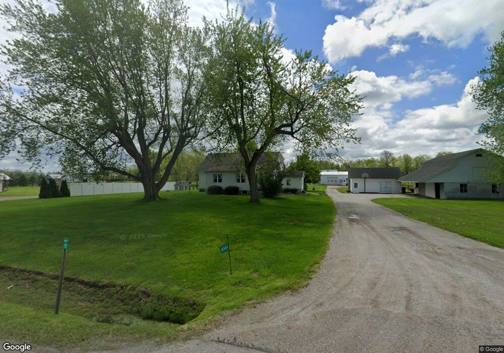
16349 Nauvoo Rd Middlefield, OH 44062
Estimated Value: $223,854 - $319,000
3
Beds
1
Bath
2,104
Sq Ft
$132/Sq Ft
Est. Value
About This Home
This home is located at 16349 Nauvoo Rd, Middlefield, OH 44062 and is currently estimated at $278,714, approximately $132 per square foot. 16349 Nauvoo Rd is a home located in Geauga County with nearby schools including Jordak Elementary School, Cardinal Middle School, and Cardinal High School.
Ownership History
Date
Name
Owned For
Owner Type
Purchase Details
Closed on
Nov 23, 2020
Sold by
Byler Allen W and Byler Ruth A
Bought by
Wengerd Aaron D and Miller Becca
Current Estimated Value
Purchase Details
Closed on
Sep 7, 2001
Sold by
Byler William W and Byler Esther O
Bought by
Byler Allen W and Byler Ruth A
Purchase Details
Closed on
Sep 19, 1994
Sold by
Byler Emma M
Bought by
Byler Lester W and Byler Betty L
Home Financials for this Owner
Home Financials are based on the most recent Mortgage that was taken out on this home.
Original Mortgage
$91,800
Interest Rate
8.44%
Mortgage Type
New Conventional
Purchase Details
Closed on
Jan 1, 1990
Bought by
Byler William W
Create a Home Valuation Report for This Property
The Home Valuation Report is an in-depth analysis detailing your home's value as well as a comparison with similar homes in the area
Home Values in the Area
Average Home Value in this Area
Purchase History
| Date | Buyer | Sale Price | Title Company |
|---|---|---|---|
| Wengerd Aaron D | $215,000 | None Available | |
| Byler Allen W | $90,000 | Western Reserve Title Co Ltd | |
| Byler Lester W | $90,000 | -- | |
| Byler William W | -- | -- |
Source: Public Records
Mortgage History
| Date | Status | Borrower | Loan Amount |
|---|---|---|---|
| Closed | Byler Lester W | $91,800 |
Source: Public Records
Tax History Compared to Growth
Tax History
| Year | Tax Paid | Tax Assessment Tax Assessment Total Assessment is a certain percentage of the fair market value that is determined by local assessors to be the total taxable value of land and additions on the property. | Land | Improvement |
|---|---|---|---|---|
| 2024 | $2,331 | $55,380 | $5,430 | $49,950 |
| 2023 | $2,331 | $55,380 | $5,430 | $49,950 |
| 2022 | $2,305 | $45,790 | $4,520 | $41,270 |
| 2021 | $2,299 | $45,790 | $4,520 | $41,270 |
| 2020 | $2,367 | $45,790 | $4,520 | $41,270 |
| 2019 | $2,191 | $41,030 | $4,520 | $36,510 |
| 2018 | $2,293 | $41,030 | $4,520 | $36,510 |
| 2017 | $2,191 | $41,030 | $4,520 | $36,510 |
| 2016 | $2,037 | $43,510 | $4,520 | $38,990 |
| 2015 | $1,836 | $43,510 | $4,520 | $38,990 |
| 2014 | $1,836 | $43,510 | $4,520 | $38,990 |
| 2013 | $1,820 | $43,510 | $4,520 | $38,990 |
Source: Public Records
Map
Nearby Homes
- 16298 Weathervane Dr
- 14706 Steeplechase Dr
- 14753 Madison Rd
- 16008 Button St
- 0 Old State Rd Unit 5157703
- 13689 Old State Rd
- 15410 High Pointe Cir
- 15111 Timber Ridge Dr
- V/L High Pointe Cir
- 13105 Madison Rd
- S/L 189 Oak Hill Dr
- 15990 Old State Rd
- 13137 Old State Rd
- 14452 Burton Windsor Rd
- 16310 Madison Rd
- 14607 Erwin Dr
- 16270 Mayfield Rd
- 12342 Madison Rd
- 14028 Goodwin St
- 14752 Evergreen Dr
- 16349 Nauvoo Rd
- 16311 Nauvoo Rd
- 16352 Nauvoo Rd
- 16350 Nauvoo Rd
- 16286 Nauvoo Rd
- 16365 Nauvoo Rd
- 16403 Nauvoo Rd
- 16351 Nauvoo Rd
- 16372 Nauvoo Rd
- 16397 Nauvoo Rd
- 16262 Nauvoo Rd
- 16404 Nauvoo Rd
- 16431 Nauvoo Rd
- 16247 Nauvoo Rd
- 16470 Nauvoo Rd
- 16465 Nauvoo Rd
- 16476 Nauvoo Rd
- 14228 Madison Rd
- 16484 Nauvoo Rd
- 0 Nauvoo Rd