Estimated Value: $385,000 - $494,000
3
Beds
2
Baths
1,427
Sq Ft
$305/Sq Ft
Est. Value
About This Home
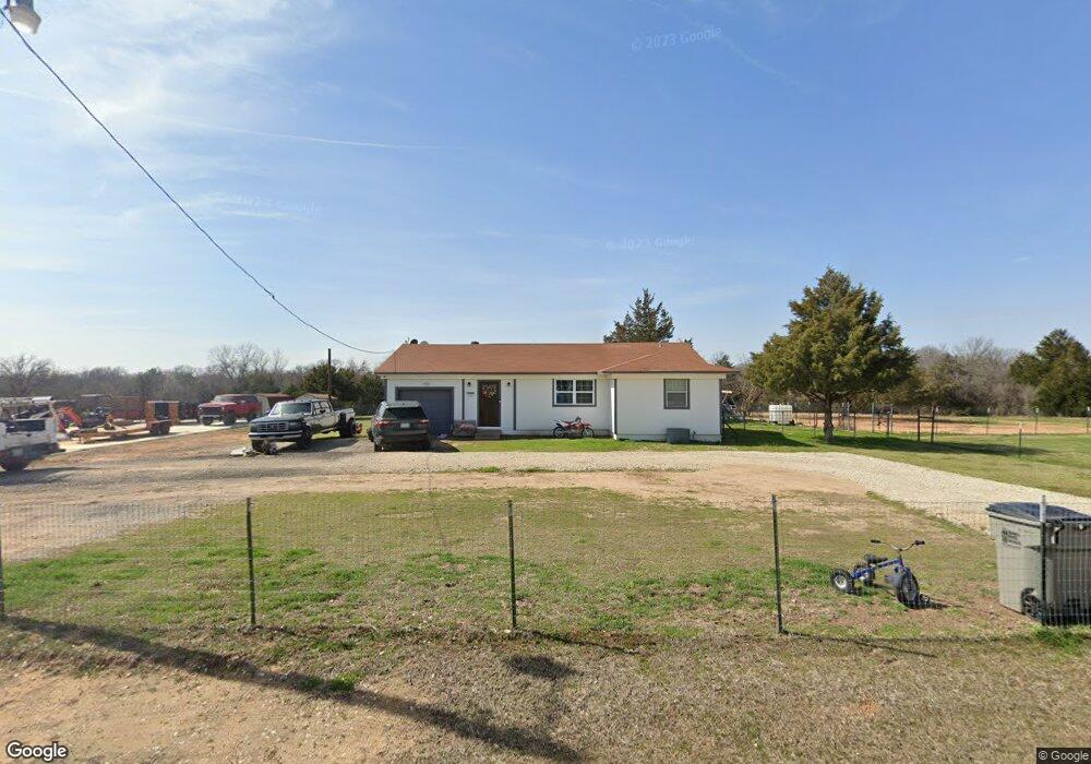
This home is located at 1635 Kay Ln, Azle, TX 76020 and is currently estimated at $434,951, approximately $304 per square foot. 1635 Kay Ln is a home located in Parker County with nearby schools including Cross Timbers Elementary School, W E Hoover Elementary School, and Santo Forte Junior High School.
Ownership History
Date
Name
Owned For
Owner Type
Purchase Details
Closed on
Nov 10, 2020
Sold by
Gunter Kenny Ray and Gunter Amy
Bought by
Swink Logan Neal and Norris Linzy Reed
Current Estimated Value
Home Financials for this Owner
Home Financials are based on the most recent Mortgage that was taken out on this home.
Original Mortgage
$271,700
Outstanding Balance
$241,774
Interest Rate
2.8%
Mortgage Type
New Conventional
Estimated Equity
$193,177
Purchase Details
Closed on
Feb 13, 2015
Sold by
Branch Lori
Bought by
Gunter Kenny Ray
Home Financials for this Owner
Home Financials are based on the most recent Mortgage that was taken out on this home.
Original Mortgage
$153,061
Interest Rate
3.78%
Mortgage Type
New Conventional
Purchase Details
Closed on
Dec 10, 2003
Sold by
Vinzant Billy Glen
Bought by
Gunter Kenny R
Create a Home Valuation Report for This Property
The Home Valuation Report is an in-depth analysis detailing your home's value as well as a comparison with similar homes in the area
Home Values in the Area
Average Home Value in this Area
Purchase History
| Date | Buyer | Sale Price | Title Company |
|---|---|---|---|
| Swink Logan Neal | -- | Providence Title Company | |
| Gunter Kenny Ray | -- | Alamo Title Company | |
| Gunter Kenny R | -- | -- |
Source: Public Records
Mortgage History
| Date | Status | Borrower | Loan Amount |
|---|---|---|---|
| Open | Swink Logan Neal | $271,700 | |
| Previous Owner | Gunter Kenny Ray | $153,061 |
Source: Public Records
Tax History Compared to Growth
Tax History
| Year | Tax Paid | Tax Assessment Tax Assessment Total Assessment is a certain percentage of the fair market value that is determined by local assessors to be the total taxable value of land and additions on the property. | Land | Improvement |
|---|---|---|---|---|
| 2025 | $1,243 | $276,683 | -- | -- |
| 2024 | $1,243 | $251,530 | -- | -- |
| 2023 | $1,243 | $301,300 | $0 | $0 |
| 2022 | $6,077 | $273,910 | $135,770 | $138,140 |
| 2021 | $6,461 | $273,910 | $135,770 | $138,140 |
| 2020 | $3,310 | $232,990 | $157,200 | $75,790 |
| 2019 | $3,157 | $232,990 | $157,200 | $75,790 |
| 2018 | $2,878 | $130,590 | $50,070 | $80,520 |
| 2017 | $2,525 | $130,590 | $50,070 | $80,520 |
| 2016 | $2,295 | $96,280 | $35,040 | $61,240 |
| 2015 | $596 | $96,280 | $35,040 | $61,240 |
| 2014 | $1,983 | $95,290 | $35,040 | $60,250 |
Source: Public Records
Map
Nearby Homes
- 1633 Kay Ln
- 11870 Fm 730 N
- 845 N Cardinal Rd
- 1012 Katie Ct
- 2001 Donna Ct
- 1001 Katie Ct
- 560 N Cardinal Rd
- TBD Nelson Rd
- 1300 Tiffany St
- TBD Harris Rd
- TBD #16 out of 13345 Briar Rd
- 7317 Briar Rd
- 809 Amon Trail
- 2001 Wood Trail
- 934 Tiffany St
- 110 Tiffany Ct
- 971 E Barry St
- 979 E Barry St
- 975 E Barry St
- 917 Wood Trail
- 1630 Kay Ln
- 1640 Kay Ln
- 1745 Kay Ln
- 1740 Kay Ln
- 12021 Fm 730 N
- 12031 Fm 730 N
- 1760 Kay Ln
- 11915 Fm 730 N
- 11955 Fm 730 N
- 11955 Fm 730 N Unit 3
- 11955 Fm 730 N Unit 5
- 12029 Fm 730 N
- 1755 Kay Ln
- 1780 Kay Ln
- 11891 Fm 730 N
- 1785 Kay Ln
- 1875 Kay Ln
- 11940 Fm 730 N
- 11940 Farm To Market Road 730 N
- 11970 Fm 730 N