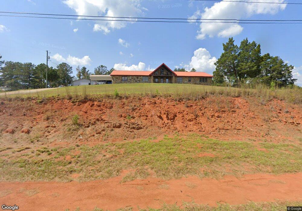
1635 New Franklin Rd Lagrange, GA 30240
Estimated Value: $299,557 - $346,000
5
Beds
3
Baths
3,106
Sq Ft
$106/Sq Ft
Est. Value
About This Home
This home is located at 1635 New Franklin Rd, Lagrange, GA 30240 and is currently estimated at $329,139, approximately $105 per square foot. 1635 New Franklin Rd is a home located in Troup County with nearby schools including Franklin Forest Elementary School, Hillcrest Elementary School, and Hollis Hand Elementary School.
Ownership History
Date
Name
Owned For
Owner Type
Purchase Details
Closed on
Sep 2, 2003
Bought by
Waugh Charles Mack
Current Estimated Value
Purchase Details
Closed on
Jan 31, 1995
Sold by
James P Murphy
Purchase Details
Closed on
Sep 10, 1993
Sold by
Charlie Mack Waugh
Bought by
James P Murphy
Purchase Details
Closed on
Sep 1, 1987
Sold by
Charles Mack Waugh
Bought by
Charlie Mack Waugh
Purchase Details
Closed on
Jan 1, 1972
Sold by
Waugh W C
Bought by
Charles Mack Waugh
Create a Home Valuation Report for This Property
The Home Valuation Report is an in-depth analysis detailing your home's value as well as a comparison with similar homes in the area
Home Values in the Area
Average Home Value in this Area
Purchase History
| Date | Buyer | Sale Price | Title Company |
|---|---|---|---|
| Waugh Charles Mack | -- | -- | |
| -- | $96,000 | -- | |
| James P Murphy | -- | -- | |
| Charlie Mack Waugh | $95,700 | -- | |
| Charles Mack Waugh | -- | -- |
Source: Public Records
Tax History Compared to Growth
Tax History
| Year | Tax Paid | Tax Assessment Tax Assessment Total Assessment is a certain percentage of the fair market value that is determined by local assessors to be the total taxable value of land and additions on the property. | Land | Improvement |
|---|---|---|---|---|
| 2024 | $1,439 | $81,812 | $10,000 | $71,812 |
| 2023 | $730 | $73,716 | $10,000 | $63,716 |
| 2022 | $1,171 | $70,556 | $10,000 | $60,556 |
| 2021 | $1,153 | $66,960 | $7,000 | $59,960 |
| 2020 | $1,719 | $66,960 | $7,000 | $59,960 |
| 2019 | $1,694 | $66,140 | $7,000 | $59,140 |
| 2018 | $1,659 | $64,976 | $7,000 | $57,976 |
| 2017 | $1,659 | $64,976 | $7,000 | $57,976 |
| 2016 | $1,633 | $64,112 | $7,000 | $57,112 |
| 2015 | $1,634 | $64,112 | $7,000 | $57,112 |
| 2014 | $1,538 | $69,862 | $8,400 | $61,462 |
| 2013 | -- | $74,157 | $8,400 | $65,757 |
Source: Public Records
Map
Nearby Homes
- 91 Richmond Dr
- 1784 New Franklin Rd
- 127 Oakmont Dr
- 104 Hidden Branches Ln
- LOT 106 River Oaks Dr
- 209 River Oaks Dr
- 118 Moss Creek Dr
- 107 Windridge
- 109 Windridge
- 127 Ashling Dr
- 105 Ridgeview Dr
- 117 Woodchase
- 89 Chase Rd
- 129 Sunny Point Cir
- 101 Sheffield Dr
- 100 Canterbury Dr
- 104 Canterbury Dr
- 102 Canterbury Dr
- 107 Dixie Creek Dr
- 100 Creekside Dr Unit LOT 60A
- 93 Richmond Dr
- 95 Richmond Dr
- 88 Richmond Dr
- 1651 New Franklin Rd
- 1629 New Franklin Rd
- 1609 New Franklin Rd
- 91 Richmond Dr Unit 28
- 89 Richmond Dr
- 90 Richmond Dr
- 86 Richmond Dr Unit 37
- 97 Richmond Dr
- 1640 New Franklin Rd
- 0 Richmond Dr Unit 8464657
- 0 Richmond Dr Unit 8279096
- 0 Richmond Dr Unit 7631338
- 0 Richmond Dr Unit 8784761
- 0 Richmond Dr Unit 8829654
- 0 Richmond Dr Unit 8564693
- 0 Richmond Dr Unit 8893863
- 0 Richmond Dr Unit 8894311