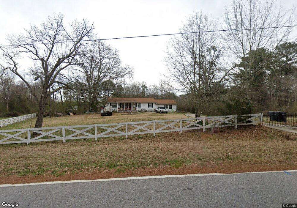
1635 River Rd McDonough, GA 30252
Estimated Value: $268,000 - $303,000
3
Beds
2
Baths
1,536
Sq Ft
$185/Sq Ft
Est. Value
About This Home
This home is located at 1635 River Rd, McDonough, GA 30252 and is currently estimated at $283,759, approximately $184 per square foot. 1635 River Rd is a home located in Henry County with nearby schools including Rock Spring Elementary School, Ola Middle School, and Ola High School.
Ownership History
Date
Name
Owned For
Owner Type
Purchase Details
Closed on
Mar 28, 2007
Sold by
Thomas Bobbie C
Bought by
Holmes Horace
Current Estimated Value
Home Financials for this Owner
Home Financials are based on the most recent Mortgage that was taken out on this home.
Original Mortgage
$116,000
Outstanding Balance
$70,252
Interest Rate
6.27%
Mortgage Type
New Conventional
Estimated Equity
$213,507
Purchase Details
Closed on
Apr 22, 1994
Sold by
Aulderhar Craig
Bought by
Lennon Bobbie
Home Financials for this Owner
Home Financials are based on the most recent Mortgage that was taken out on this home.
Original Mortgage
$55,000
Interest Rate
7.81%
Create a Home Valuation Report for This Property
The Home Valuation Report is an in-depth analysis detailing your home's value as well as a comparison with similar homes in the area
Home Values in the Area
Average Home Value in this Area
Purchase History
| Date | Buyer | Sale Price | Title Company |
|---|---|---|---|
| Holmes Horace | $145,000 | -- | |
| Lennon Bobbie | $75,000 | -- |
Source: Public Records
Mortgage History
| Date | Status | Borrower | Loan Amount |
|---|---|---|---|
| Open | Holmes Horace | $116,000 | |
| Previous Owner | Lennon Bobbie | $55,000 |
Source: Public Records
Tax History Compared to Growth
Tax History
| Year | Tax Paid | Tax Assessment Tax Assessment Total Assessment is a certain percentage of the fair market value that is determined by local assessors to be the total taxable value of land and additions on the property. | Land | Improvement |
|---|---|---|---|---|
| 2025 | $1,385 | $112,800 | $16,720 | $96,080 |
| 2024 | $1,385 | $104,080 | $15,120 | $88,960 |
| 2023 | $560 | $99,160 | $14,560 | $84,600 |
| 2022 | $1,914 | $73,920 | $13,440 | $60,480 |
| 2021 | $1,613 | $61,640 | $11,520 | $50,120 |
| 2020 | $1,520 | $57,840 | $10,840 | $47,000 |
| 2019 | $1,791 | $52,840 | $10,280 | $42,560 |
| 2018 | $1,610 | $48,000 | $9,520 | $38,480 |
| 2016 | $1,274 | $39,240 | $7,920 | $31,320 |
| 2015 | $951 | $30,320 | $8,720 | $21,600 |
| 2014 | $838 | $27,320 | $8,720 | $18,600 |
Source: Public Records
Map
Nearby Homes
- 6192 Highway 81 E
- 1062 Crown Landing Pkwy
- 1820 River Rd
- 4627 Highway 212
- 5506 Highway 81 S
- 290 White Birch Dr
- 153 Helen Rd
- 233 Cobblestone Ln
- 205 Dupont Ct
- 105 White Birch Dr
- 120 Lummus Rd
- 1739 Snapping Shoals Rd
- 101 Elite Way
- 32 Island Shoals Rd
- 925 Wynn Rd
- 456 Old Tree Dr
- 735 Jackson Lake Rd
- 735 Jackson Lake Rd Unit 122
- 85 Brittney Ln
- 1045 Matthews Way
- 1000 Crown Landing Pkwy
- 1004 Crown Landing Pkwy
- 1725 River Rd
- 1008 Crown Landing Pkwy
- 1629 River Rd
- 1012 Crown Landing Pkwy
- 1001 Crown Landing Pkwy
- 1003 Crown Landing Pkwy
- 1009 Crown Landing Pkwy
- 1735 River Rd
- 1016 Crown Landing Unit 5
- 1016 Crown Landing Pkwy
- 1013 Crown Landing Pkwy
- 6433 Highway 81 E
- 6407 Highway 81 E
- 1017 Crown Landing Pkwy
- 1020 Crown Landing Pkwy Unit 6
- 1020 Crown Landing Pkwy
- 1567 River Rd
- 1505 Terminal Ct Unit 1505